Chapter 2: Structure And Physiography
Stand anywhere in India and you are standing on the wreckage of a collision that has not finished.
About 4,600 million years ago the Earth took shape, and for most of that time the land now called India was nowhere near Asia. It lay far to the south of the equator, locked into a much larger landmass, with what is today Australia joined to it. Then the great block cracked apart. Australia drifted away to the southeast, and the Indian piece began a slow journey north — a journey it has never stopped.
When the leading edge of the Indian plate met Asia, neither side could give way. Rock that had lain flat was squeezed, folded and thrust upward, and out of that crush rose the Himalayas: young, still rising, still shaken by earthquakes because the push continues even now.
The old core of India rode through all of this almost untouched. This rigid Peninsular Block, built of some of the most ancient rock on Earth, bent and trembled far less than the new mountains to its north. Between the two, a long trough was slowly buried under sand and silt carried down by the rivers, until it became the flat, crowded plains where most Indians live.
Mountains in the north, plateau in the south, plains in between — the map of India is the record of that unfinished collision.
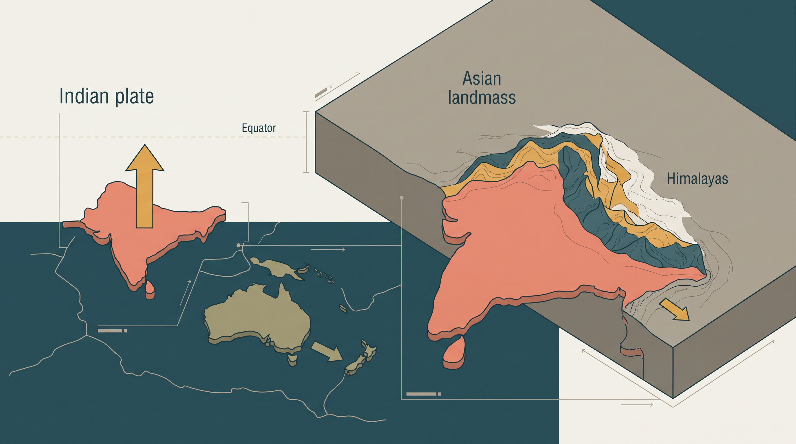
Fig. 2.0 – The northward drift of the Indian plate and the Himalayan collision.
2.1 The Geological Divisions Of India
Our planet has a history. The Earth took shape about 4,600 million years ago, and the landforms we see today are not its original features. They are the outcome of change worked over that enormous span of time. Two great families of forces have driven that change, and they pull in opposite directions.
Endogenic forces come from within the Earth. They build the land: they lift it, fold rock into mountains, crack the crust along faults, and move whole slabs of the outer shell. Exogenic forces act on the surface from outside — running water, wind, ice, waves and weather. They wear the land down: they break rock apart, carry the debris away, and drop it somewhere else. Every surface and subsurface feature of India is the running result of these two forces working against each other, one raising the land and the other cutting it back.
A Plate On The Move
You met plate tectonics earlier, in Fundamentals of Physical Geography — the idea that the Earth’s rigid outer shell is broken into large plates that drift slowly and carry the continents with them. India rides on one such plate, and its journey explains much of what follows.
Millions of years ago the Indian plate lay to the south of the equator. It was far larger then, and the Australian plate was part of it. Over time the block broke apart. The Australian portion moved away towards the southeast, and the Indian portion began to move north. That northward movement has never stopped; it continues today, and it presses on the physical environment of the whole subcontinent.
It is worth pausing to do two things the chapter asks of you. First, try to picture, phase by phase, how the Indian plate travelled from south of the equator to where it now sits. Second, try to name the consequences that a plate still pushing north would have — the raising of mountains, the shaking of the ground, the shaping of the coast. Keep those answers in mind; the rest of the chapter will confirm them.
Three Divisions From One Process
It is this interplay — endogenic and exogenic forces together with the sideways movement of the plates — that produced the present geological structure of India, meaning the arrangement, age and type of the rocks beneath it, and the landscape-shaping processes still at work on top. Because that structure differs so sharply from one part of the country to another, India can be sorted, on the basis of its geology and rock formations, into three broad geological divisions. These divisions follow the physical features closely:
- the Peninsular Block — the ancient, rigid southern core;
- the Himalayas and other Peninsular Mountains — the young, still-forming ranges;
- the Indo-Ganga-Brahmaputra Plain — the deep trough between the two, filled with river sediment.
The whole of this process, from the forces that drive it to the three divisions it produces, can be traced as a single chain (Fig. 2.1).
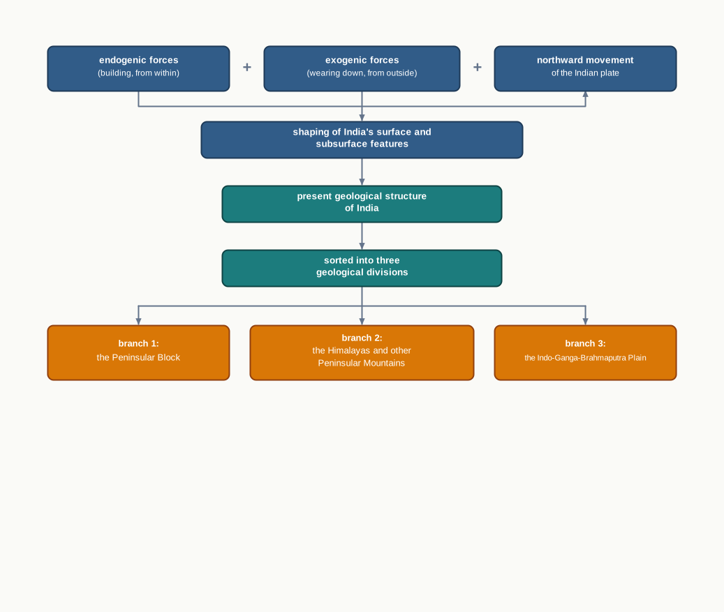
Fig. 2.1 – Forces shaping India’s geological structure and its three divisions.
The rest of this chapter follows these three divisions in turn, and then reads the surface they produce as the physiography of India.
2.2 The Peninsular Block
The Peninsular Block is the ancient southern core of India, and the first of the three geological divisions. Everything about it — its rock, its worn-down hills, its gentle rivers — points to one fact: it is very old and has stayed very still.
Where It Lies
The northern edge of the block is not a sharp line but an irregular boundary. It can be traced from Kachchh, in the far west of Gujarat, running along the western flank of the Aravali Range near Delhi, and then roughly parallel to the Yamuna and the Ganga as far as the Rajmahal Hills, in the east near the Ganga delta.
The block does not end neatly at that line. Several outliers sit beyond it. The Karbi Anglong hills and the Meghalaya Plateau in the northeast, and Rajasthan in the west, are all extensions of the same block. In the northeast, the Malda fault in West Bengal — a fracture in the crust — separates these parts from the Chotanagpur plateau of eastern India. In Rajasthan, the desert and other desert-like features lie over the block, hiding the ancient rock beneath a cover of sand.
The extent of the block, its boundary and its detached outliers can be followed on the map (Map 2.A1).
Map
Map 2.A1 Caption: The northern boundary and outlying extensions of the ancient Peninsular Block. Brief: Outline map of India showing the Peninsular Block shaded. Draw the irregular northern boundary as a heavy line running from Kachchh, along the western flank of the Aravali Range near Delhi, then roughly parallel to the Yamuna and the Ganga to the Rajmahal Hills and the Ganga delta. Mark the detached outliers — the Karbi Anglong hills, the Meghalaya Plateau and Rajasthan — in the same shade with a lighter tint. Mark the Malda fault separating the northeastern parts from the Chotanagpur plateau. Key must distinguish block, outliers and boundary line. Show the full extent of India as officially defined. Add no feature the chapter does not name.
What It Is Made Of
The Peninsula is built essentially from a great mass of very ancient gneisses and granites. Gneiss is a banded metamorphic rock and granite a coarse igneous rock; both form deep in the crust, and both are among the oldest rocks on Earth. Together they make up the major part of the block.
Since the Cambrian period, which began more than five hundred million years ago, the Peninsula has stood like a rigid block. It has barely folded or buckled while younger lands around it were being crushed and lifted. There are exceptions: part of its western coast has been submerged beneath the sea, and some other parts were changed by tectonic activity — slow movements of the crust. But even these left the original basement, the foundation rock underneath, untouched. The core has stayed remarkably steady across an immense stretch of time.
Faulting And The Rift Valleys
Being part of the Indo-Australian Plate, the block has still felt vertical movements and block faulting — where the crust cracks and blocks of it are pushed up or dropped down along the faults. Where a long strip of land slips down between two roughly parallel faults, it forms a rift valley, a steep-sided trough set below the land on either side.
The valleys of the Narmada, the Tapi and the Mahanadi are rift valleys of this kind. The Satpura block mountains, standing up between them, are the blocks that were left high while the strips beside them dropped. So even a rigid block carries the marks of movement, written as faults rather than folds.
Old Mountains, Gentle Rivers
Most of the Peninsula’s uplands are relict and residual mountains — the worn-down stumps of far older, once higher ranges, left standing after long ages of erosion. The Aravali hills, the Nallamala hills, the Javadi hills, the Veliconda hills, the Palkonda range and the Mahendragiri hills are all of this kind: low, rounded and ancient.
Because the block is old and worn to low relief, its river valleys are shallow and their slope is gentle. That slope is measured as gradient — the fall in height of a river’s bed over a given distance along its course, a measure of steepness you learned to calculate in Practical Work in Geography, Part I. A useful exercise is to work out the gradient of a Himalayan river and of a Peninsular river and set the two side by side. The Peninsular figure comes out far gentler, because the land it crosses was ground down long ago.
Where these rivers reach the sea, many of them build a delta — a low, fanned-out spread of sediment laid down where the river slows and drops its load. Most of the Peninsula’s east-flowing rivers do this before entering the Bay of Bengal. The deltas of the Mahanadi, the Krishna, the Kaveri and the Godavari are important examples.
2.3 The Himalayas And Other Peninsular Mountains
The second geological division is the opposite of the first in almost every way. Where the Peninsular Block is ancient and rigid, the Himalayas and the other Peninsular mountains are young, weak and flexible in their geological structure.
Still Being Built
Because they are young and not yet set firm, these mountains are still caught in the interplay of exogenic and endogenic forces. That interplay is still shaping them, producing faults, folds and thrust plains. A fold is rock bent into a wave by sideways pressure; a fault is a crack along which blocks of crust slip past each other; a thrust is a fault where one mass of rock is pushed up and over another. All three are signs of a range that is still moving, not one that has settled.
This is exactly the difference between the two divisions. The Peninsular Block, rigid and stable since the Cambrian, resists these forces and barely changes. The young mountains, weak and flexible, give way to them and go on folding, faulting and rising.
Young Mountains, Young Rivers
These mountains are tectonic in origin — raised by movements of the crust, not piled up in any other way. They are still high and steep, and the rivers that cut across them are fast and powerful. Geographers call this the youthful stage of a river: the early part of its life, when it flows down a steep slope and spends its energy cutting downward into the rock.
A youthful river cuts straight down into its bed far more than it swings from side to side. That vigorous downcutting is what carves the landforms typical of these mountains: deep, narrow gorges; V-shaped valleys, whose steep sides slope down to meet at the river like the two strokes of the letter V; rapids, where water breaks white over uneven rock; and waterfalls, where it drops over a hard step in the bed. Each of these is indicative, as the chapter puts it, of a river still young and still cutting down.
You can see the result in the photograph of a gorge (Fig. 2.2) — a valley so deep and narrow that the river almost fills its floor.
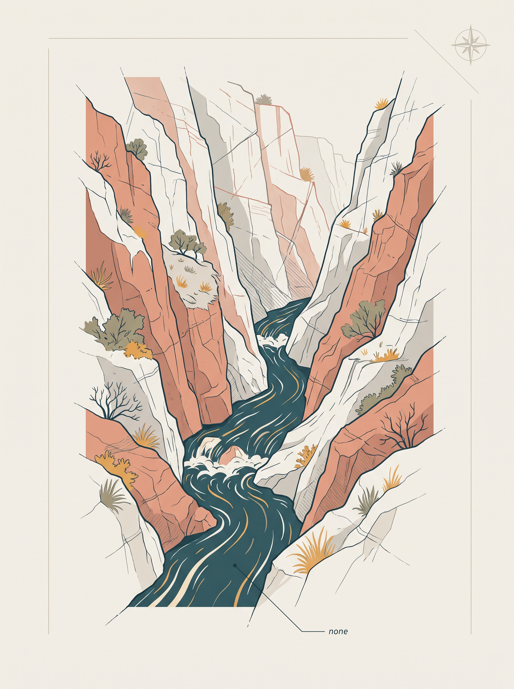
Fig. 2.2 – A gorge cut by a fast-flowing youthful river.
The whole chain, from a rising mountain to the landforms on its rivers, can be read at a glance (Fig. 2.3).
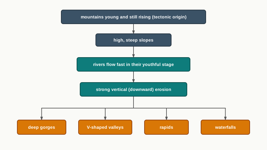
Fig. 2.3 – Youthful rivers and their resulting landforms.
2.4 Indo-Ganga-Brahmaputra Plain
The third geological division is the great plain built by three rivers — the Indus, the Ganga and the Brahmaputra. It lies as a broad, low belt between the young mountains to the north and the old Peninsular Block to the south. Unlike the other two divisions, it was not raised up. It was filled in.
A Trough That Filled With Sediment
The plain began as a geosynclinal depression — a long trough in the crust that slowly sank and collected sediment over a great span of time. This trough reached its fullest development during the third phase of the Himalayan mountain formation, approximately about 64 million years ago. As the mountains rose to the north and the rigid block held firm to the south, a deep hollow was left between the two.
Since then, the trough has been filled layer by layer with alluvium — the sand, silt and clay that rivers carry and drop along their course. Both the Himalayan rivers from the north and the Peninsular rivers from the south have poured their sediment into it. The alluvial deposits now reach an average depth of between 1,000 and 2,000 m. That is up to two kilometres of loose river material resting on the buried floor of the old trough.
The plain is best pictured not from above but in a cut-through side view, which shows the fill sitting between mountain and block (Fig. 2.4).
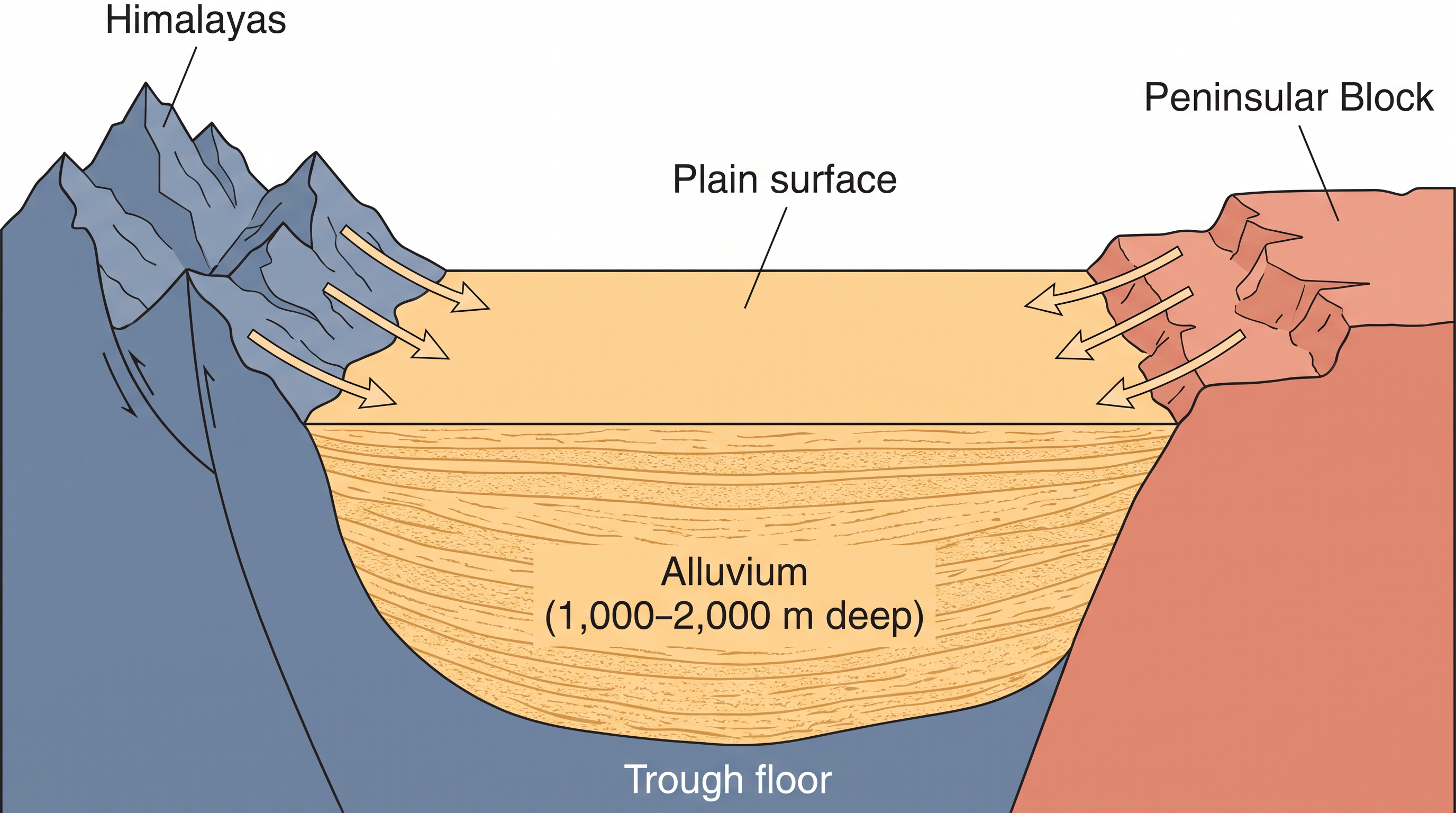
Fig. 2.4 – Cross-section of the Indo-Ganga-Brahmaputra plain.
Why The Structure Matters
The three divisions taken together show how differently one country can be built. From the rigid southern block, to the folding northern mountains, to the sediment-filled plain between them, the variation in geological structure is large, and it reaches far beyond the rocks themselves.
That variation shapes the relief and physiography of India — the actual form of its surface, its heights and hollows. The relief and physiography have been greatly influenced by the geological and geomorphological processes still active in the subcontinent. It is to that surface, the outward face of all this structure, that the chapter now turns.
2.5 Physiography
Physiography is the outcome of three things working together: the structure beneath a place, the processes acting on it, and the stage of development it has reached. In other words, the shape of the land records both what it is made of and what has happened to it. The land of India shows great diversity in its physical features, and that diversity follows straight from the geological structure of the last three sections.
The north has a vast expanse of rugged country — a series of mountain ranges with varied peaks, beautiful valleys and deep gorges. The south is a stable tableland, a broad, high, flat-topped surface, here cut into highly dissected plateaus, worn-down rocks and long lines of scarps, where a scarp is a steep step in the land. Between these two lies the vast north Indian plain.
Based on these broad variations, India is divided into six physiographic divisions: the Northern and Northeastern Mountains; the Northern Plain; the Peninsular Plateau; the Indian Desert; the Coastal Plains; and the Islands. The physical map of India shows all six at once (Fig. 2.5).
Map
Fig. 2.5 Caption: The physical map of India, showing its ranges, plateaus, plains, deserts, coasts and islands. Brief: Preserve the NCERT physical map of India. Retain the height key (above 900 m; 600-900 m; 300-600 m; 0-300 m), the peaks marked as triangles, the mountain ranges, the major rivers, the numbered physiographic units and the latitude-longitude grid exactly as printed. Show the full extent of India as officially defined, including the Andaman and Nicobar Islands and Lakshadweep.
2.5.1 The North And Northeastern Mountains
The North and Northeastern Mountains are made up of the Himalayas and the Northeastern hills. The Himalayas are not a single ridge but a series of parallel mountain ranges. Among the important ones is the Greater Himalayan range, which includes the Great Himalayas and the Shiwalik.
How The Ranges Are Aligned
The way the ranges are turned changes as you move along them. In the northwestern part of India their general orientation runs from northwest to southeast. In the Darjiling and Sikkim regions they lie roughly east-west. In Arunachal Pradesh they run from southwest to northwest, and in Nagaland, Manipur and Mizoram they turn to a north-south direction. The chain therefore bends around the northern and eastern edge of the country rather than running straight.
The Great Himalayan range, also called the central axial range, is about 2,500 km long from east to west, and its width varies between 160 and 400 km from north to south. On the map you can see that the Himalayas stand almost like a strong, long wall between the Indian subcontinent and the countries of Central and East Asia (Fig. 2.6).
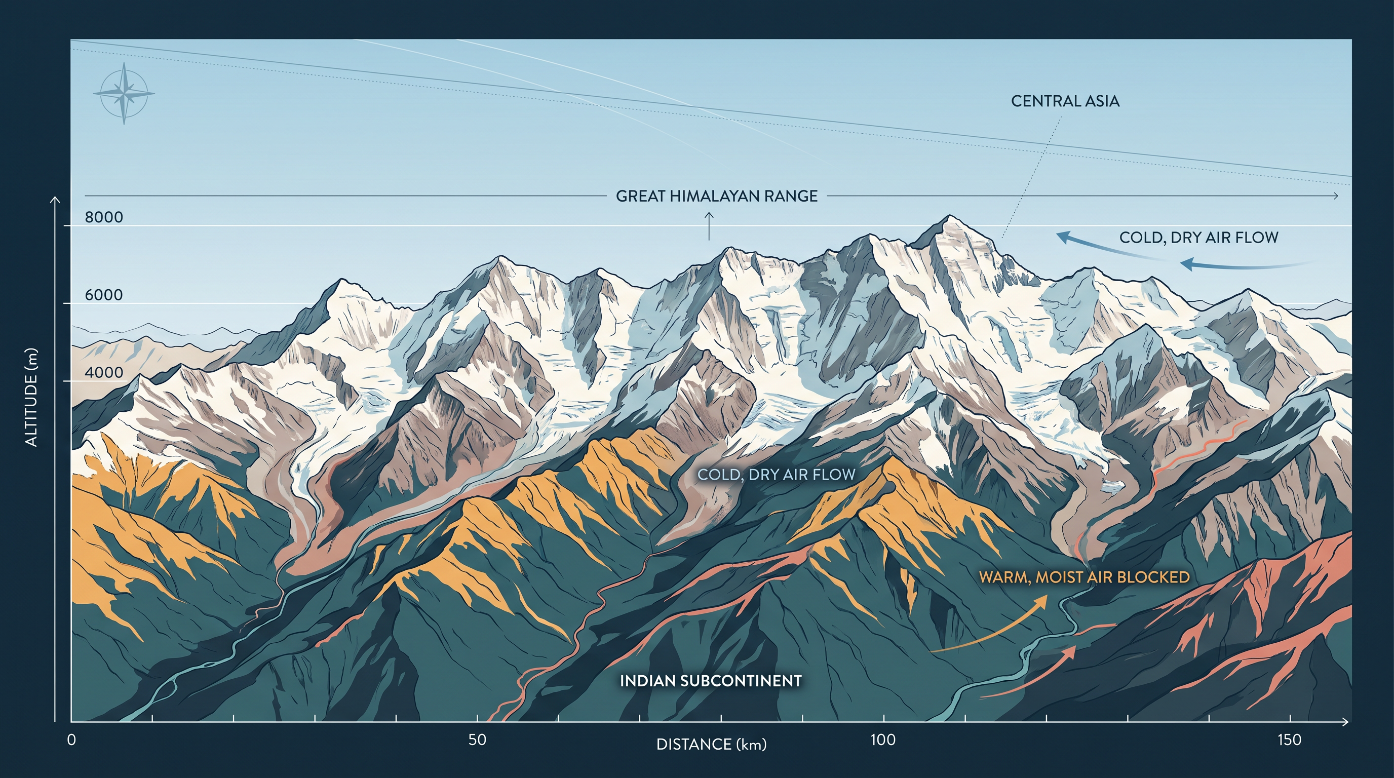
Fig. 2.6 – The Himalayan mountain wall.
More Than A Barrier
That wall is not only a physical barrier. It is also a climatic, drainage and cultural divide: it shapes the weather on either side, controls where rivers run, and separates ways of life. The chapter asks you to think about the impact of the Himalayas on the geoenvironment — the combined physical setting — of the countries of South Asia, and to look for similar great divides elsewhere in the world.
2.5.2 The Northern Plains
The northern plains are built from the alluvial deposits carried down by three rivers — the Indus, the Ganga and the Brahmaputra. The plain stretches about 3,200 km from east to west, its width varying between 150 and 300 km. Beneath it, the alluvium reaches a maximum depth of between 1,000 and 2,000 m, resting on the old buried trough.
Three Belts From North To South
From north to south the plain falls into three major zones — the Bhabar, the Tarai and the alluvial plains — and the alluvial plains split again into the Khadar and the Bhangar. These belts follow the slope down from the foothills (Fig. 2.7).
The Bhabar is a narrow belt, 8 to 10 km wide, running parallel to the Shiwalik foothills at the point where the slope breaks. Here the streams and rivers rushing off the mountains dump their heavy load of rocks and boulders, and sometimes sink out of sight into the loose gravel. South of it lies the Tarai belt, about 10 to 20 km wide, where those streams surface again but without a proper channel, spreading into marshy, swampy ground. The Tarai carries a luxurious growth of natural vegetation and a varied wildlife.
South of the Tarai come the old and new alluvial belts: the Bhangar, the older alluvium lying a little higher, and the Khadar, the newer alluvium laid down closer to the rivers. These plains show the landforms of a river in its mature stage — sand bars (ridges of deposited sand), meanders (looping bends), oxbow lakes (curved lakes left when a meander is cut off) and braided channels (a river split into many threads around sandy islands). The Brahmaputra plains in particular are known for their riverine islands and sand bars, and most of this area suffers periodic floods and shifting river courses that build braided streams.
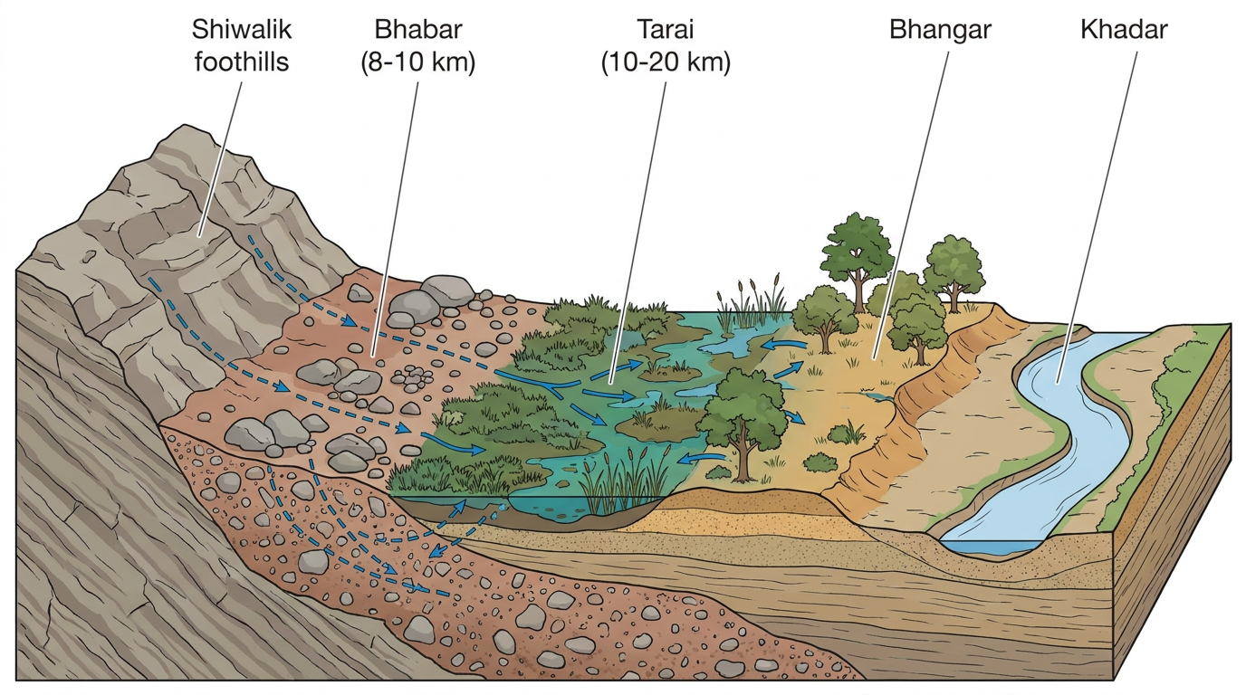
Fig. 2.7 – Transect of the northern plain from the Shiwalik foothills.
Deltas, Divides And A Fertile Floor
Where these great rivers meet the sea, they build some of the largest deltas in the world — the famous Sunderbans delta at the mouth of the Ganga-Brahmaputra is one example. Away from the deltas, the plain is otherwise almost featureless, with a general elevation of only 50 to 150 m above mean sea level.
The plain is not one basin but two river systems meeting. The states of Haryana and Delhi form a water divide — the high ground that separates one river system from another — between the Indus and the Ganga systems. To the east, the Brahmaputra flows from the northeast to the southwest, then takes an almost 90° turn southward at Dhubri, in Assam, before entering Bangladesh. Across all of it, the fertile alluvial soil supports wheat, rice, sugarcane and jute, and with them one of the most densely settled populations on Earth (Fig. 2.8).
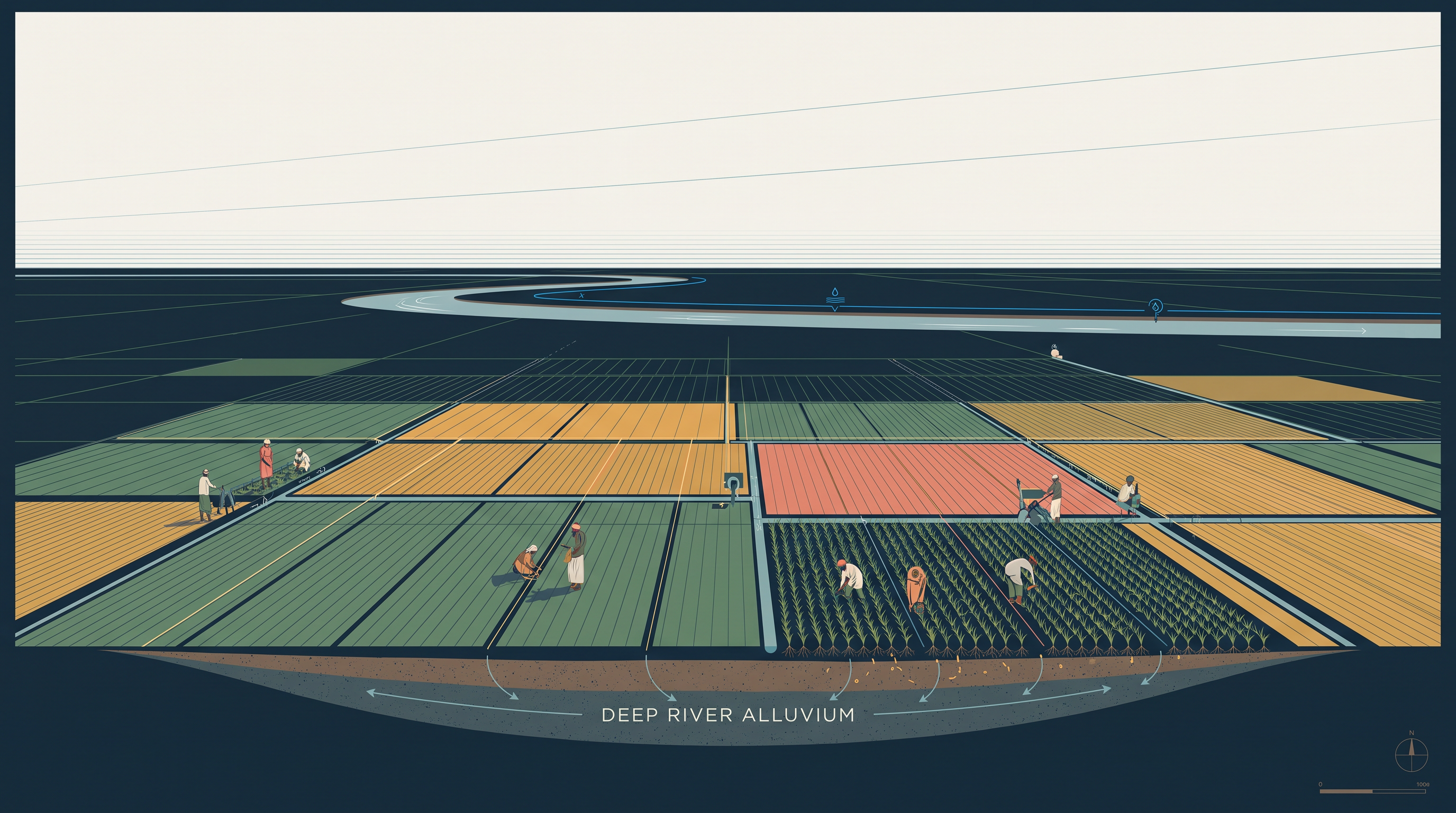
Fig. 2.8 – Agriculture on the deep alluvium of the northern plain.
2.5.3 The Peninsular Plateau
Rising from about 150 m above the river plains to an elevation of 600 to 900 m is the irregular triangle known as the Peninsular plateau. Its outer corners are marked by the Delhi ridge in the northwest (an extension of the Aravalis), the Rajmahal hills in the east, the Gir range in the west, and the Cardamom hills in the south. An extension also appears in the northeast, as the Shillong and Karbi-Anglong plateau.
The Peninsula is made of a series of patland plateaus — old, flat-topped upland surfaces — such as the Hazaribagh, Palamu, Ranchi, Malwa, Coimbatore and Karnataka plateaus. This is one of the oldest and most stable landmasses of India. Its general slope runs from west to east, which is why so many of its rivers flow eastward — a pattern the chapter asks you to check by naming rivers that reach the Bay of Bengal and the Arabian Sea, and by noting which landforms, such as deltas, mark the east-flowing rivers but not the west-flowing ones.
Features Of An Old, Faulted Surface
The plateau carries the features of a very old, hard, much-moved surface: tors (piles of rounded blocks), block mountains, rift valleys, spurs, bare rocky ground, lines of hummocky (low, rounded) hills, and wall-like quartzite dykes — hard rock ridges that offer natural sites for storing water. The western and northwestern part has an emphatic cover of black soil.
The plateau has gone through repeated phases of upliftment and submergence, with crustal faulting and fractures. The Bhima fault deserves special mention because of its recurrent seismic activity — that is, repeated earthquakes. These movements have given the plateau a varied relief. Its northwestern part, in particular, is cut by ravines and gorges; the ravines of Chambal, Bhind and Morena are well-known examples (Fig. 2.9).
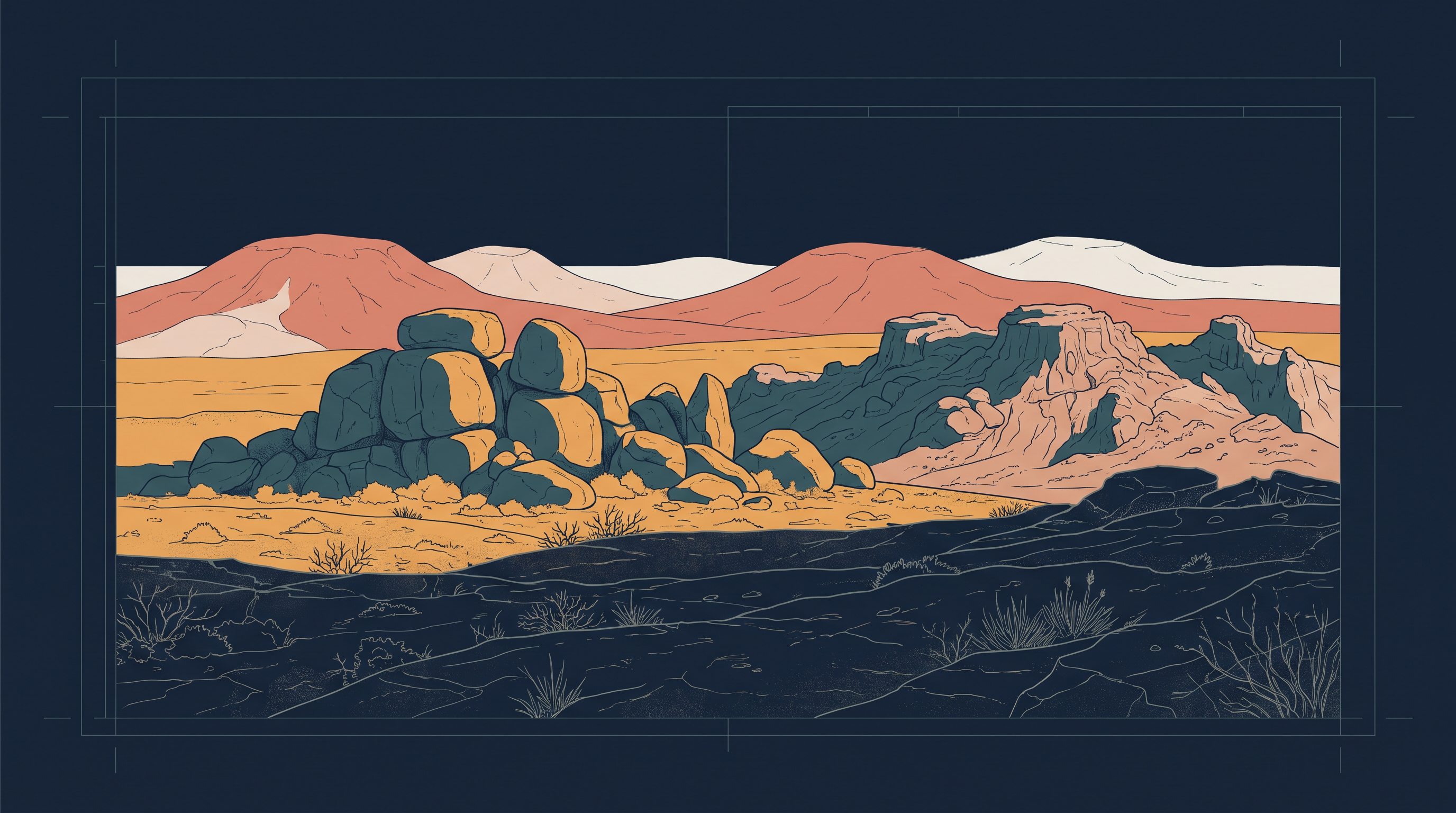
Fig. 2.9 – The worn, hard rock surface of the Peninsular plateau.
On the basis of its main relief features, the Peninsular plateau divides into three broad groups: the Deccan Plateau, the Central Highlands and the Northeastern Plateau.
2.5.3.1 The Deccan Plateau
The Deccan Plateau is bordered by the Western Ghats in the west, the Eastern Ghats in the east, and the Satpura, Maikal range and Mahadeo hills in the north. The Western Ghats go by different local names — Sahyadri in Maharashtra, the Nilgiri hills in Karnataka and Tamil Nadu, and the Anaimalai and Cardamom hills in Kerala.
The Western Ghats are higher and more continuous than the Eastern Ghats, with an average elevation of about 1,500 m that rises from north to south. Anaimudi (2,695 m), the highest peak of the Peninsular plateau, stands on the Anaimalai hills of the Western Ghats, followed by Dodabetta (2,637 m) on the Nilgiri hills. Most of the Peninsular rivers rise in the Western Ghats.
The Eastern Ghats are discontinuous, low and much eroded, cut into by rivers such as the Mahanadi, the Godavari, the Krishna and the Kaveri. Their important ranges include the Javadi hills, the Palconda range, the Nallamala hills and the Mahendragiri hills. The Eastern and Western Ghats meet each other at the Nilgiri hills.
2.5.3.2 The Central Highlands
The Central Highlands are bounded on the west by the Aravali range. The Satpura range, a series of scarped plateaus on the south, generally lies between 600 and 900 m above sea level and forms the northernmost boundary of the Deccan plateau. It is a classic example of relict mountains that are highly denuded — worn down — and broken into discontinuous ranges.
The plateau’s reach extends as far west as Jaisalmer, where it has been buried under longitudinal sand ridges and crescent-shaped sand dunes called barchans. This region carries the mark of metamorphic processes in its past, shown by rocks such as marble, slate and gneiss.
The Central Highlands generally stand between 700 and 1,000 m above sea level and slope towards the north and northeast. Most of the tributaries of the Yamuna rise in the Vindhyan and Kaimur ranges. Banas is the only significant tributary of the Chambal that rises instead from the Aravali in the west. An eastern extension of the Central Highlands is formed by the Rajmahal hills, and to the south of these lies a large store of mineral resources in the Chotanagpur plateau.
2.5.3.3 The Northeastern Plateau
The Northeastern Plateau is really an extension of the main Peninsular plateau that has been pulled apart from it. It is believed that the force of the northeastward movement of the Indian plate, at the time the Himalayas were forming, opened a huge fault between the Rajmahal hills and the Meghalaya plateau. That depression was later filled by the sediment of many rivers, so that today the Meghalaya and Karbi Anglong plateaus stand detached from the main Peninsular Block.
The Meghalaya plateau is further divided into three — the Garo Hills, the Khasi Hills and the Jaintia Hills — each named after the tribal groups living there, with a further extension in the Karbi Anglong hills of Assam. Like the Chotanagpur plateau, the Meghalaya plateau is rich in minerals such as coal, iron ore, sillimanite, limestone and uranium. It receives the heaviest rain from the southwest monsoon, and that constant rain has worn its surface down sharply; at Cherrapunji the surface is bare rock, stripped of any permanent vegetation.
2.5.4 The Indian Desert
To the northwest of the Aravali hills lies the Great Indian desert, a land of undulating ground dotted with longitudinal dunes and barchans. It receives low rainfall, below 150 mm a year, and so has an arid climate — dry, with thin vegetation cover. For these features it is also called Marusthali.
A Buried Sea, A Wind-Carved Surface
It is believed that during the Mesozoic era this region lay under the sea. Beneath the dry surface, then, is the rock of an old sea floor, and the underlying structure is in fact an extension of the Peninsular plateau. Yet, because the climate is now so dry, the surface has been reshaped by physical weathering — rock broken apart by heat and cold — and by the action of the wind, giving it a face the buried plateau never had.
Dunes, Dry Rivers And Salt
The well-marked desert features here include mushroom rocks (rocks undercut by wind-blown sand into a stalk-and-cap shape), shifting dunes, and oases — mostly in the southern part. By its orientation the desert splits into two: the northern part slopes towards Sindh, the southern towards the Rann of Kachchh. A photograph of the desert (Fig. 2.10) invites you to identify the type of sand dunes it shows.
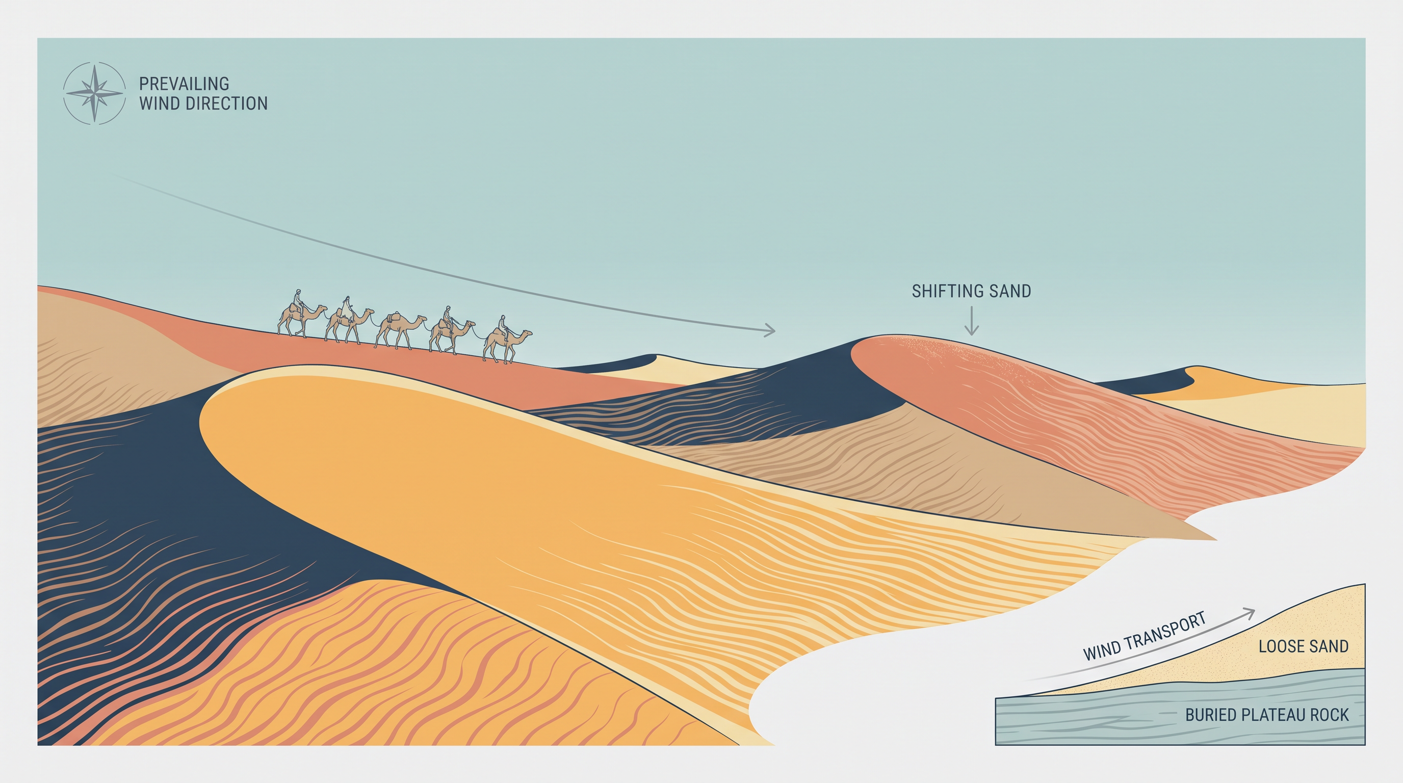
Fig. 2.10 – Sand dunes in the Indian Desert.
Most rivers here are ephemeral — they flow only for a while after rain and then dry up. The Luni, in the southern desert, is the one river of some significance. With low rainfall and high evaporation, this is a water-deficit region. Some streams simply vanish after a short distance, ending in a lake or a playa — a shallow, flat desert basin that holds water only briefly. This is a case of inland drainage, where the water never reaches the sea. The lakes and playas hold brackish (slightly salty) water, and that water is the main local source of salt.
2.5.5 The Coastal Plains
India has a long coastline, and on the basis of its location and the geomorphological processes at work, the coastal plains divide into two: the western coastal plains and the eastern coastal plains.
The Western Coast: Submerged And Narrow
The western coastal plain is an example of a submerged coast — a coast that has sunk, so the sea has drowned its lower edge. It is believed that the city of Dwaraka, once part of the mainland along the west coast, now lies submerged. Because of this drowning, the plain is a narrow belt, but it offers deep, sheltered water that makes natural conditions for ports and harbours; Kandla, Mazagaon, JLN port Navha Sheva, Marmagao, Mangalore and Cochin are among the important natural ports here.
Running from the Gujarat coast in the north to the Kerala coast in the south, the western coast divides into the Kachchh and Kathiawar coast in Gujarat, the Konkan coast in Maharashtra, and the Goan and Malabar coasts in Karnataka and Kerala. The plain is narrow in the middle and broadens towards the north and the south. The rivers crossing it form no deltas. The Malabar coast has a distinctive feature in its Kayals, or backwaters — lagoons and channels used for fishing and inland navigation, and prized by tourists; the famous Nehru Trophy Vallamkali boat race is held each year on Punnamada Kayal in Kerala.
The Eastern Coast: Emergent And Broad
Compared with the west, the eastern coastal plain is broader, and it is an example of an emergent coast — a coast that has risen out of the sea. Here the eastward-flowing rivers have built well-developed deltas as they enter the Bay of Bengal: the deltas of the Mahanadi, the Godavari, the Krishna and the Kaveri. Because the coast is emergent, it has fewer ports and harbours, and its continental shelf — the gently sloping, shallow sea floor fringing the land — reaches as much as 500 km out to sea, which makes deep ports hard to build. The chapter asks you to name some ports on the eastern coast (Fig. 2.11).
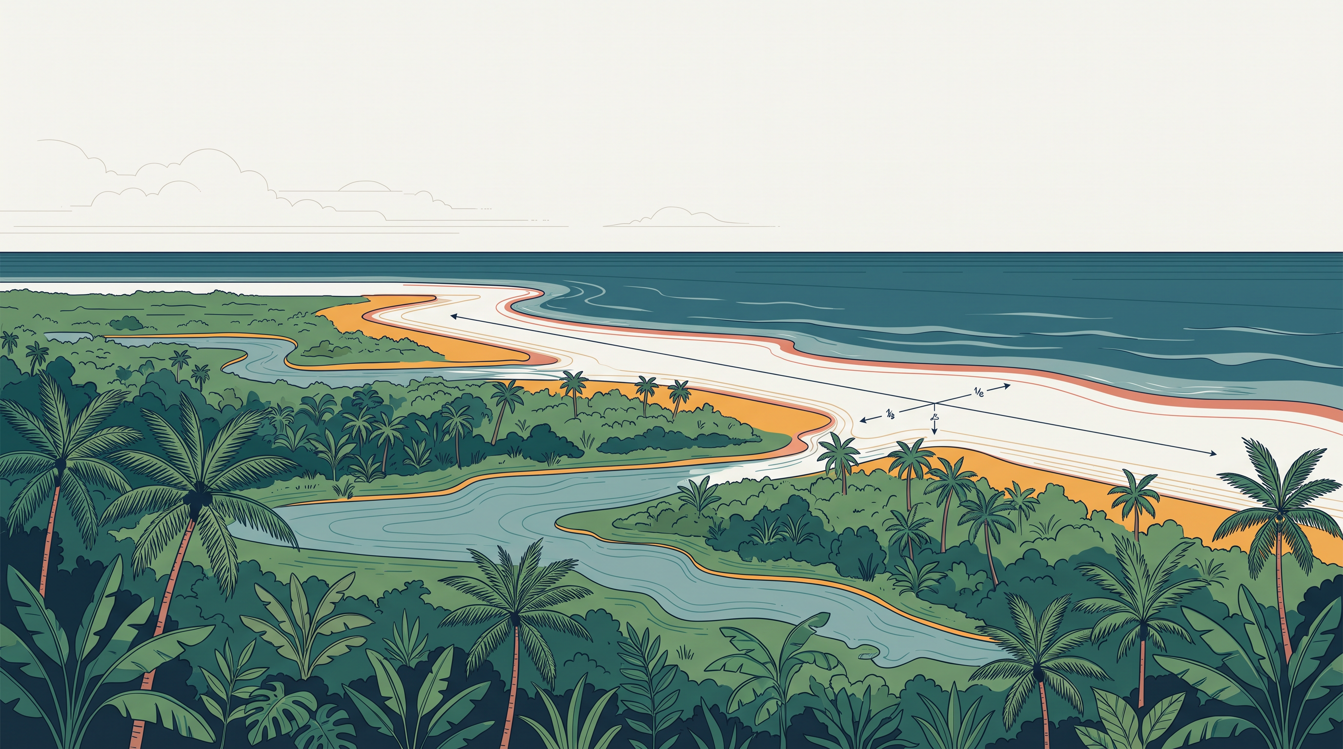
Fig. 2.11 – The coastal plains of India.
2.5.6 The Islands
India has two major island groups — one in the Bay of Bengal and the other in the Arabian Sea — and they were made in completely different ways.
The Bay Of Bengal Islands
The Bay of Bengal group has about 572 islands and islets, lying roughly between 6°N and 14°N and between 92°E and 94°E. Its two main clusters include Ritchie’s archipelago and the Labrynth island — an archipelago being a group or chain of islands. The whole group falls into two broad categories: the Andaman in the north and the Nicobar in the south, separated by a stretch of water called the Ten degree channel.
These islands are believed to be the raised tops of submarine mountains — mountains that otherwise lie beneath the sea. Some smaller ones, however, are volcanic in origin, and Barren island, the only active volcano in India, sits within the Andaman and Nicobar group. The coastline has coral deposits and fine beaches, and the islands receive convectional rainfall — rain from moist air that is heated, rises and cools — giving them an equatorial type of vegetation (Fig. 2.12).
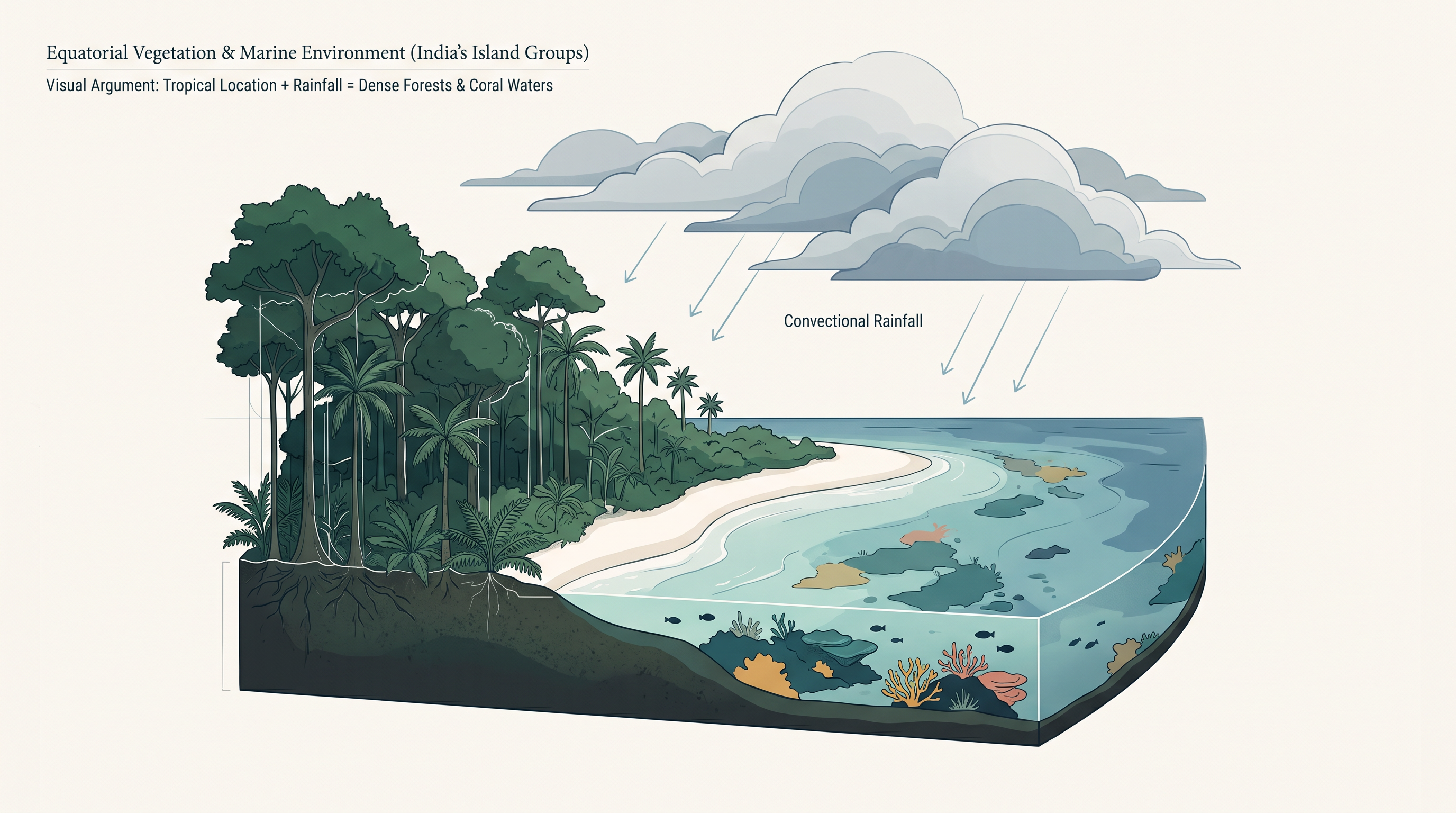
Fig. 2.12 – Equatorial vegetation on an Indian island.
A box in the chapter recalls that on 26 December 2004 the Andaman and Nicobar Islands suffered one of the most devastating natural calamities in memory. It asks you to name that calamity, to identify the other areas it harmed, and to say what its major consequence was.
The Arabian Sea Islands
The Arabian Sea group includes Lakshadweep and Minicoy, scattered between 8°N and 12°N and between 71°E and 74°E, some 220 to 440 km off the Kerala coast. This entire group is built of coral deposits — the hard remains of colonies of tiny sea animals. There are about 36 islands, of which 11 are inhabited; Minicoy, at 453 sq. km, is the largest. The group is broadly split by the Nine degree channel, with Amini Island to the north and Canannore Island to the south. On their eastern seaboard these islands carry storm beaches — ridges of unconsolidated pebbles, shingles, cobbles and boulders thrown up by storm waves.
2.6 Summary
- The Earth is about 4,600 million years old, and its landforms are the result of two opposed force families: endogenic forces that build the land from within, and exogenic forces that wear it down from outside.
- The Indian plate drifted north from south of the equator, after the Australian plate broke away to the southeast, and this northward movement still continues today.
- On the basis of its geological structure, India falls into three geological divisions: the Peninsular Block, the Himalayas and other Peninsular Mountains, and the Indo-Ganga-Brahmaputra Plain.
- The Peninsular Block is built of ancient gneisses and granites and has been rigid and stable since the Cambrian; its uplands are worn-down relict and residual mountains, and its rivers run in shallow, low-gradient valleys.
- Block faulting on the Peninsula produced the rift valleys of the Narmada, the Tapi and the Mahanadi, with the Satpura block mountains standing between; its east-flowing rivers build deltas before reaching the Bay of Bengal.
- The Himalayas and other Peninsular mountains are young, weak and flexible, still folding and faulting; being tectonic in origin, their youthful rivers cut gorges, V-shaped valleys, rapids and waterfalls.
- The Indo-Ganga-Brahmaputra plain began as a geosynclinal trough that reached its greatest development about 64 million years ago, and has since been filled by Himalayan and Peninsular river sediment to a depth of 1,000 to 2,000 m.
- Physiography is the outcome of structure, process and the stage of development; on this basis India divides into six physiographic divisions.
- The Northern and Northeastern Mountains are the Himalayas as a series of parallel ranges whose orientation changes across the country; the Great Himalayan range runs about 2,500 km east to west and forms a physical, climatic, drainage and cultural divide.
- The Northern Plain, built of alluvium from the Indus, Ganga and Brahmaputra, extends about 3,200 km and passes north to south through the Bhabar, the Tarai, and the older Bhangar and newer Khadar, ending in great deltas such as the Sunderbans.
- The Peninsular Plateau is an old, stable triangle at 600–900 m, marked by tors, block mountains, rift valleys and the ravines of Chambal, Bhind and Morena, with black soil in its west; it splits into the Deccan Plateau, the Central Highlands and the Northeastern Plateau.
- On the Deccan, the Western Ghats are higher and continuous, carrying Anaimudi (2,695 m), while the Eastern Ghats are low and broken; the two meet at the Nilgiri hills.
- The Central Highlands lie between the Aravali and the Satpura and reach west to Jaisalmer under barchan dunes; the Northeastern Plateau holds the detached Meghalaya and Karbi Anglong plateaus, where heavy monsoon rain has left Cherrapunji bare.
- The Indian Desert, northwest of the Aravali, gets under 150 mm of rain a year, was once under the sea, and drains inland through ephemeral rivers such as the Luni into brackish playas that yield salt.
- The Coastal Plains contrast a submerged western coast — narrow, delta-free, port-rich, with the Kayals of Malabar — against an emergent eastern coast that is broad, delta-rich and fronted by a shelf reaching up to 500 km out.
- The Islands form two groups: the Andaman and Nicobar in the Bay of Bengal, mostly the tops of submarine mountains with the volcanic Barren Island, and the coral-built Lakshadweep and Minicoy in the Arabian Sea.
The whole chapter can be held in one chain: a single process shaping India’s structure and then its surface (Fig. 2.13).
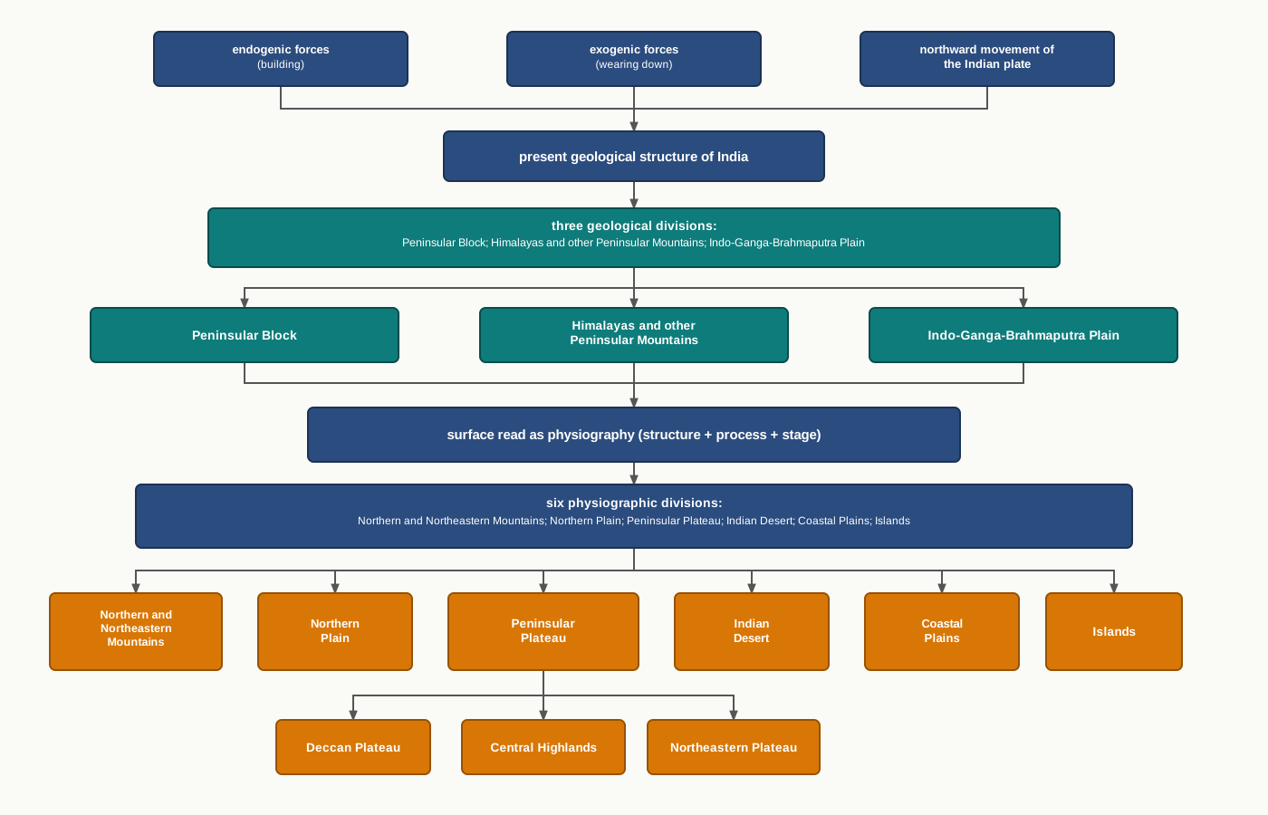
Fig. 2.13 – The geological and physiographic divisions of India.
What This Chapter Cannot Tell You
This chapter maps the structure and shape of the land, but it says almost nothing about the people who live on each landform or how they use it. Its broad divisions and boundary lines smooth over great local variety — a single ‘plateau’ or ‘plain’ hides much internal difference the category cannot show. And its long ages and deep figures, from ‘since the Cambrian’ to ‘1,000–2,000 m of alluvium’, are broad estimates of structure, not exact measurements of when or how each feature came to be.
2.7 NCERT Questions
Which one of the water bodies separates the Andaman from the Nicobar?
- 11° Channel
- Gulf of Mannar
- 10° Channel
- Andaman Sea
On which of the following hill ranges is the ‘Dodabeta’ peak situated?
- Nilgiri hills
- Anaimalai hills
- Cardamom hills
- Nallamala hills
If a person is to travel to Lakshadweep, from which coastal plain would he prefer to set out, and why? (about 30 words)
Where in India will you find a cold desert? Name some important ranges of this region. (about 30 words)
Why is the western coastal plain devoid of any delta? (about 30 words)
Make a comparison of the island groups of the Arabian Sea and the Bay of Bengal. (not more than 125 words)
What are the important geomorphological features found in the river valley plains? (not more than 125 words)
If you move from Badrinath to the Sunderbans delta along the course of the river Ganga, what major geomorphological features will you come across? (not more than 125 words)
Make a list of major Himalayan peaks from the west to the east with the help of an atlas.
Identify the major landforms of your state and analyse the major economic activity practised by the people in each landform.
2.8 Check Your Concepts
From the key of the physical map (Fig. 2.5), list the four height categories it uses. Into which category does the northern plain, with its general elevation of 50–150 m, fall?
Contrast the Bhabar and the Tarai belts of the northern plain: what happens to the streams in each belt, and why does it happen there?
Distinguish the Western Ghats from the Eastern Ghats in terms of height and continuity, and name the hills where the two chains meet.
The western coast has many natural ports while the eastern coast has few. Using the ideas of a submerged coast and an emergent coast, explain why.
Arrange in the correct order the stages by which the Indo-Ganga-Brahmaputra plain was formed, from the geosynclinal trough to the deep alluvial plain.
The Himalayan rivers cut gorges and V-shaped valleys, while the rivers of the northern plain make meanders and ox-bow lakes. Link each set of landforms to the stage of the river that produces it.
The northern plain has a surface elevation of only 50–150 m, yet its alluvium runs 1,000–2,000 m deep. What does this contrast tell you about how the plain was built, and name one thing about the plain’s structure that the physical map (Fig. 2.5) cannot show.