Chapter 5: Natural Vegetation
Set out from the western slope of the Western Ghats, the long chain of hills running down India’s west coast, just after the monsoon, and the forest closes over your head. Rain here tops 200 cm a year, the air stays warm and humid, and the trees climb 60 m into a canopy so dense the ground barely sees the sun. Nothing sheds its leaves all at once, so the hillside stays green in every month. This is evergreen forest, and it exists because the climate here allows it.
Now travel east and inland, and the rain thins. By the plains of Uttar Pradesh and the higher parts of the Peninsular plateau, the yearly total has fallen to between 70 and 200 cm, and the forest has changed its habit. When the dry season comes, whole stands of trees drop their leaves together, and the forest stands bare and grey until the rains return. These are the deciduous, or monsoon, forests, the most widespread in the country.
Keep going towards Rajasthan. Now rainfall drops below 50 cm. The tall trees are gone. What is left is thorn and scrub, plants that stay leafless for most of the year to save water, with tussocky grass rising between them.
You have not changed the soil or crossed a border. You have followed the falling rain, and the vegetation has answered it, step by step.
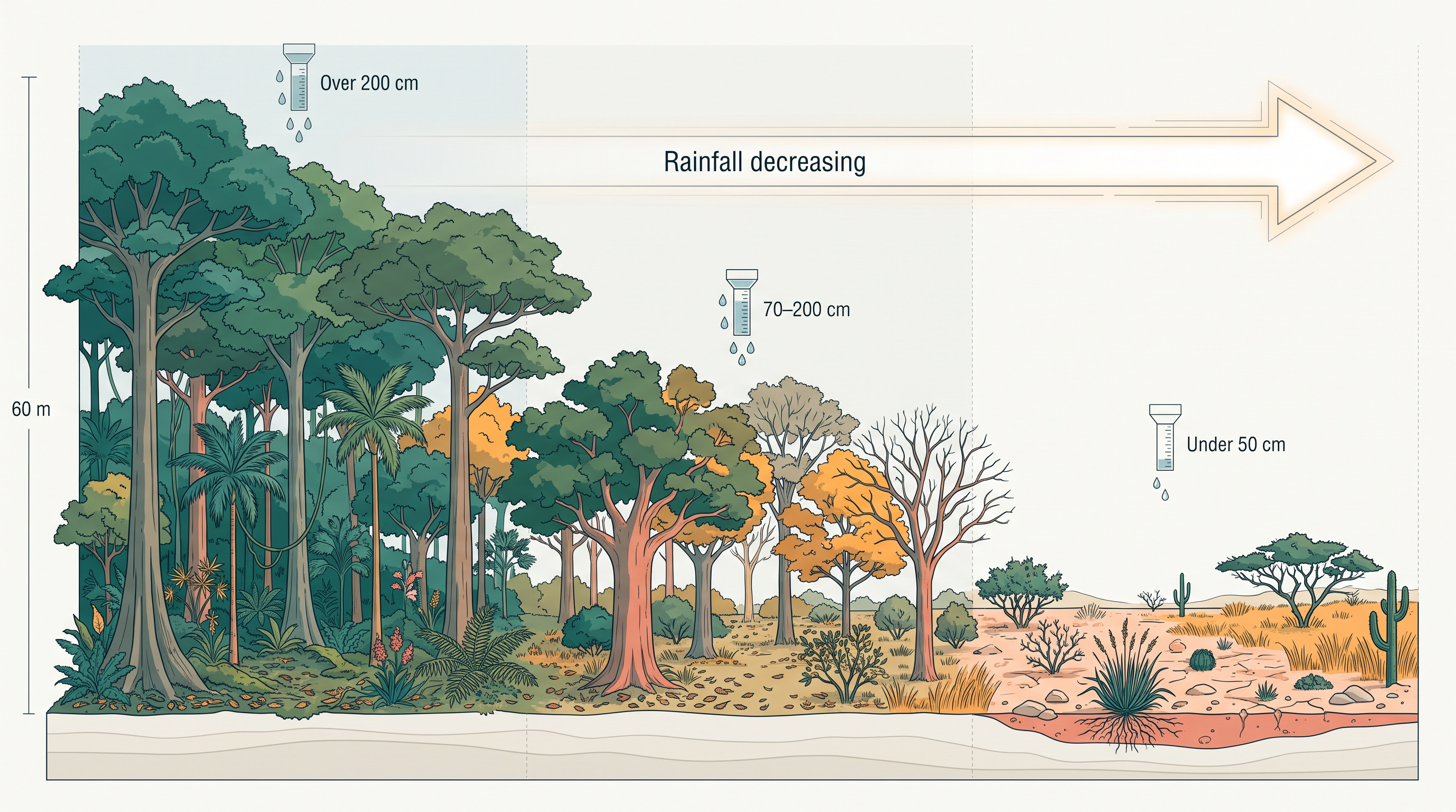
Fig. 5.0 – Forest types and falling rainfall.
5.1 Types Of Forests
The trees in a city park, a roadside avenue or a mango orchard were planted and are tended by people. Left to themselves, plants sort themselves out differently. Natural vegetation is a plant community that has been left undisturbed long enough for its species to adjust as fully as possible to the climate and soil of a place. The same kind of tree may grow wild in a forest and, quite separately, be planted and watered in a garden — only the first is natural vegetation.
India carries an unusual range of it. The Himalayan heights hold temperate vegetation; the Western Ghats and the Andaman and Nicobar Islands hold tropical rain forests; the deltas hold tropical forests and mangroves; and the desert and semi-desert of Rajasthan hold cacti, bushes and thorny plants. As the climate and soil change from one region to another, so does the vegetation.
Geographers group India’s forests using two features together: the vegetation type that dominates, and the climatic region it grows in. On this basis the forests fall into five groups — tropical evergreen and semi evergreen forests, tropical deciduous forests, tropical thorn forests, montane forests, and littoral and swamp forests.
The national picture is easiest to read on a map.
Map
Fig. 5.1 Caption: Natural vegetation of India. Brief: Reproduce the printed India natural-vegetation map showing the full extent of India as officially defined; shade the five classes exactly per the key — littoral and swamp forest, montane forest, tropical thorn forest, tropical deciduous forests, and tropical evergreen and semi evergreen forests; keep the latitude and longitude grid, the Tropic of Cancer, the scale bar, and the labels for neighbouring countries and seas as printed.
Each of these five is not a loose label but the outcome of a particular climate.
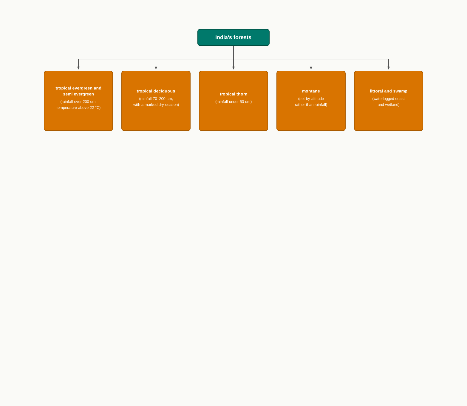
Fig. 5.2 – Climatic basis of forest types.
5.1.1 Tropical Evergreen And Semi Evergreen Forests
These forests grow on the western slope of the Western Ghats, in the hills of the northeastern region and on the Andaman and Nicobar Islands, the island group in the Bay of Bengal. They need warmth and moisture together: an annual rainfall above 200 cm and a mean annual temperature above 22 °C.
Where that much rain falls, the forest becomes stratified — arranged in distinct layers from the ground up. Shrubs and creepers cover the floor, short trees stand above them, and tall trees rise over all, reaching 60 m or more. Because the climate never forces a dry rest, there is no single season for shedding leaves, flowering or fruiting. Some tree is always in leaf, so the forest looks green the year round, which is what evergreen means. Its valued species include rosewood, mahogany, aini and ebony.
The semi evergreen forests grow in the less rainy parts of the same regions. Here evergreen and moist deciduous trees mix, and it is the evergreen climbers growing through them that give the whole forest its green character. Its main species are white cedar, hollock and kail. A stand of this dense, layered forest is shown in Fig. 5.3.
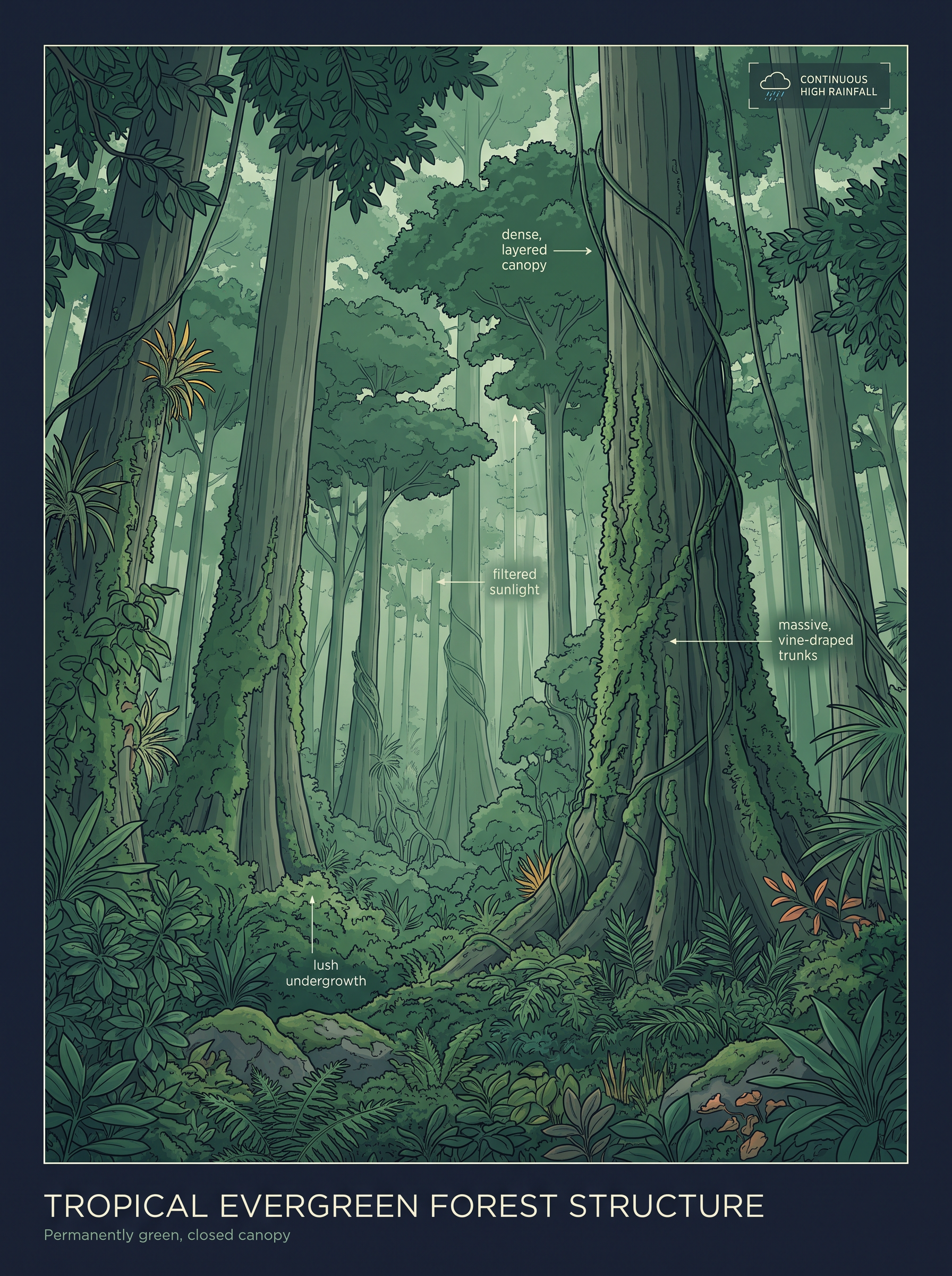
Fig. 5.3 – Tropical evergreen forest.
A History Of Exploitation
The British understood the economic value of India’s forests and began cutting them on a large scale. They also changed what grew there. In Garhwal and Kumaon, in the western and central Himalaya, the oak forests were replaced by pine, whose chir timber was needed to lay railway lines. Other forests were cleared for plantations of tea, rubber and coffee, and timber was taken for construction because wood insulates against heat. The protective use of the forest gave way to a commercial one.
5.1.2 Tropical Deciduous Forests
These are the most widespread forests in India, and because their rhythm follows the rains they are also called the monsoon forests. They grow where rainfall is between 70 and 200 cm. Deciduous trees drop all their leaves in the dry season to cut water loss, then leaf out again when the rain returns. Within this rainfall band, the amount of water splits the forest into two kinds.
The moist deciduous forests take the wetter half, where rainfall records 100 to 200 cm. They are strongest in the northeastern states along the Himalayan foothills, on the eastern slopes of the Western Ghats and in Odisha, in eastern India. Their main species are teak, sal, shisham, hurra, mahua, amla, semul, kusum and sandalwood.
The dry deciduous forests take the drier half, with rainfall between 70 and 100 cm, and cover vast stretches of the country. On their wetter edge they grade into moist deciduous forest; on their drier edge they thin towards thorn forest. They are found in the rainier parts of the Peninsula and across the plains of Uttar Pradesh and Bihar.
In the higher-rainfall parts of the Peninsular plateau and the northern plain, these forests open into a parkland — teak and other trees scattered among patches of grass. When the dry season starts, the trees shed their leaves completely and the forest looks like a vast grassland studded with bare trunks. Its common trees are tendu, palas, amaltas, bel, khair and axlewood. In the western and southern part of Rajasthan, low rainfall and overgrazing leave the cover very scanty. Fig. 5.4 shows a deciduous forest.
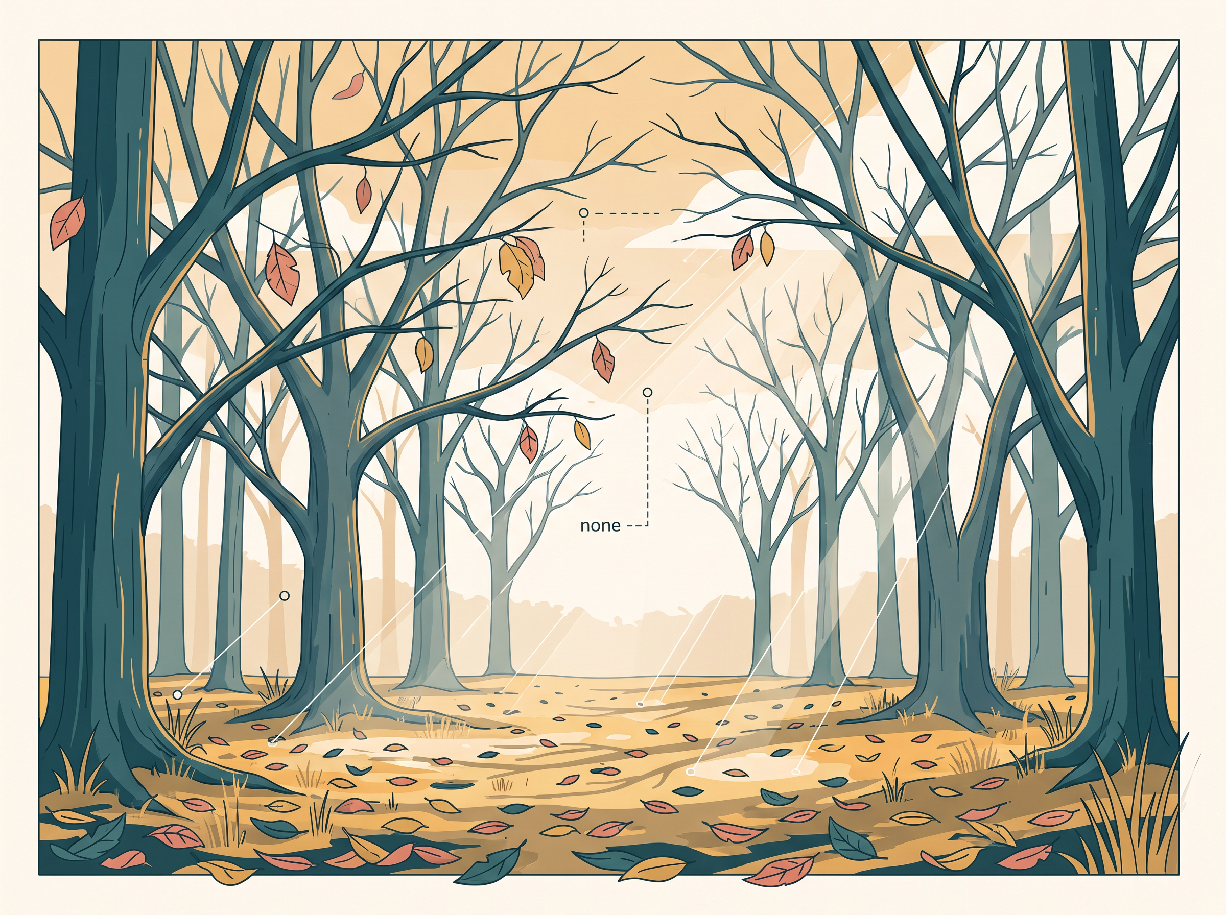
Fig. 5.4 – Tropical deciduous forest.
5.1.3 Tropical Thorn Forests
Where rainfall drops below 50 cm, forest gives way to thorn. These tropical thorn forests are made of grasses and shrubs rather than tall trees, and they cover the semi-arid areas — lands that are dry but not true desert — of south west Punjab, Haryana, Rajasthan, Gujarat, Madhya Pradesh and Uttar Pradesh. To survive on so little water, the plants stay leafless for most of the year, giving the land the look of scrub. The important species are babool, ber and wild date palm, along with khair, neem, khejri and palas. Beneath them, tussocky grass grows up to 2 m as the undergrowth. Fig. 5.5 shows a stretch of thorn forest.
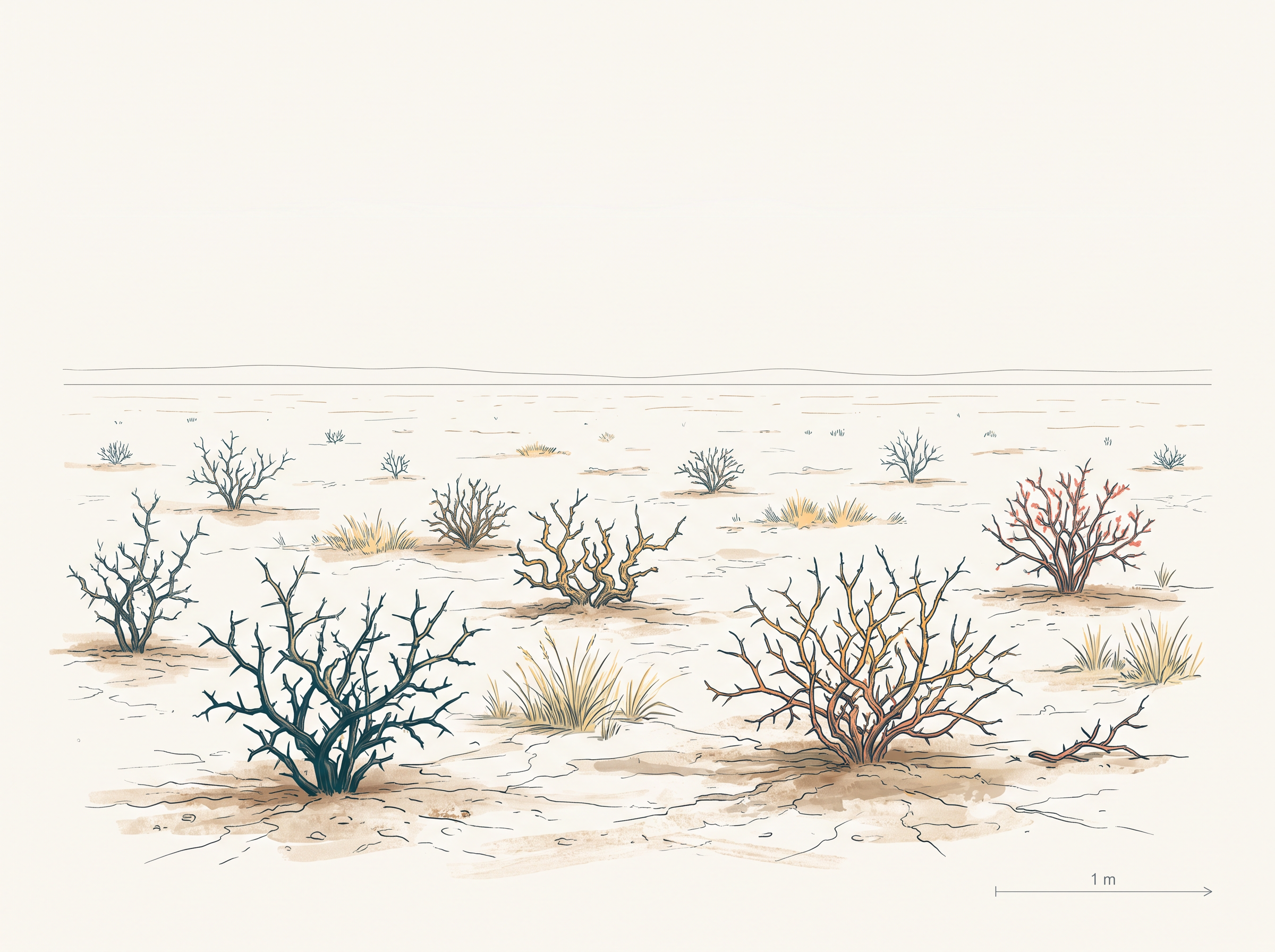
Fig. 5.5 – Tropical thorn forest.
5.1.4 Montane Forests
On a mountain, temperature falls steadily as you climb, and the vegetation changes with it. Mountain forests fall into two groups: the northern mountain forests of the Himalaya, and the southern mountain forests of Peninsular India.
The Northern Mountain Forests
The Himalayan ranges show a full succession of vegetation, from the tropical at the base to the tundra — the cold, treeless zone — at the top, each belt handed over to the next as the air cools with height. Deciduous forest holds the foothills. Above it, between 1,000 and 2,000 m, comes the wet temperate forest. In the higher hills of northeastern India and in the hilly areas of West Bengal and Uttaranchal, evergreen broad-leaf trees such as oak and chestnut dominate.
Between 1,500 and 1,750 m, pine forests are well developed, with chir pine as a useful commercial tree. Deodar, a highly valued endemic species — one that grows naturally in only this region and nowhere else — is found mainly in the western Himalaya, and its durable wood is used in construction. In the same zone grow the chinar and the walnut, whose wood sustains the famous Kashmir handicrafts. Blue pine and spruce appear between 2,225 and 3,048 m, and here and there this zone opens into temperate grassland.
Higher still, the forest gives way to Alpine forests and pastures. Silver firs, junipers, pines, birch and rhododendrons grow between 3,000 and 4,000 m. These high pastures are used heavily for transhumance — the seasonal movement of herders with their animals between low and high pastures — by tribes such as the Gujjars, the Bakarwals, the Bhotiyas and the Gaddis. The southern slopes of the Himalaya carry a thicker cover than the drier north-facing slopes, because they catch more rain. At the very top, only mosses and lichens survive, as part of the tundra vegetation.
The Southern Mountain Forests
The southern mountain forests lie in three distinct areas of Peninsular India: the Western Ghats, the Vindhyas and the Nilgiris. Because these hills are nearer the tropics and only about 1,500 m above sea level, their vegetation is temperate in the higher parts and subtropical lower down, especially on the Western Ghats in Kerala, Tamil Nadu and Karnataka. The temperate forests here are called Sholas, found in the Nilgiris and in the Anaimalai and Palani hills. Other trees of economic value include magnolia, laurel, cinchona and wattle. Such forests also grow in the Satpura and the Maikal ranges of central India. Fig. 5.6 shows montane forest on a Himalayan slope.
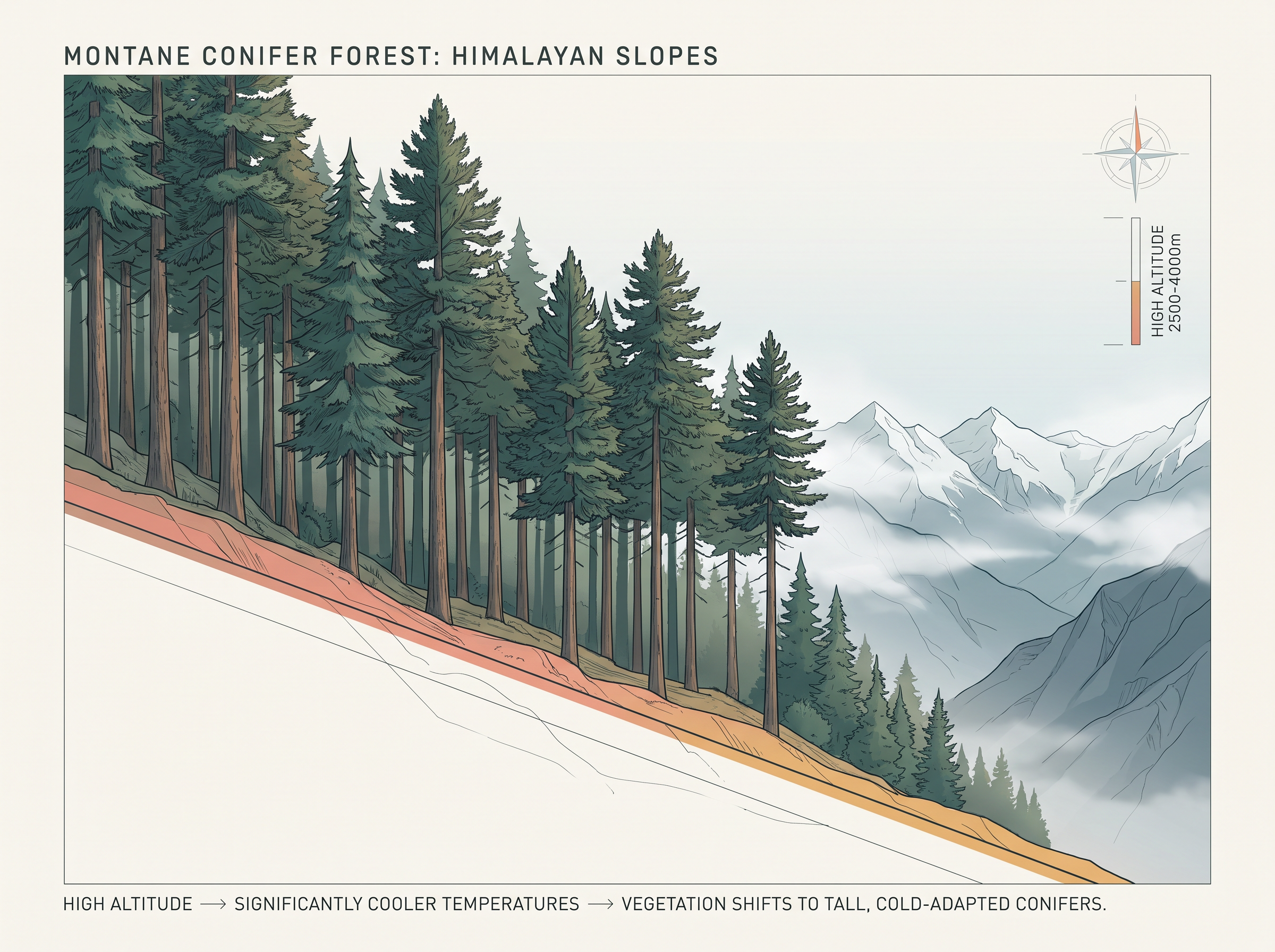
Fig. 5.6 – Montane forest.
5.1.5 Littoral And Swamp Forests
The word littoral means of the shore, and these are the forests of India’s coasts and wetlands. India has a rich variety of wetland habitats. About 70 per cent of this area is under paddy cultivation, and the total wetland area is 3.9 million hectares — a hectare being a square 100 m on each side, or 10,000 square metres. Two of these wetlands, Chilika Lake in Odisha and the Keoladeo National Park at Bharatpur in Rajasthan, are protected as water-fowl habitats under the Convention on Wetlands of International Importance, known as the Ramsar Convention. An international convention like this is simply an agreement among member states of the United Nations.
India’s wetlands are grouped into eight kinds: the reservoirs of the Deccan Plateau in the south together with the lagoons and other wetlands of the southern west coast; the vast saline expanses of Rajasthan, Gujarat and the Gulf of Kachchh; the freshwater lakes and reservoirs running from Gujarat eastwards through Rajasthan, with Keoladeo National Park, and Madhya Pradesh; the delta wetlands and lagoons of the east coast, such as Chilika Lake; the freshwater marshes of the Gangetic Plain; the floodplains of the Brahmaputra together with the marshes and swamps of the northeastern hills and the Himalayan foothills; the lakes and rivers of the montane region of Kashmir and Ladakh; and the mangrove forest and other wetlands of the island arcs of the Andaman and Nicobar Islands.
Mangroves are salt-tolerant trees that grow where land meets the tidal sea, along salt marshes, tidal creeks, mud flats and estuaries. Their many species tolerate salt, and, crisscrossed by creeks of still water and tidal flow, they shelter a wide variety of birds. In India the mangrove forests cover 4,992 sq. km, about 7 per cent of the world’s mangroves. They are best developed in the Andaman and Nicobar Islands and in the Sunderbans of West Bengal, with other important stretches in the Mahanadi, the Godavari and the Krishna deltas. These forests too are being encroached upon, and so they need conservation. Fig. 5.7 shows a mangrove forest.
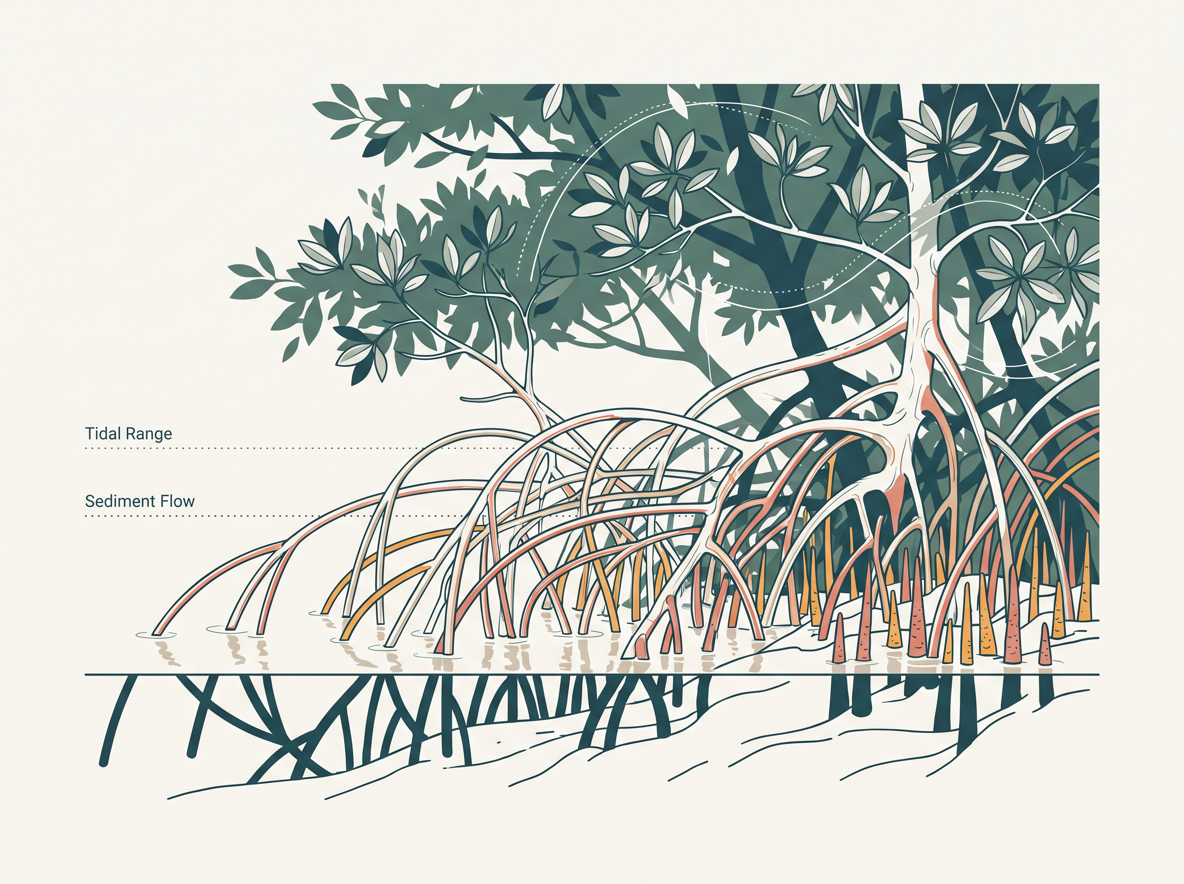
Fig. 5.7 – Mangrove forest.
5.2 Forest Conservation
Forests are tied to life and to their surroundings in tangled ways, and they hand the economy and society many benefits, some direct and many indirect. Because so much rests on them, conserving forests is a matter of human survival and prosperity, not only of scenery. For this reason the Government of India set out to build a conservation effort for the whole country. It adopted a forest policy in 1952 and revised it in 1988. Under the newer policy the government aims to manage forests sustainably — protecting and expanding the forest reserve on one side, and meeting the needs of local people on the other.
The policy set out several linked aims. It aimed to bring 33 per cent of the country’s geographical area under forest cover, and to keep the environment stable by restoring forests wherever the ecological balance had been disturbed. It sought to conserve the country’s natural heritage — its biological diversity and its genetic pool. It looked to check soil erosion and the spread of desert land, and to bring down the swing between floods and droughts.
Beyond protecting what stood, the policy set out to grow the forest back. It aimed to raise forest cover through social forestry and afforestation — the planting of trees — on degraded land. It aimed to lift the productivity of forests so that timber, fuel, fodder and food would reach the rural people who depend on them, while nudging them towards substitutes for wood. And it aimed to build a massive people’s movement, women included, to plant trees, halt the felling of trees and so lighten the pressure on the forests still standing.
The people most bound up with India’s forests are its tribal communities. For many of them the forest is home, livelihood and their very existence — it provides food, fruit, edible leaves, honey, roots and wild game, and the material to build houses and practise their crafts. In the tribal economy the forest is the main source of sustenance, and these communities are widely regarded as living in close balance with nature and guarding the forest. Their long-held knowledge of the forest can itself help forests recover. This is why the policy leans towards partnership: rather than treating tribal people only as collectors of minor forest produce, it argues they should be made growers of that produce and drawn into conservation. On this basis the following steps were taken.
5.2.2 Farm Forestry
Farm forestry is the third kind of social forestry, and here farmers grow trees for both commercial and non-commercial purposes on their own farmland. The forest departments of the states hand out tree seedlings free of cost to small and medium farmers. Land that would otherwise sit idle — the margins of fields, grasslands and pastures, the ground around homes and cattle sheds — can be planted with trees under non-commercial farm forestry.
5.3 Wildlife
You may have seen animals and birds in a zoo, in captivity. The wildlife of India, living free, is a great natural heritage. It is estimated that about 4-5 per cent of all known plant and animal species on the earth are found in India. The main reason for this richness is the sheer variety of the country’s ecosystems — the natural communities of living things together with the surroundings they live in — which India has preserved and supported through the ages. Where the vegetation is varied, as the earlier sections showed, the habitats are varied too, and varied habitats hold varied life.
That richness is now under strain. Over the years, human activity has disturbed the habitats of wild animals, their numbers have dropped sharply, and some species stand at the brink of extinction. The decline has several causes working at once.
Industrial and technological advance brought a rapid rise in the exploitation of forest resources. More and more land was cleared for agriculture, human settlement, roads, mining and reservoirs, shrinking the space left for wildlife. Pressure on forests grew as local people lopped trees for fodder and fuelwood and removed small timber. Grazing by domestic cattle told on wildlife and its habitat. Hunting, once taken up as a sport by the elite — with hundreds of wild animals killed in a single hunt — has given way to commercial poaching, which is now rampant. And forest fire adds its own toll.
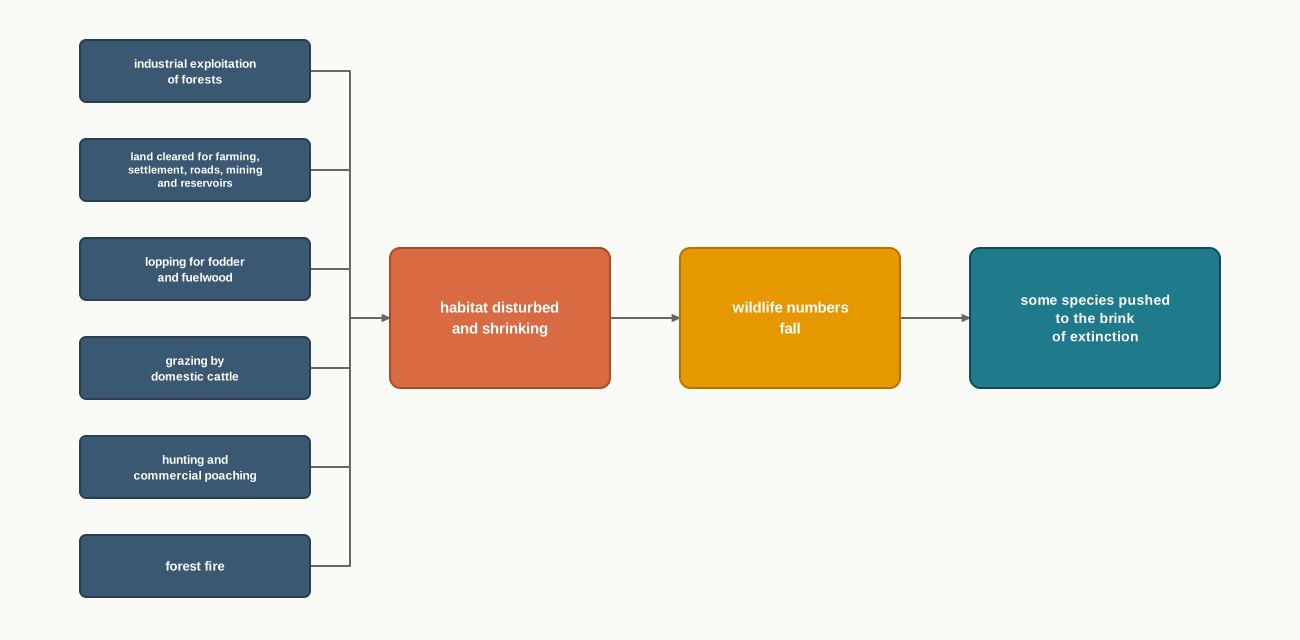
Fig. 5.9 – Pressures on wildlife habitat.
It is increasingly felt that conserving wildlife matters both to the nation and to the world’s shared heritage, and that it works hand in hand with ecotourism — travel to natural areas managed so that the wildlife and its habitat are protected rather than harmed. What, then, has the government done in this direction?
5.4 Wildlife Conservation In India
Protecting wildlife has a long tradition in India. Old story collections such as the Panchtantra and the Jungle Books have lasted across generations because of the love for wildlife they carry, and they leave a deep mark on young readers.
The turning point in law came in 1972, when a comprehensive Wildlife Act gave the country its main legal framework for protecting wildlife. The Act has two main objectives: to protect the endangered species listed in its schedule, its official list, and to give legal backing to conservation areas, which it classifies as national parks, sanctuaries and closed areas. In 1991 the Act was amended thoroughly — punishments were made more stringent, and new provisions were added to protect named plant species and to conserve endangered wild animals. Today the country has 107 national parks and 573 wildlife sanctuaries.
Wildlife conservation is a wide field with great promise for human well-being, but it works only when every individual grasps its importance and does their bit. For the effective conservation of flora and fauna — the plant and animal life of a place — the Government of India has taken special steps, working with UNESCO’s ‘Man and Biosphere Programme’.
The Special Schemes
Some of these steps are schemes built around a single animal. Project Tiger, launched in 1973, works to keep a viable population of tigers in India — a population large and healthy enough to sustain itself — for scientific, aesthetic, cultural and ecological reasons, and to preserve areas of biological importance as a natural heritage for people to learn from and enjoy. It began in nine tiger reserves covering 16,339 sq. km. It has since grown to 58 tiger reserves, taking in 84,487 sq. km of core tiger habitat spread across 18 states. Over this period the tiger count rose from 1,411 in 2006 to 3,682 in 2023, more than 75 per cent of the world’s tigers.
A rise of this size did not come from leaving tigers alone. It came from guarding the core habitat they need to breed and from raising the number of protected reserves from nine to 58, so that India now holds more than three-quarters of the world’s wild tigers. But the figure is a single national total gathered across 18 states. It tells us the direction — a strong recovery — without telling us how the tigers are shared out. A few reserves may be crowded while others hold very few, and a national total hides that spread.
Project Elephant, launched in 1992, helps the states that carry free-ranging herds of wild elephants. Its aim is the long-term survival of viable elephant populations in their natural habitat, and it too runs across 18 states. A herd in the open is shown in Fig. 5.10.
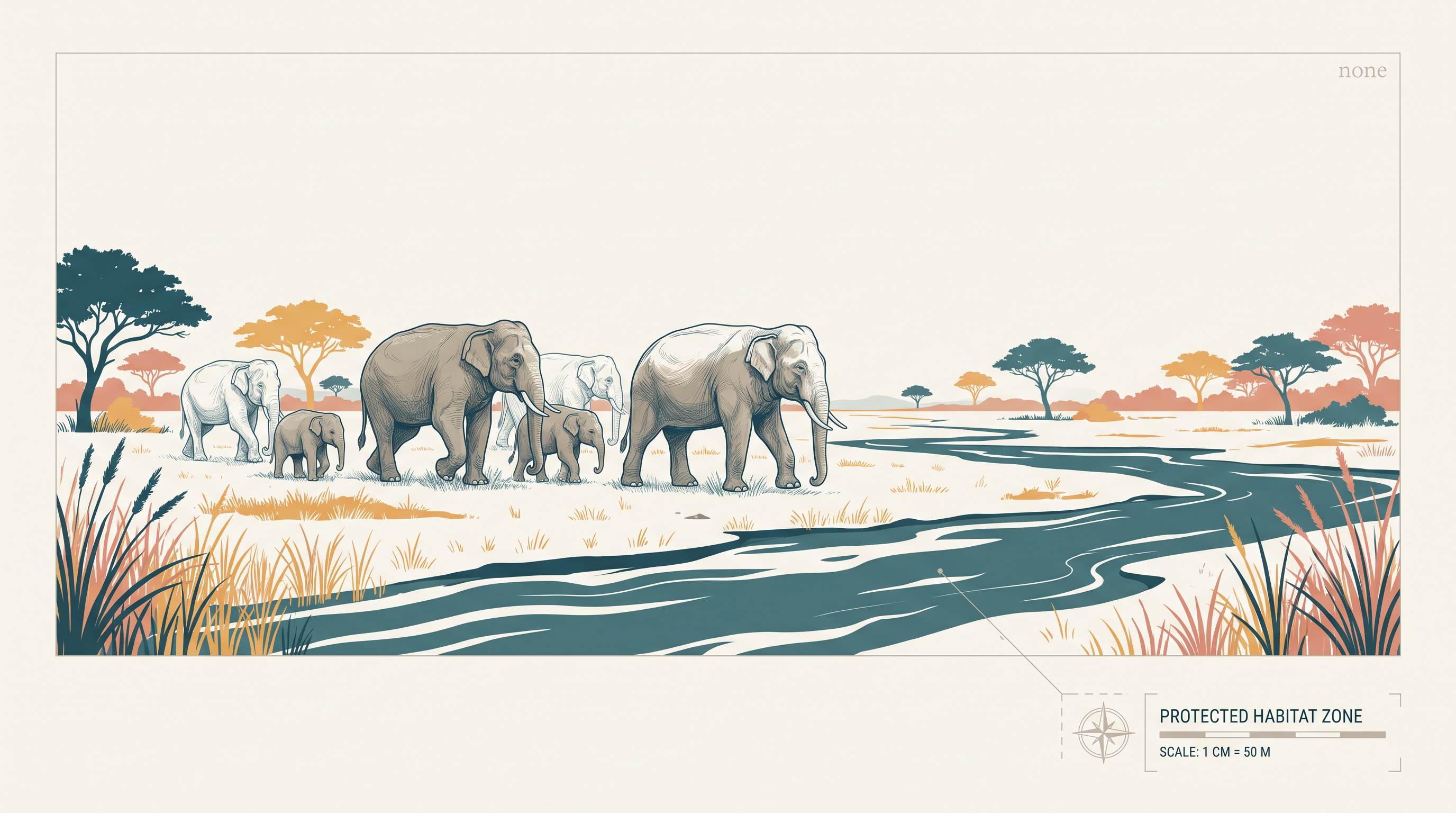
Fig. 5.10 – Elephants in natural habitat.
Beyond these two, the government has launched other efforts, including the Crocodile Breeding Project, Project Hangul, and the conservation of the Himalayan Musk deer.
5.5 Biosphere Reserves
A biosphere reserve is a unique or representative ecosystem, of land or of coast, that is recognised internationally under UNESCO’s Man and Biosphere (MAB) Programme. The idea is to protect a whole living region — not just a single species or a single patch — and to do it in a way that also serves the people who live there and the scientists who study it.
The Three Objectives
A biosphere reserve is built to meet three objectives at once, shown in Fig. 5.11.
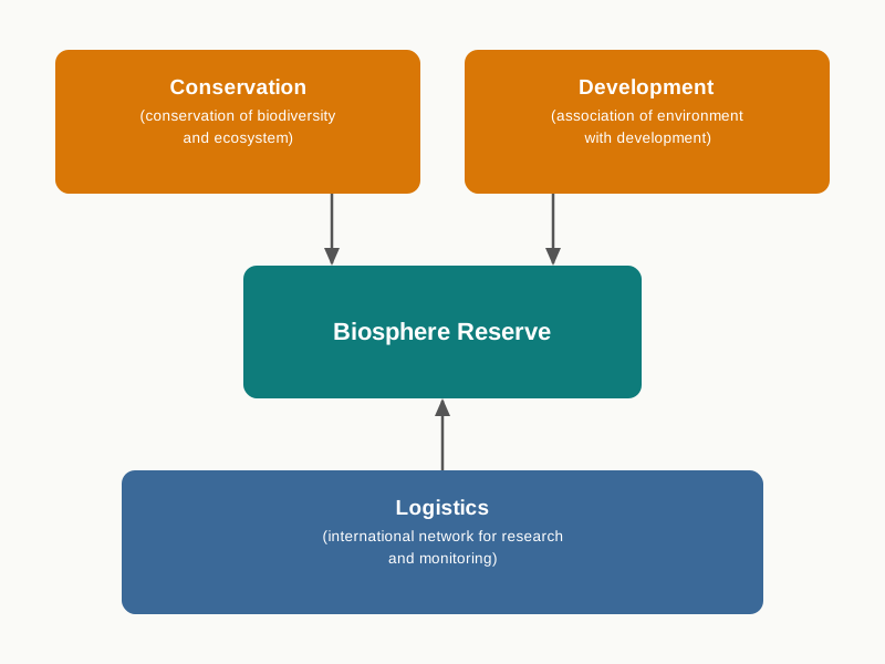
Fig. 5.11 – Objectives of a biosphere reserve.
The first objective is conservation — protecting the biodiversity and the ecosystem of the area. The second is development — tying the care of the environment to the needs of the people around it, so that protection and livelihood are not set against each other. The third is logistics — belonging to an international network for research and monitoring, so that what is learned in one reserve can inform the rest. A biosphere reserve is where these three meet.
Biosphere Reserves In India
India has 18 biosphere reserves, listed in Table 5.1 and mapped in Fig. 5.12. Of these, twelve have been recognised by UNESCO on its World Network of Biosphere Reserves.
The map in Fig. 5.12 shows where these reserves lie across the country.
Map
Fig. 5.12 Caption: India: biosphere reserves. Brief: Reproduce the printed map showing the full extent of India as officially defined, with the biosphere reserves marked at their locations as labelled points — among them Nanda Devi, Khangchendzonga, Dehang Debang, Dibru-Saikhowa, Manas, Nokrek, Pachmarhi, Achanakmar-Amarkantak, Similipal, Sunderbans, Nilgiri, Agasthyamalai, Gulf of Mannar and Great Nicobar — keeping the latitude and longitude grid, the Tropic of Cancer, the scale bar and the neighbouring labels as printed.
5.6 Summary
- Natural vegetation is a plant community left undisturbed long enough to adjust fully to the climate and soil of a place; it is not the planted, tended vegetation of gardens and orchards.
- India’s forests are classified, by dominant vegetation type and climatic region together, into five groups: tropical evergreen and semi evergreen, tropical deciduous, tropical thorn, montane, and littoral and swamp forests.
- Tropical evergreen and semi evergreen forests grow where rainfall exceeds 200 cm and temperature stays above 22 °C; they are stratified, reach 60 m, and stay green all year.
- Tropical deciduous, or monsoon, forests are the most widespread, growing on 70-200 cm of rain; they shed their leaves in the dry season and split into moist deciduous (100-200 cm) and dry deciduous (70-100 cm).
- Tropical thorn forests hold ground where rainfall falls below 50 cm, forming leafless scrub with tussocky grass up to 2 m.
- Montane forests change with altitude: the northern Himalayan forests run from tropical foothills up to tundra, while the southern Peninsular forests include the temperate Sholas.
- Littoral and swamp forests are the vegetation of wetlands and tidal coasts, where salt-tolerant mangroves grow.
- Under the British, the protective use of forests gave way to large-scale commercial exploitation.
- The forest policy of 1952, revised in 1988, seeks sustainable management — expanding forest reserve while meeting local needs — and set a target of 33 per cent forest cover.
- Social forestry, classified in 1976 into urban, rural and farm forestry, plants and protects trees for environmental, social and rural development; rural forestry covers agro-forestry and community forestry.
- India holds about 4-5 per cent of the world’s known species, but wildlife has declined under habitat loss, land clearing, grazing, hunting, poaching and fire.
- The Wildlife Act of 1972, amended in 1991, protects endangered species and conservation areas; the country has 107 national parks and 573 wildlife sanctuaries.
- Special schemes — Project Tiger (1973), Project Elephant (1992) and others — protect particular species; the tiger count rose from 1,411 in 2006 to 3,682 in 2023.
- A biosphere reserve, recognised under UNESCO’s Man and Biosphere Programme, joins conservation, development and logistics; India has 18, of which twelve are on the UNESCO World Network.
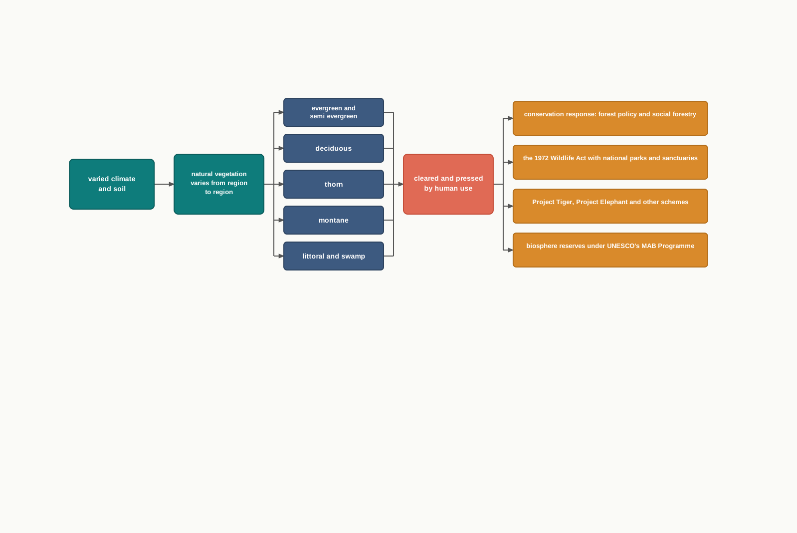
Fig. 5.13 – Chapter summary: from forests to conservation.
What This Chapter Cannot Tell You
The five-type scheme and the vegetation map draw broad belts; they cannot show the actual trees on one hillside, and at national scale the small patches vanish. The tiger count and the counts of parks, sanctuaries and reserves are national totals — they record direction and number, not how wildlife or forests fare place by place, nor the size and health of any single reserve. A forest-cover target of 33 per cent, or a column of designation years, says nothing about how much forest actually stands today, or whether it is thriving or degraded.
5.7 NCERT Questions
Sandalwood is an example of:
- Evergreen forest
- Deciduous forest
- Deltaic forest
- Thorny forest
Which one of the following was the purpose of Project Tiger?
- to kill tigers
- to put tigers in the Zoo
- to protect tigers from illegal hunting
- to make films on tigers
In which one of the following states is the Nandadevi Biosphere reserve situated?
- Bihar
- Uttar Pradesh
- Uttarakhand
- Odisha
How many of the Biosphere reserves from India are recognised by the UNESCO?
- One
- Two
- Twelve
- Four
Which one of the following proportion of area of the country was targeted to be under forest in Forest Policy of India?
- 33
- 44
- 55
- 22
What is natural vegetation? Under what climatic conditions do tropical evergreen forests develop? (about 30 words)
What do you understand by social forestry? (about 30 words)
Define biosphere reserves. (about 30 words)
What is the difference between forest area and forest cover? (about 30 words)
What steps have been taken up to conserve forests? (not more than 150 words)
How can people’s participation be effective in conserving forests and wildlife? (not more than 150 words)
On the outline map of India, mark and label the following.
- Areas having mangrove forests.
- Biosphere reserves of Nanda Devi, Sunderbans, Gulf of Mannar and Nilgiri.
- The location of the Forest Survey of India headquarters.
List the trees, bushes and shrubs found around your school. Write their local names and their uses.
5.8 Check Your Concepts
The chapter divides deciduous forests into moist deciduous and dry deciduous. Give the rainfall range of each, and name one region where each is found.
Using Table 5.1, work out how many of India’s biosphere reserves were designated before the year 2000.
Look at Fig. 5.1. Which single type of vegetation covers the largest area of India, and to which rainfall condition does it belong?
Project Tiger recorded 1,411 tigers in 2006 and 3,682 in 2023. By how many did the tiger population increase over this period? Show your working.
Starting from the foothills and climbing to the highest reaches, describe in order the succession of vegetation found on the Himalayan slopes.
Wildlife numbers in India have fallen sharply. Set out the main human activities that have caused this decline.
Tropical thorn forests, rather than tall trees, cover the semi-arid areas of north-west India. Explain what feature of the climate produces this, and how the plants there survive it.
5.2.1 Social Forestry
Social forestry means managing and protecting forests, and planting trees on barren land, in order to help environmental, social and rural development. In 1976 the National Commission on Agriculture divided social forestry into three kinds: urban forestry, rural forestry and farm forestry. The split is easiest to hold as a branching tree.
Fig. 5.8 – The three kinds of social forestry.
Urban forestry raises and manages trees on public and private land in and around towns and cities — the green belts, parks, roadside avenues and industrial and commercial green belts of the built-up landscape.
Rural forestry works in the countryside and rests on two ideas: agro-forestry and community forestry. Agro-forestry raises trees and farm crops together on the same land, waste patches included, so that food, fodder, fuel, timber and fruit come off the plot side by side. Community forestry raises trees on public or shared land — the village pasture and temple land, roadsides, canal banks, the strips along railway lines and school grounds. Its aim is to benefit the community as a whole, and it gives landless people a way to share in tree-raising and its gains, which otherwise reach only those who own land.