Chapter 7: Transport And Communication
For most of history, a merchant in Moscow and a market on the Russian Pacific coast lived in different worlds. Between them lay thousands of kilometres of forest, swamp and frozen plain, crossed only on foot, by cart, or by river in the short season when the ice broke. Goods that reached a European port in weeks took months to reach the Pacific — if they arrived at all.
Then came the rails. The Trans–Siberian Railway, running 9,332 km from St. Petersburg in the west to Vladivostok on the Pacific coast in the east, became the longest such route in the world, double-tracked and electrified along its whole length. It crossed the Ural Mountains, the line where Europe becomes Asia, and pushed on past the great rivers Ob and Yenisei, past Irkutsk, a fur centre, and Chita, an agricultural one.
The railway did far more than carry passengers. It opened Russia’s vast Asian interior to the markets of Western Europe, stitching producing regions to consuming ones across a continent that had always held them apart. A forest, a mine or a wheat field is worth little until its produce can reach someone who wants it. That link — the route and the carrier that make exchange possible — is what this chapter is about, whether the carrier runs on rails, floats on water, flies through the air, or flows through a pipe.
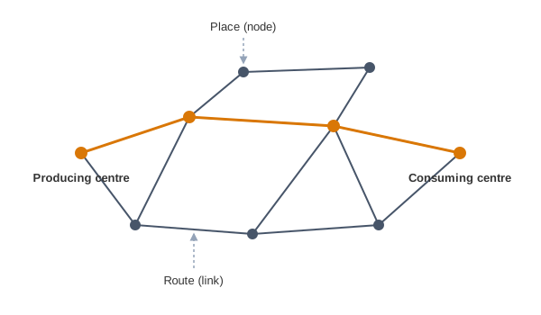
Fig. 7.0 – Nodes and links in a transport network.
7.1 Transport
Why Movement Is Needed
Natural resources, economic activities and markets are rarely found together in one place. A mineral lies where geology put it, a crop grows where the climate allows it, a factory stands where labour and power are cheap, and the buyers may be a continent away. For any of this to be useful, the produce of one place must reach the people of another.
That is the work of transport, communication and trade. Together they build the links between producing centres, where goods are made or grown, and consuming centres, where they are used. The whole system of mass production and exchange is complex, yet it rests on a simple bargain: each region produces the items for which it is best suited, and relies on others for the rest.
This is why high living standards and quality of life depend on efficient transport, communication and trade. A place cut off from these links cannot sell what it makes or buy what it lacks.
Transport And Communication Split Apart
In earlier days, the means of transport and communication were the same. A message travelled no faster than the messenger who carried it — a rider, a runner, a ship. Today the two have acquired distinct and specialised forms, and information can now race far ahead of any vehicle.
Transport is the network of links and carriers through which trade takes place. Communication is the separate business of moving information, which this chapter turns to at its end.
What Transport Is
Transport is a service or facility for carrying persons and goods from one place to another, using humans, animals and different kinds of vehicles. These movements take place over three media — land, water and air. Roads and railways make up land transport; shipping and waterways make up water transport; and airways are the third. Pipelines are a mode of their own, carrying materials such as petroleum, natural gas and ores in liquid form.
Transport is far more than the vehicle. It is an organised service industry, built to meet a basic need of society. It includes the transport arteries — the roads, tracks and routes themselves — the vehicles that carry people and goods along them, and the organisation that maintains the arteries and handles loading, unloading and delivery.
Every nation also develops transport for defence. Assured and speedy transport, together with efficient communication, lets scattered peoples cooperate and hold together as one country. The principal modes fall into a small, tidy family, set out in Fig. 7.1.
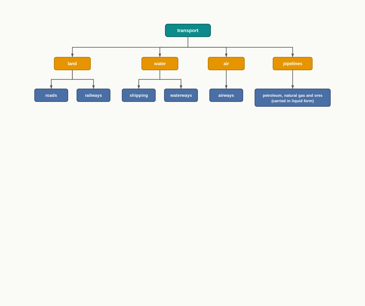
Fig. 7.1 – The principal modes of transport.
Networks: Nodes And Links
Geographers picture a transport system as a network. A transport network is several places, called nodes, joined together by a series of routes, called links, to form a pattern. A node is a place where routes meet — a town, a port, a junction — and a link is the route that joins one node to the next.
Reading transport as a web of nodes and links is the habit this whole chapter builds. Whichever mode is doing the carrying, the question is always the same: which places are joined, by what route, and how well.
7.2 Modes Of Transportation
The world moves its people and goods by four principal modes: land, water, air and pipelines. Each is used both for inter-regional transport, between one region and another, and for intra-regional transport, within a single region. Every one of these modes except pipelines carries both passengers and freight — the goods a carrier moves, as opposed to the people it moves.
No single mode is best for everything. The importance of a mode depends on three things: the type of goods and services to be carried, the cost of carrying them, and which mode is actually available. A well-run system does not force everything through one carrier; it matches each job to the mode that suits it.
How The Job Picks The Mode
International movement of goods, from one continent to another, is handled by ocean freighters — large cargo ships. Over short distances, and wherever door-to-door delivery matters, road transport is cheaper and faster. Railways come into their own for large volumes of bulky material carried long distances within a country. High-value, light and perishable goods — the ones that must arrive fast and can pay for speed — go by airways.
Because each mode covers what the others cannot, in a well-managed transport system the various modes complement each other rather than compete. This matching of the job to the carrier is set out in Fig. 7.2.
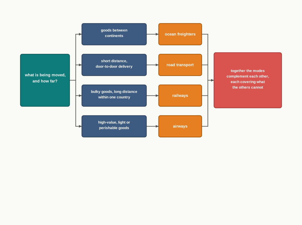
Fig. 7.2 – Matching transport mode to the job.
7.2.1 Land Transport
Most movement of goods and services takes place over land. The story of land transport is really the story of how much load a person could shift, and how fast.
From Porters To Engines
In early days, humans themselves were the carriers. In parts of north India a bride was, and sometimes still is, carried on a palanquin — a palki or doli — by four porters called Kahars. Later, animals became beasts of burden: mules, horses and camels still carry loads of cargo in rural areas. The invention of the wheel made carts and wagons possible, multiplying the load a single animal could pull.
The real revolution came with the steam engine in the eighteenth century. Perhaps the first public railway line opened in 1825, between Stockton and Darlington in northern England. From then on, railways became the most popular and fastest form of transport of the nineteenth century. In the United States they opened up the continental interior — land far from any coast — to commercial grain farming, mining and manufacturing.
Later, the internal combustion engine, which burns its fuel inside the engine to drive the vehicle, transformed road transport, bringing better roads and the motor cars and trucks that run on them. Among the newer forms of land transport are pipelines, ropeways and cableways. Pipelines carry liquids such as mineral oil, water, sludge and sewage. Today the great freight carriers are the railways, ocean vessels, barges, boats, motor trucks and pipelines. This long climb from the human porter to the engine is traced in Fig. 7.3.
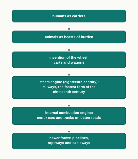
Fig. 7.3 – The evolution of land transport.
The Old Forms Still Matter
The old, elementary forms — the human porter, the pack animal, the cart, the wagon — are the most expensive means of transport for the load they shift, while large freighters are the cheapest. Yet the old forms have not vanished. They supplement the modern carriers by reaching into places those carriers cannot — the interiors of large countries. In the densely populated districts of India and China, a great deal of overland transport still moves by human porters, or by carts drawn or pushed by people.
Different animals suit different ground. Horses are used as draught animals even in Western countries. Dogs and reindeer draw sledges over the snow-covered ground of North America, northern Europe and Siberia. Mules are preferred in mountainous regions, camels carry caravans across deserts, and in India bullocks pull carts.
Where slopes are too steep for roads, transport climbs onto a cable. Ropeways and cable cars, such as those in Austria (Fig. 7.4), carry people and goods up mountain slopes and to mines that no road could reach.
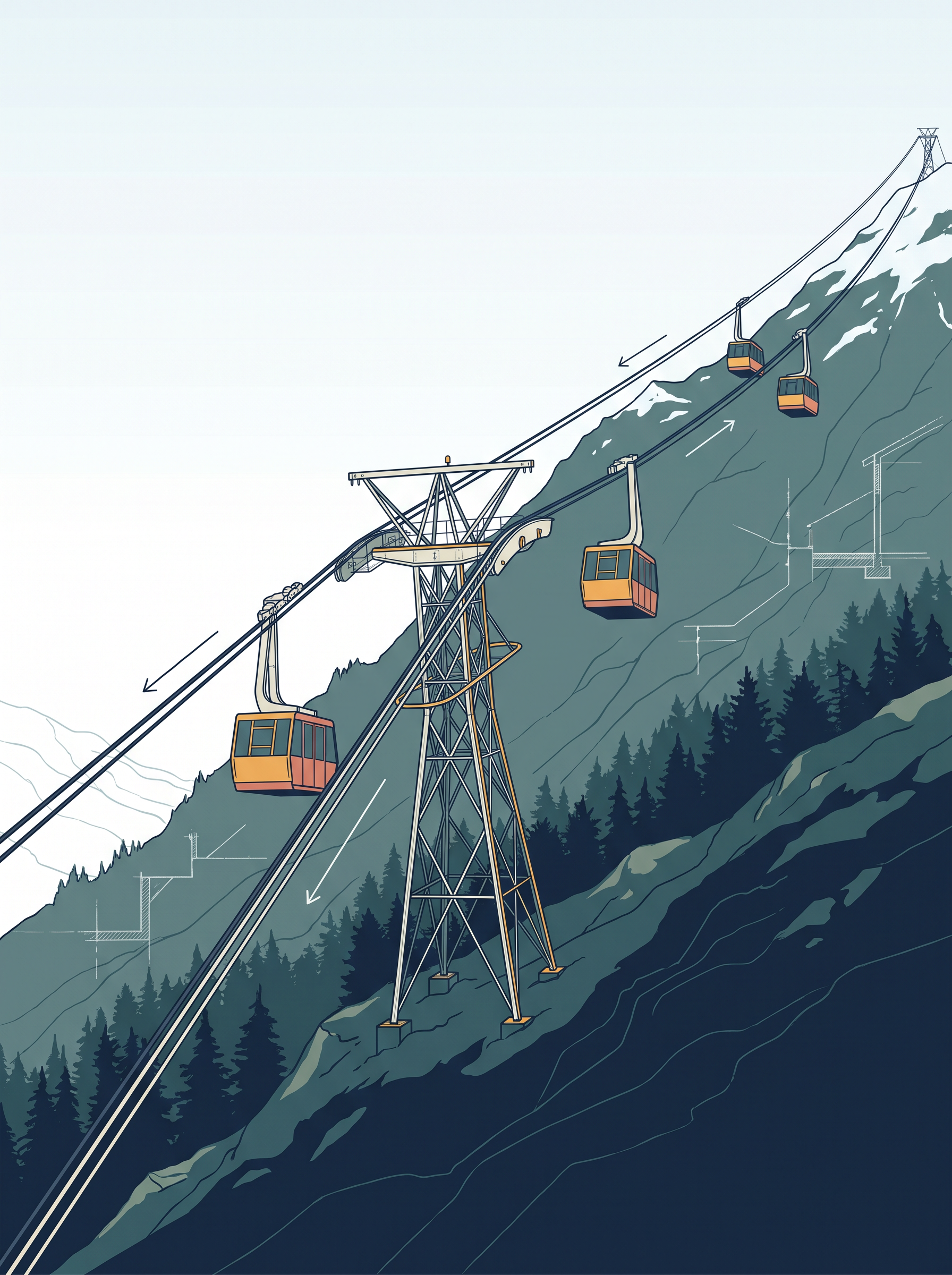
Fig. 7.4 – Ropeway and cable cars in Austria.
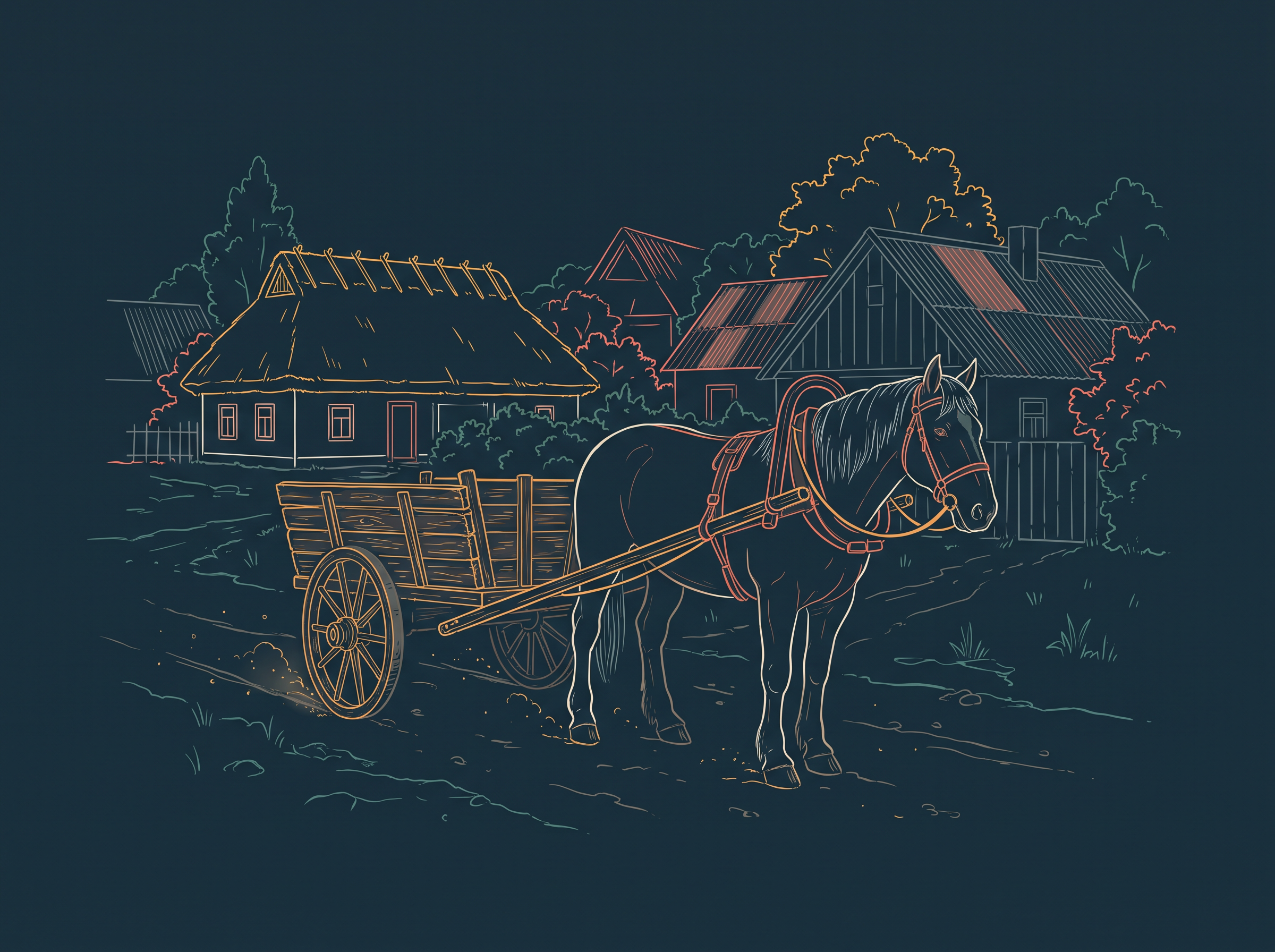
Fig. 7.5 – A horse cart in a village in Ethiopia.
7.2.2 Roads
For short distances, road transport is the most economical mode — more so than railways — and freight transport by road is gaining importance because it offers door-to-door service, from the factory gate to the shop with no reloading in between.
Metalled And Unmetalled Roads
Not all roads are built alike. An unmetalled road is a plain earth track, simple to make but not serviceable in every season: in the rainy season it becomes unmotorable. A metalled road has a hard, surfaced top of stone, tar or concrete. Even metalled roads are seriously handicapped during heavy rains and floods.
Where floods are frequent, the high embankment of a railway track and a well-maintained rail service are a more reliable answer. But railway route length is small, and rail alone cannot serve the needs of vast, developing countries cheaply. Roads therefore play a vital role in a nation’s trade and commerce, and in promoting tourism.
The quality of roads varies greatly between developed and developing countries, because building and maintaining them demands heavy expenditure. In developed countries good roads are near-universal and provide long-distance links — motorways, the autobahns of Germany, and inter-state highways for speedy movement — along which lorries of ever-increasing size and power run. Even so, the world’s road system as a whole is not well developed.
Where The Roads Are
The world’s total motorable road length is only about 15 million km, and North America alone accounts for 33 per cent of it. That continent also has the highest road density — the length of road per unit of area — and the highest number of registered vehicles, more even than Western Europe. Reading a single share like this is a skill worth practising, and it is worked through in WC 7.A1.
Roads follow wealth and vehicles, not land area or need. North America’s slice — close to 5 million km out of a 15-million-km world total — mirrors its industrial economy and heavy car ownership, and matches its high road density. The figure tells us where roads have been built, not where people most lack them; much of the developing world, with far more people, shares the remaining two-thirds.
Traffic Flows And Congestion
Traffic on roads has increased dramatically in recent years. When the road network cannot cope with the demand placed on it, congestion follows, and city roads suffer from it chronically. Traffic is uneven through the day: it has peaks, the high points, and troughs, the low points, with the peaks during the rush hours before and after work. Most cities in the world now face this problem.
Cities are trying several ways to ease the crush: charging a higher parking fee to discourage private cars, building a Mass Rapid Transit (MRT) system, improving the public bus service, and constructing expressways.
7.2.3 Highways
Highways are metalled roads that connect distant places, built for unobstructed vehicular movement. To keep traffic flowing without interruption they are made about 80 m wide, with separate traffic lanes, bridges, flyovers and dual carriageways — the two directions of traffic kept apart. In developed countries, every city and port town is linked through highways. One such highway is shown in Fig. 7.6.
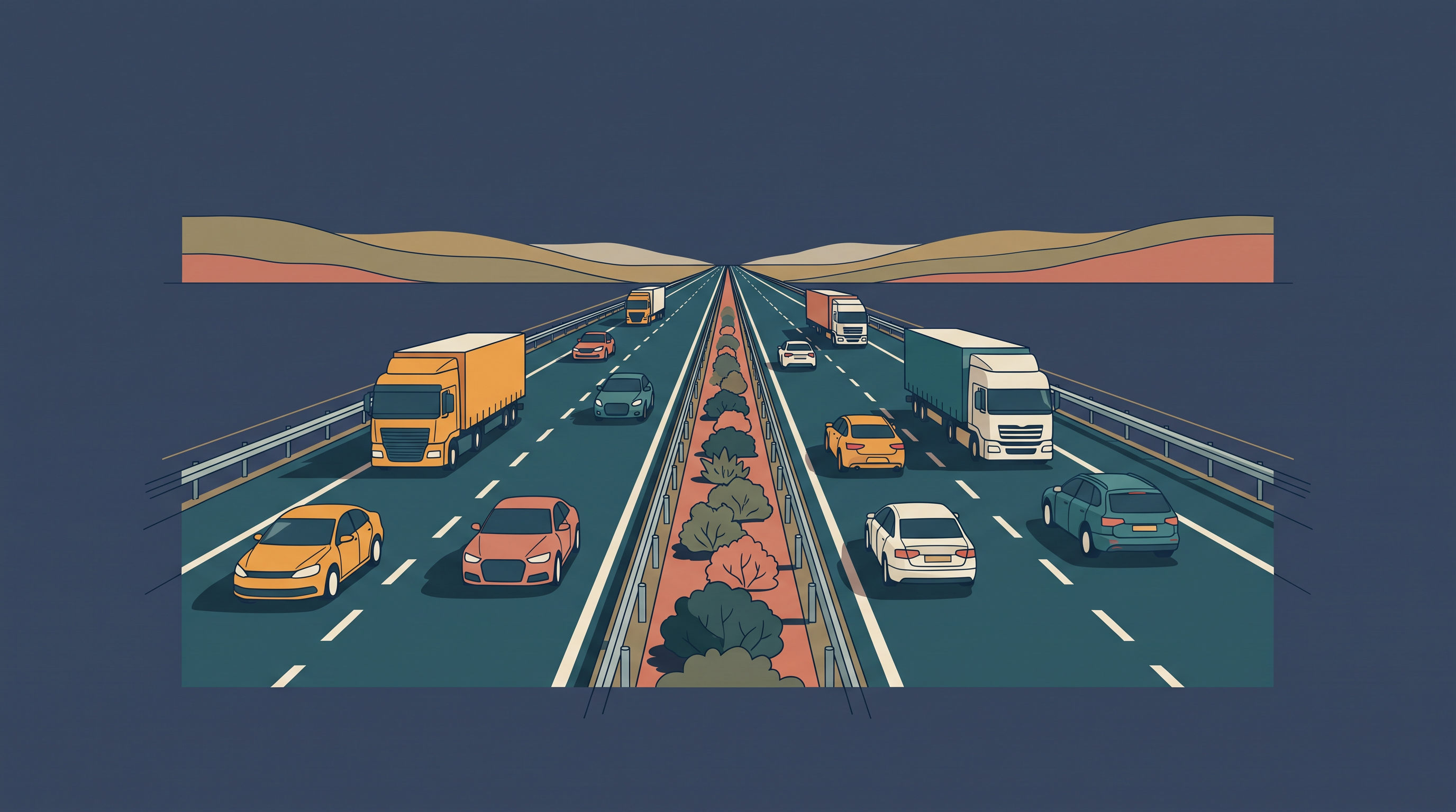
Fig. 7.6 – The Dharmavaram–Tuni National Highway, India.
Highways Across The Continents
In North America highway density is high — about 0.65 km of highway for every square kilometre of land — so that every place lies within 20 km of a highway. Cities on the Pacific coast in the west are well connected with those on the Atlantic coast in the east, and Canadian cities in the north with Mexican cities in the south. The Trans-Canadian Highway links Vancouver, in British Columbia on the west coast, to St. John’s City in Newfoundland on the east coast, while the Alaskan Highway links Edmonton in Canada to Anchorage in Alaska.
The Pan-American Highway, a large part of which is already built, is planned to connect the countries of South America, Central America and the USA–Canada. In Australia, the Trans-Continental Stuart Highway connects Darwin on the north coast with Melbourne, running via Tennant Creek and Alice Springs.
Europe has many vehicles and a well-developed highway network, but there its highways face strong competition from railways and waterways. In Russia, a dense highway network has grown in the industrialised region west of the Ural Mountains, with Moscow as its hub; the Moscow–Vladivostok Highway serves the region to the east. Because Russia is so vast, though, its highways matter less than its railways.
In China, highways criss-cross the country, connecting major cities such as Tsungtso near the Vietnam boundary, Shanghai in the centre, Guangzhou in the south and Beijing in the north; a newer highway links Chengdu with Lhasa in Tibet. In India, many highways link the major towns and cities: the Golden Quadrilateral (GQ), or Super Expressway, connects the four metropolitan cities of New Delhi, Mumbai, Chennai and Kolkata. In Africa, one highway joins Algiers in the north to Conakry in Guinea, and another connects Cairo to Cape Town.
7.2.4 Border Roads
Roads laid along a country’s international boundaries are called border roads. They do two jobs at once: they knit people living in remote frontier areas into the life of the major cities, and they serve defence. Almost every country builds such roads to carry goods to border villages and military camps.
7.2.5 Railways
Railways are a mode of land transport built for carrying bulky goods and passengers over long distances.
Gauges And Commuters
A railway’s gauge is the distance between its two rails, and gauges vary from country to country. They are roughly grouped as broad gauge (more than 1.5 m), standard gauge (1.44 m), metre gauge (1 m) and smaller gauges; the standard gauge is the one used in the United Kingdom. Commuter trains — short-distance trains that carry people to and from work — are very popular in the UK, USA, Japan and India, moving millions daily across their cities. In all, about 13 lakh km (1.3 million km) of railway are open for traffic in the world. A commuter train of this kind is shown in Fig. 7.7.
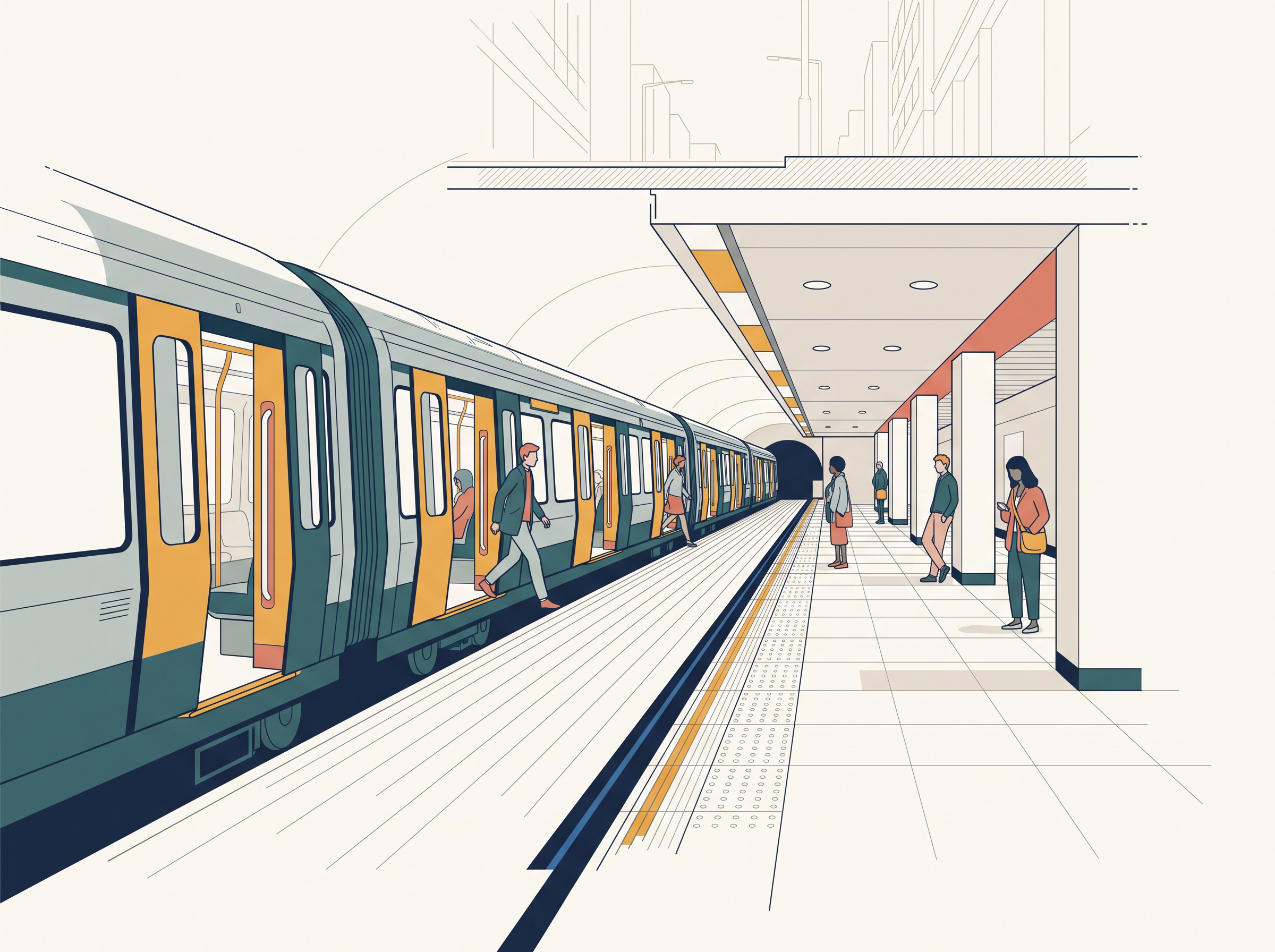
Fig. 7.7 – A commuter tube train in Vienna.
The Great Rail Regions
Europe has one of the densest rail networks in the world — about 4,40,000 km (440,000 km), most of it double or multiple-tracked. Belgium has the highest density: 1 km of railway for every 6.5 sq km of area, which packs a great deal of track into a small country. The important rail heads — the junctions where many lines meet — are London, Paris, Brussels, Milan, Berlin and Warsaw.
In many European countries passenger traffic matters more than freight, and underground railways are important in London and Paris. The Channel Tunnel, operated by the Euro Tunnel Group through England, connects London with Paris beneath the sea. Trans-continental railway lines, however, have lost some of their importance to the quicker, more flexible airways and roadways.
In Russia, railways carry about 90 per cent of the country’s total transport, with a very dense network west of the Urals. Moscow is the most important rail head, its major lines radiating across the vast country, and its underground railways and commuter trains are heavily used.
North America has one of the most extensive rail networks, nearly 40 per cent of the world’s total. Unlike much of Europe, its railways carry long-distance bulky freight — ores, grains, timber and machinery — more than passengers, and the densest network lies in the highly industrialised, urbanised belt of East Central USA and adjoining Canada. In Canada, railways are in the public sector and spread across sparsely populated areas, the transcontinental lines carrying the bulk of the wheat and coal.
Australia has about 40,000 km of railway, a quarter of it in New South Wales alone; the west–east Australian National Railway runs from Perth to Sydney, while New Zealand’s railways lie mainly in the North Island, serving the farming areas.
In South America, the network is densest in two regions — the Pampas of Argentina and the coffee-growing region of Brazil — which together hold 40 per cent of the continent’s route length. Among the rest, only Chile has a considerable network, linking coastal centres with interior mining sites; Peru, Bolivia, Ecuador, Colombia and Venezuela have only short single-track lines from ports to the interior, with no inter-connecting links. There is just one trans-continental route in South America, linking Buenos Aires in Argentina with Valparaiso in Chile across the Andes Mountains, through the Uspallatta Pass at a height of 3,900 m.
In Asia, the rail network is densest in the thickly populated areas of Japan, China and India; other countries have relatively few routes, and West Asia is the least developed of all, because of its vast deserts and sparse population.
In Africa, the second largest continent, there are only 40,000 km of railway, and South Africa alone accounts for 18,000 km of it, drawn there by gold, diamond and copper mining. Its important routes are four: the Benguela Railway through Angola to the Katanga–Zambia Copper Belt; the Tanzania Railway from the Zambian Copper Belt to Dar-es-Salaam on the coast; the railway through Botswana and Zimbabwe that links the landlocked states to the South African network; and the Blue Train from Cape Town to Pretoria in the Republic of South Africa. Elsewhere — in Algeria, Senegal, Nigeria, Kenya and Ethiopia — railway lines connect port cities to the interior but do not join up into a good network across countries.
7.2.6 Trans–Continental Railways
A trans–continental railway runs right across a continent, linking its two ends. Such lines were built for economic and political reasons — to open long-distance runs in different directions, tie distant regions to the centre, and move goods and people across a whole landmass. The most important of them are described below.
7.2.7 Trans–Siberian Railway
The Trans–Siberian Railway is Russia’s major rail route, running from St. Petersburg in the west to Vladivostok on the Pacific coast in the east, and passing through Moscow, Ufa, Novosibirsk, Irkutsk, Chita and Khabarovsk. At 9,332 km it is the longest trans-continental railway in the world, double-tracked and electrified along its length, and the most important route in Asia. It helped open Russia’s Asian region to West European markets.
The line crosses the Ural Mountains and the Ob and Yenisei rivers; Chita is an important agro-centre and Irkutsk a fur centre. From it, connecting links run south to Odessa in Ukraine, Baku on the Caspian coast, Tashkent in Uzbekistan, Ulan Bator in Mongolia, and Shenyang and Beijing in China. The full route is mapped in Fig. 7.8.
Map
Fig. 7.8 Caption: The Trans–Siberian Railway across Russia. Brief: Map of Russia showing the Trans–Siberian route as a marked line from St. Petersburg and Moscow in the west to Vladivostok on the Pacific in the east, with intermediate stops labelled (Kazan, Yekaterinburg, Tyumen, Omsk, Novosibirsk, Krasnoyarsk, Angarsk, Chita, Khabarovsk); show the Baltic Sea, Caspian Sea and Sea of Okhotsk, a latitude–longitude grid, and a distance scale bar in km.
7.2.8 Trans–Canadian Railways
The Trans–Canadian Railway is a 7,050 km line running from Halifax in the east to Vancouver on the Pacific coast, passing through Montreal, Ottawa, Winnipeg and Calgary (Fig. 7.9). It was built in 1886, at first as part of an agreement to bring British Columbia, on the west coast, into the Federation of States.
Later the line gained economic weight, because it joined the Quebec–Montreal Industrial Region to the wheat belt of the Prairie Region and to the Coniferous Forest region in the north, making each region complementary to the others. A loop line from Winnipeg to Thunder Bay, on Lake Superior, links the railway to one of the world’s great waterways. This line is the economic artery of Canada, and wheat and meat are its important exports.
Map
Fig. 7.9 Caption: The Trans–Canadian Railway. Brief: Map of Canada showing the route as a marked line from Halifax in the east through Quebec, Montreal, Ottawa, Winnipeg, Regina, Calgary and Kamloops to Vancouver and Victoria on the Pacific; show Hudson Bay, the Atlantic and Pacific Oceans, the United States boundary to the south, a grid and a scale bar in km.
7.2.9 The Union And Pacific Railway
The Union and Pacific Railway connects New York, on the Atlantic coast, to San Francisco, on the Pacific coast, passing through Cleveland, Chicago, Omaha, Evans, Ogden and Sacramento. The most valuable goods carried on this route are ores, grain, paper, chemicals and machinery.
7.2.10 The Australian Trans–Continental Railway
The Australian Trans–Continental Railway runs west to east across the southern part of the continent, from Perth on the west coast to Sydney on the east coast, passing through Kalgoorlie, Broken Hill and Port Augusta (Fig. 7.10). Another major line runs north to south, connecting Adelaide with Alice Springs, and is to be joined further to the Darwin–Birdum line.
Map
Fig. 7.10 Caption: The Australian Trans–Continental Railway. Brief: Map of Australia showing the west–east route as a marked line from Perth through Kalgoorlie, Forrest, Port Augusta, Broken Hill and Petterborough to Sydney; show the Indian Ocean and the Timor, Coral and Tasman Seas, a grid and a scale bar in km.
7.2.11 The Orient Express
The Orient Express runs from Paris to Istanbul, passing through Strasbourg, Munich, Vienna, Budapest and Belgrade. It has cut the journey from London to Istanbul to about 96 hours, against the 10 days the sea route once took. Its chief exports are cheese, bacon, oats, wine, fruits and machinery. There is also a proposal to build a Trans–Asiatic Railway, which would link Istanbul with Bangkok by way of Iran, Pakistan, India, Bangladesh and Myanmar.
7.3 Water Transport
Water transport has one great advantage over land and air: it needs no route to be built. The oceans already link every coast to every other, and they can be sailed by ships of all sizes; all that has to be provided is a port at each end. Moving on water is also much cheaper, because the friction of water is far less than that of land, so the energy cost of carrying a load is lower.
Water transport falls into two kinds — sea routes, which cross the open oceans, and inland waterways, which run along rivers, canals and lakes. The rest of this section takes each in turn.
7.3.1 Sea Routes
The oceans offer a smooth highway that can be crossed in every direction, and it costs nothing to maintain. Turning that open sea into a usable routeway with sea-going vessels was an important step in how humans adapted to their physical surroundings. Compared with land and air, ocean transport is a cheaper means of haulage — the carrying of load — for bulky material moved over long distances from one continent to another.
Modern passenger liners and cargo ships carry radar, wireless and other aids to help them navigate. Refrigerated chambers now keep perishable goods fresh, while tankers and other specialised ships carry particular cargoes. The spread of containers — standard steel boxes that stack and lock — has made loading and unloading at the world’s major ports far easier.
7.3.2 Important Sea Routes
The world’s major sea routes are drawn together in Fig. 7.11. The most important of them are taken up one by one in the subsections that follow.
Map
Fig. 7.11 Caption: The major sea routes of the world and the sea ports along them. Brief: World map showing the major shipping routes as dotted lines linking the leading sea ports (New York, London, Hamburg, Panama, Colon, Rio de Janeiro, Cape Town, Suez, Aden, Mumbai, Colombo, Singapore, Hong Kong, Shanghai, Yokohama, Honolulu, Vancouver, San Francisco, Sydney and others); include a key marking ‘major sea routes’ and ‘sea ports’; mark ‘Not to Scale’ and carry the note that the international boundary shown may not be authentic. Every map of India must show the full extent of India as officially defined.
7.3.3 The Northern Atlantic Sea Route
This route links north-eastern USA and north-western Europe, the two most industrially developed regions of the world. The foreign trade carried over it is greater than that of the whole of the rest of the world put together — about one-fourth of the world’s foreign trade moves along it. It is therefore the busiest route on Earth, which is why it is also called the Big Trunk Route, and both its coasts have highly advanced ports and harbour facilities. It is worth opening an atlas and finding some of the important ports along the coasts of the USA and Western Europe.
7.3.4 The Mediterranean–Indian Ocean Sea Route
This route passes through the heart of the Old World and serves more countries and people than any other. Some of its important ports are Port Said, Aden, Mumbai, Colombo and Singapore. The building of the Suez Canal greatly cut the distance and time along it, compared with the older route that ran the long way round the Cape of Good Hope.
7.3.5 The Cape Of Good Hope Sea Route
This trade route connects the highly industrialised region of Western Europe with West Africa, South Africa, South-east Asia, and the commercial farming and livestock economies of Australia and New Zealand. Trade and traffic between East and West Africa are rising, as rich natural resources are developed — gold, diamond, copper, tin, groundnut, oil palm, coffee and fruits.
7.3.6 The Southern Atlantic Sea Route
This route runs across the Atlantic Ocean, connecting West European and West African countries with Brazil, Argentina and Uruguay in South America. Far less traffic moves along it, because both South America and Africa have limited development and smaller populations. Only south-eastern Brazil, the Plata estuary, and parts of South Africa carry large-scale industry. There is also little traffic between Rio de Janeiro and Cape Town, because South America and Africa produce much the same goods and resources, and so have little to exchange.
7.3.7 The North Pacific Sea Route
Trade across the vast North Pacific moves along several routes that all converge at Honolulu. The direct route follows the Great Circle — the shortest path between two points across the curved surface of the globe — linking Vancouver and Yokohama and halving the travelling distance (2,480 km). This route joins the ports on the west coast of North America with those of Asia: Vancouver, Seattle, Portland, San Francisco and Los Angeles on the American side, and Yokohama, Kobe, Shanghai, Hong Kong, Manila and Singapore on the Asian side.
7.3.8 The South Pacific Sea Route
This route connects Western Europe and North America with Australia, New Zealand and the scattered Pacific islands, passing through the Panama Canal. It is also used to reach Hong Kong, the Philippines and Indonesia. The distance from Panama to Sydney is 12,000 km, and Honolulu is an important port along the way.
7.3.9 Coastal Shipping
Water transport is plainly a cheaper mode. While the oceanic routes join different countries, coastal shipping carries goods along a single country’s own shoreline, and it suits nations with long coastlines, such as the USA, China and India. In Europe, groups of neighbouring member states with adjoining coasts are well placed for coastal shipping, one member’s coast linking with the next. Developed properly, coastal shipping can take load off the crowded land routes.
7.3.10 Shipping Canals
The Suez and the Panama Canals are two vital man-made navigation canals. Each is a waterway cut by human hands to serve as a gateway of commerce for both the eastern and the western worlds.
7.3.11 The Suez Canal
The Suez Canal was built in 1869 in Egypt, running between Port Said in the north and Port Suez in the south, and joining the Mediterranean Sea to the Red Sea. It gave Europe a new gateway to the Indian Ocean, and it shortens the direct sea distance between Liverpool and Colombo compared with the route round the Cape of Good Hope.
It is a sea-level canal without locks, about 160 km long and 11 to 15 m deep. Roughly 100 ships pass through each day, and each takes 10 to 12 hours to cross. The tolls are so heavy that some shippers still find it cheaper to take the longer Cape route whenever the extra time does not matter.
A railway runs beside the canal down to Suez, and from Ismailia a branch line goes to Cairo. A navigable fresh-water canal from the Nile also joins the Suez Canal at Ismailia, supplying fresh water to Port Said and Suez. The canal and its links are mapped in Fig. 7.12.
Map
Fig. 7.12 Caption: The Suez Canal, linking the Mediterranean Sea to the Red Sea. Brief: Map of the Suez Canal from Port Said on the Mediterranean in the north to Suez on the Gulf of Suez in the south, showing the ship canal, the branch railway to Cairo, the fresh-water canal from the Nile joining at Ismailia, and the lakes along the route (Lake Manzala, Great Bitter Lake, Little Bitter Lake); include a scale bar in km.
7.3.12 The Panama Canal
The Panama Canal connects the Atlantic Ocean in the east to the Pacific Ocean in the west. It was cut across the Panama Isthmus — the narrow neck of land joining North and South America — between Panama City and Colon, by the US government, which bought a strip 8 km wide on either side and named it the Canal Zone.
The canal is about 72 km long and required a very deep cutting for 12 km of its length. It uses a six-lock system: ships are raised and lowered across the different levels, 26 m up and then down, before they reach the Gulf of Panama. The canal shortens the sea distance between New York and San Francisco by 13,000 km, and likewise shortens the routes between Western Europe and the west coast of the USA, and between north-eastern and central USA and East and South-east Asia. Its economic significance is somewhat less than that of the Suez Canal, yet it is vital to the economies of Latin America. Its layout is shown in Fig. 7.13.
Map
Fig. 7.13 Caption: The Panama Canal, joining the Atlantic and Pacific Oceans. Brief: Map of the Panama Canal from Colon on the Atlantic to Panama and Balboa on the Pacific, showing the ship canal, Gatun Lake, the Gatun, Pedro Miguel and Miraflores locks, the Culebra Cut, and the limit of the Canal Zone; include an inset locating Panama between the two oceans and a scale bar in km.
The chapter also looks ahead. The Panama Canal handles about 5 per cent of world shipping, and it had grown so overloaded that it was widened — a third shipping lane added through two new lock complexes, the existing channel deepened and widened, water-saving basins built to move ships between sea and lake level, and the maximum level of Gatun Lake raised by 0.45 m to hold more water. Meanwhile Nicaragua proposed a rival canal, able to take ships more than double the size. The chapter’s own comparison sets the expanded Panama canal against the planned Nicaragua canal: 80 km long against 280 km; completion projected for 2014–15 against 2018; a cost of $5.25 billion against $20 billion; a maximum ship size of 120,000 tonnes against 250,000 tonnes; and a New York to San Francisco distance of 9,500 km against 8,700 km, about a day less. It is worth asking what would happen to traffic through the Panama Canal once such a rival opened.
7.3.13 Inland Waterways
Rivers, canals, lakes and coastal areas have served as waterways since ancient times, carried by boats and steamers hauling both cargo and passengers. Whether an inland waterway can be developed depends on three things: its navigability — how easily and safely a channel can be sailed, which turns on the width and depth of the channel — the steadiness of its water flow, and the transport technology in use.
In dense forests, rivers may be the only means of transport at all. Very heavy cargo — coal, cement, timber and metallic ores — moves well by inland waterway. In ancient times riverways were the main highways of travel, as they were in India. But they lost their importance later, to competition from railways, to the loss of water where rivers were diverted for irrigation, and to poor maintenance.
The value of rivers as inland waterways, for trade both at home and abroad, is recognised across the developed world. Despite their built-in limits, many rivers have been improved to make them more navigable — by dredging the channel deeper, stabilising the river banks, and building dams and barrages, a barrage being a low dam thrown across a river to regulate its flow. The river waterways described next are among the world’s important highways of commerce. A river made navigable can carry heavy traffic (Fig. 7.14, Fig. 7.15).
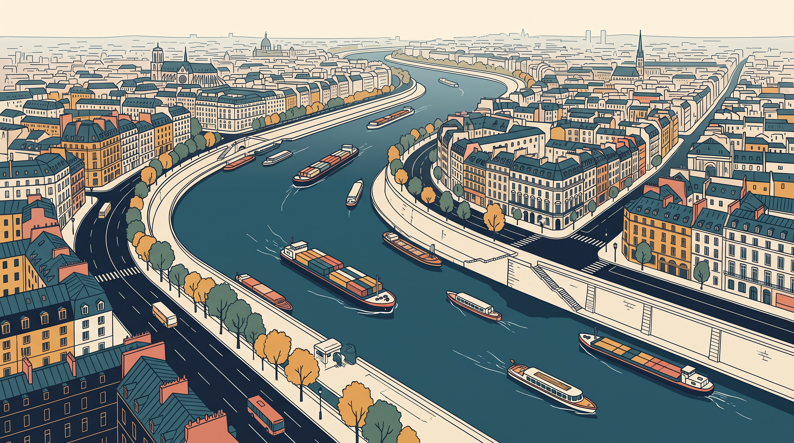
Fig. 7.14 – The Seine River as an inland waterway.
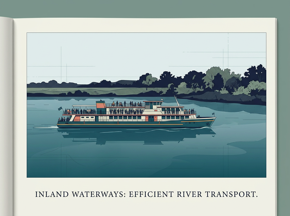
Fig. 7.15 – Passenger transport on an inland waterway.
7.3.14 The Rhine Waterways
The Rhine flows through Germany and the Netherlands. It is navigable for 700 km, from Rotterdam at its mouth in the Netherlands up to Basel in Switzerland, and ocean-going vessels can reach as far inland as Cologne. The Ruhr river joins the Rhine from the east; it runs through a rich coalfield, and the whole basin has grown into a prosperous manufacturing area, with Dusseldorf as its Rhine port.
Huge tonnage moves along the stretch south of the Ruhr, and this is the world’s most heavily used waterway. Each year more than 20,000 ocean-going ships and 2,00,000 (two hundred thousand) inland vessels exchange their cargoes on it. The Rhine connects the industrial areas of Switzerland, Germany, France, Belgium and the Netherlands with the North Atlantic Sea Route. Its course is mapped in Fig. 7.17.
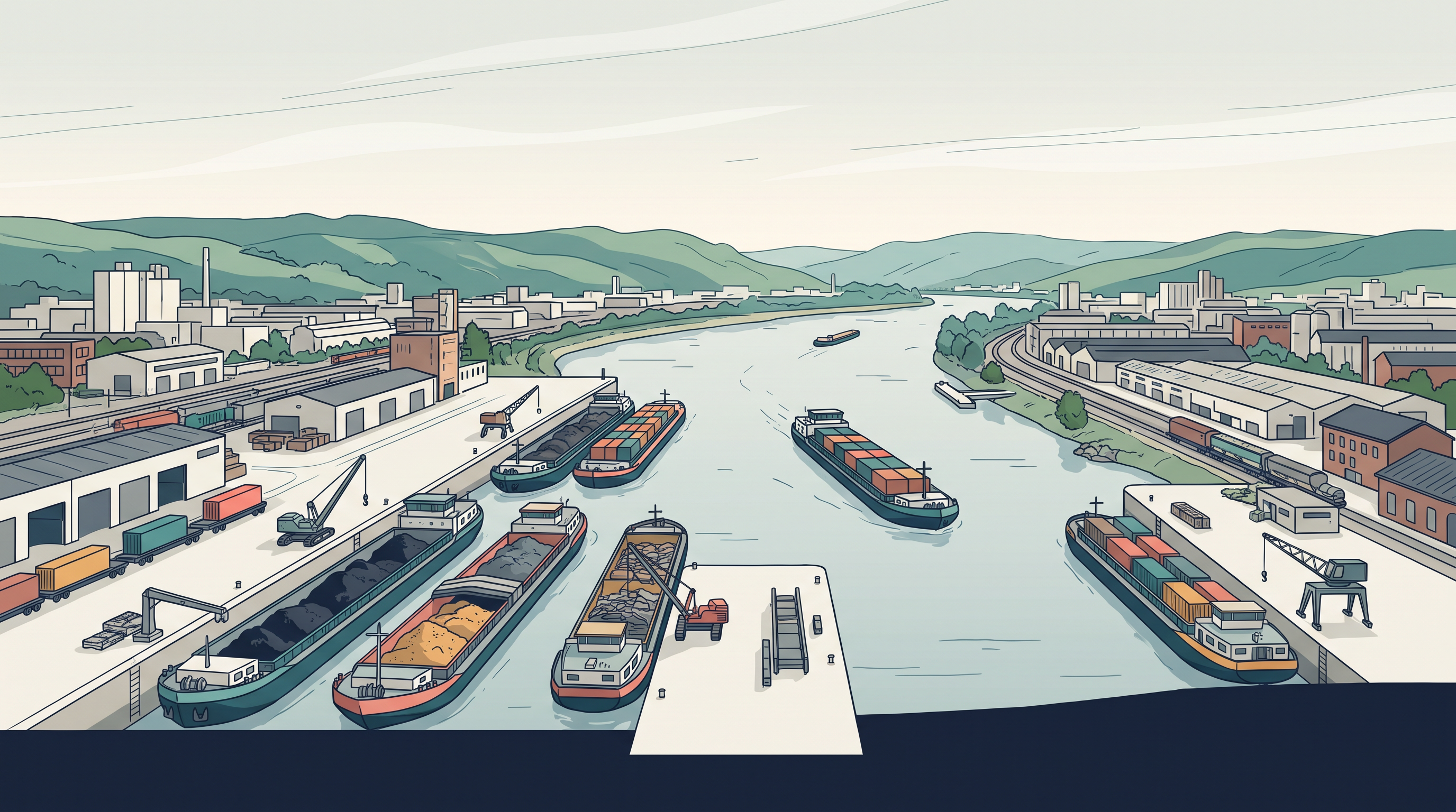
Fig. 7.16 – Freight barges on the Rhine waterway.
Map
Fig. 7.17 Caption: The Rhine waterway. Brief: Map of the Rhine from Rotterdam at its mouth in the Netherlands, through Duisburg, Cologne, Koblenz, Mainz and Mannheim, to Basel in Switzerland; label the Ruhr and other tributaries, the Black Forest, and the neighbouring countries (Netherlands, Germany, France, Belgium); include a scale bar in km.
7.3.15 The Danube Waterway
This important inland waterway serves Eastern Europe. The Danube rises in the Black Forest and flows eastwards through many countries, and it is navigable as far as Taurna Severin. Its chief export items are wheat, maize, timber and machinery.
7.3.16 The Volga Waterway
Russia has a great many developed waterways, of which the Volga is one of the most important. It gives a navigable route of 11,200 km and drains into the Caspian Sea. The Volga–Moscow Canal connects it with the Moscow region, and the Volga–Don Canal connects it with the Black Sea.
7.3.17 The Great Lakes – St. Lawrence Seaway
The Great Lakes of North America — Superior, Huron, Erie and Ontario — are joined by the Soo Canal and the Welland Canal to form an inland waterway. Together with the estuary of the St. Lawrence River, they make a unique commercial waterway in the northern part of North America. Ports along it, such as Duluth and Buffalo, are fitted out with all the facilities of ocean ports.
Large ocean-going vessels can sail up the river deep into the continent, as far as Montreal. Beyond that, goods must be trans-shipped — transferred to smaller vessels — because of rapids in the river. To get around the rapids, canals up to 3.5 m deep have been dug.
7.3.18 The Mississippi Waterways
The Mississippi–Ohio waterway connects the interior of the USA with the Gulf of Mexico in the south. Large steamers can travel along this route as far up as Minneapolis.
7.4 Air Transport
Air transport is the fastest means of transport, but it is also very costly. Because it is so fast, passengers prefer it for long journeys, and valuable cargo can be moved quickly across the whole world. Often it is the only way to reach places that nothing else can.
Air travel has brought a revolution in connectivity. It overcomes the frictions of the physical world — the mountainous snowfields and inhospitable deserts that once blocked movement — and it has widened the reach of transport everywhere. Aircraft carry goods to the communities of the far north of Canada, which the frozen ground would otherwise cut off. In the Himalayan region, roads are often blocked by landslides, avalanches or heavy snowfall, and at such times air travel is the only way to reach a place.
Airways also carry great strategic importance, as the use of air power in military operations — such as the air strikes by US and British forces in Iraq — has shown. The air network as a whole is expanding very fast.
Building aircraft and running them needs elaborate infrastructure: hangars, and facilities for landing, fuelling and maintenance. Airports too are very expensive to build, which is why they have developed most in highly industrialised countries, where there is a large volume of traffic. One such airport is shown in Fig. 7.18.
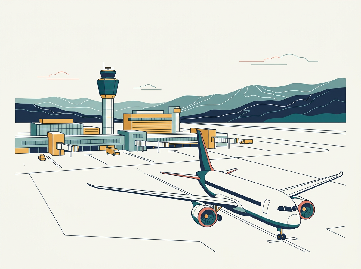
Fig. 7.18 – A commercial aircraft parked at an airport.
At present no place in the world is more than 35 hours away — a startling fact, made possible by those who build and fly aircraft. Travel can now be measured in hours and minutes rather than years and months, and frequent air services reach many parts of the world. The United Kingdom pioneered commercial jet transport, while the USA built up international civil aviation largely after the Second World War. Today more than 250 commercial airlines run regular services, and supersonic aircraft — faster than the speed of sound — cross between London and New York in three and a half hours.
7.4.1 Inter-Continental Air Routes
In the Northern Hemisphere there is a clear east–west belt of inter-continental air routes. The network is densest over Eastern USA, Western Europe and South-east Asia, and the USA alone accounts for 60 per cent of the world’s airways. The nodal points — the places where routes converge and from which they radiate to every continent — include New York, London, Paris, Amsterdam, Frankfurt, Rome, Moscow, Karachi, New Delhi, Mumbai, Bangkok, Singapore, Tokyo, San Francisco, Los Angeles and Chicago. These are drawn together in Fig. 7.19.
Map
Fig. 7.19 Caption: The major airports of the world. Brief: World map marking the major airports as dots, named (New York, London, Paris, Amsterdam, Frankfurt, Rome, Moscow, Karachi, New Delhi, Mumbai, Bangkok, Singapore, Tokyo, San Francisco, Los Angeles, Chicago and others), with a key labelling ‘major air ports’; show the equator and the tropics. Every map of India must show the full extent of India as officially defined.
By contrast, Africa, the Asiatic part of Russia and South America are short of air services. Between 10° and 35° south, in the Southern Hemisphere, air services are limited, held back by sparser population, less landmass and slower economic development.
7.5 Pipelines
Pipelines are used widely to carry liquids and gases — water, petroleum and natural gas — as a steady, uninterrupted flow. Water piped to homes is familiar to everyone, and cooking gas, or LPG (liquefied petroleum gas), is delivered through pipelines in many parts of the world. Even solids can travel this way once they are made to flow: coal can be carried as a liquefied form, and in New Zealand milk is piped from farms to factories.
In the USA there is a dense network of oil pipelines running from the producing areas to the consuming areas. Big Inch is one such famous pipeline, carrying petroleum from the oil wells of the Gulf of Mexico to the North-eastern States. About 17 per cent of all freight in the USA, measured in tonne-kilometres — one tonne of goods carried one kilometre — moves through pipelines. Pipelines like the one in Fig. 7.20 do much of this quiet, continuous work.
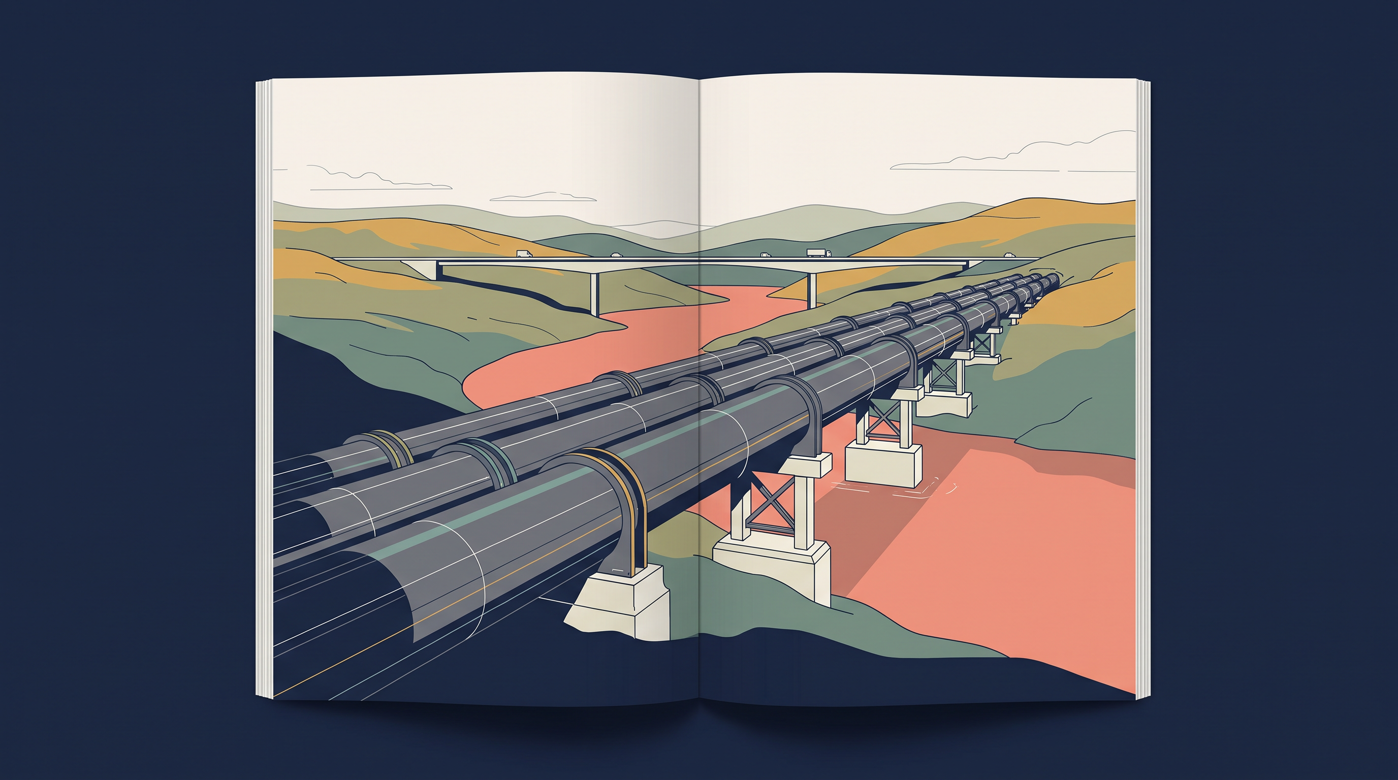
Fig. 7.20 – Pipelines transporting natural gas in Ukraine.
In Europe, Russia, West Asia and India, pipelines connect oil wells to refineries, and refineries to ports or to domestic markets. Turkmenistan, in Central Asia, has extended pipelines to Iran and to parts of China. A proposed international oil and natural gas pipeline, running from Iran to India by way of Pakistan, is planned to be the longest in the world.
7.6 Communications
For long-distance communication, human beings have used many methods, of which the telegraph and the telephone were the most important. The telegraph, an early system that sent coded messages along wires, was instrumental in the colonisation of the American West. In the early and mid-twentieth century, the American Telegraph and Telephone Company (AT&T) held a monopoly over the telephone industry of the USA.
The telephone became a critical factor in the urbanisation of America. Firms centralised their operations at city headquarters and placed branch offices in smaller towns — something only possible once distant offices could talk to one another instantly. Even today the telephone is the most commonly used mode. In developing countries, cell phones, made possible by satellites, are important for reaching rural areas.
The pace of change since then has been phenomenal. The first major breakthrough was the optic fibre cable (OFC) — a thin thread of glass that carries data as pulses of light. Faced with growing competition, telephone companies across the world upgraded their old copper-cable systems with optic fibre, which moves large quantities of data rapidly, securely and almost free of error. With the digitisation of information in the 1990s — the turning of text, sound and pictures into the numbers a computer can read — telecommunication gradually merged with computers to form the integrated networks we call the Internet.
7.6.1 Satellite Communication
Today the Internet is the largest electronic network on the planet, connecting about 1,000 million (one billion) people in more than 100 countries. Much of this reach rests on satellites. Every time you make a cell-phone call, send an SMS, or watch a programme on cable television, you are using satellite communication.
Communication through satellites grew into a new field from the 1970s, after the USA and the former USSR pioneered space research. Artificial satellites — devices placed in orbit around the Earth — now connect even the remotest corners of the globe. They have made the unit cost and time of communication invariant with distance: that is, it costs the same to communicate over 500 km as over 5,000 km by satellite.
India too has made great strides in satellite development. Aryabhatt was launched on 19 April 1975, Bhaskar-I in 1979 and Rohini in 1980. On 19 June 1981, APPLE — the Arian Passenger Payload Experiment — was launched through an Arian rocket. Satellites such as Bhaskar, Challenger and INSAT I-B have made long-distance communication, television and radio very effective, and weather forecasting through television is now a real boon.
7.6.2 Cyber Space – Internet
Cyberspace is the world of electronic, computerised space, taken in by the Internet and its World Wide Web (www). In plain terms, it is the electronic digital world in which people communicate and reach information over computer networks, without any physical movement of the sender or the receiver. Cyberspace exists everywhere — in an office, on a sailing boat, in a flying plane, and virtually anywhere at all.
The speed at which this network has spread is without parallel in human history. There were fewer than 50 million Internet users in 1995, about 400 million in 2000, over two billion in 2010, and about 5.4 billion in 2023. That climb is drawn in Fig. 7.21.
Graph
Fig. 7.21 Caption: The number of Internet users worldwide, 1995 to 2023. Brief: Line graph; x-axis the year (1995, 2000, 2010, 2023); y-axis the number of Internet users, scaled in millions rising to billions; plot the four points — fewer than 50 million in 1995, about 400 million in 2000, over two billion in 2010, about 5.4 billion in 2023 — and join them; data source: the figures given in this subsection (Cyber Space – Internet, 7.6.2).
In recent years the users have shifted from the USA towards the developing countries. The percentage share of the USA fell from 66 in 1995 to only 25 in 2005, and the majority of the world’s users are now spread across the USA, UK, Germany, Japan, China and India.
As billions use the Internet each year, cyberspace keeps widening the economic and social space of human life — through e-mail, e-commerce (buying and selling online), e-learning (studying online) and e-governance (dealing with government online). The Internet, together with fax, television and radio, is reaching more and more people across place and time. It is these modern communication systems, even more than transport, that have turned the idea of a global village — the whole world drawn into one small, connected community — into reality.
7.7 Summary
- Resources, economic activities and markets are rarely found in one place, so transport, communication and trade are needed to link producing centres to consuming centres; efficient links raise living standards.
- Transport is the carriage of persons and goods over three media — land, water and air — with pipelines as a mode of their own; it is an organised service industry, not just the vehicles.
- A transport network is a set of places, called nodes, joined by routes, called links, into a connected pattern.
- The right mode for a job depends on the goods, the cost and the mode available; in a well-managed system, the modes complement each other rather than compete.
- Land transport evolved from human porters and pack animals, to carts after the wheel, to railways after the steam engine, and to road vehicles after the internal combustion engine.
- Roads suit short-distance, door-to-door movement; metalled roads outlast unmetalled ones in bad weather; road density and vehicle numbers are highest in North America.
- Highways are wide metalled roads built for uninterrupted movement; border roads tie remote frontiers to the cities and serve defence.
- Railways carry bulky goods and passengers over long distances, and rail networks are densest in Europe, North America, and the crowded parts of Asia.
- Trans-continental railways run across a whole continent — the Trans-Siberian, the Trans-Canadian, the Union and Pacific, the Australian Trans-Continental, and the Orient Express.
- Water transport needs no route to be built and is the cheapest way to haul bulky goods; it divides into sea routes and inland waterways.
- The chief sea routes are the Northern Atlantic or Big Trunk Route, the Mediterranean–Indian Ocean, the Cape of Good Hope, the Southern Atlantic, the North Pacific and the South Pacific; coastal shipping runs along a country’s own shore.
- The Suez and Panama Canals are man-made shortcuts that cut sea distances and reshaped world trade.
- Inland waterways such as the Rhine, Danube, Volga, Great Lakes–St. Lawrence Seaway and Mississippi carry heavy cargo where rivers are wide, deep and navigable.
- Air transport is the fastest but costliest mode, kept for passengers and for high-value or urgent cargo; its routes crowd the industrialised Northern Hemisphere.
- Pipelines carry liquids and gases — and even liquefied solids — in a continuous flow from producing to consuming areas.
- Communication split away from transport with the telegraph and telephone; satellites then made the cost of communication the same over any distance; and the Internet now moves information with no physical movement at all, making the global village real.
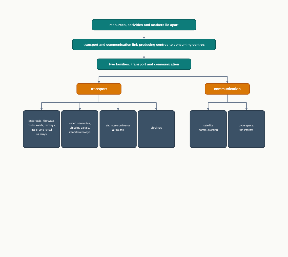
Fig. 7.22 – Summary of transport and communication modes.
What This Chapter Cannot Tell You
The route maps and share figures show where transport has been built and where it is busiest, not how much each link actually carries — on a not-to-scale map, a thin line can be the busiest of all.
Many of the chapter’s numbers describe a particular moment, not today: an old share of the world’s Internet users, canal-completion years now past. They are kept as printed, but they have moved on.
A national or continental total — a country’s share of the world’s roads or railways — hides where the network is dense and where people still walk. The average tells you the whole; it hides the parts inside it.
7.8 NCERT Questions
- The Trans–Continental Stuart Highway runs between
- Darwin and Melbourne
- Edmonton and Anchorage
- Vancouver and St. John’s City
- Chengdu and Lhasa
- Which country has the highest density of railway network?
- Brazil
- U.S.A
- Canada
- Russia
- The Big Trunk Route runs through
- The Mediterranean – Indian ocean
- The North Atlantic Ocean
- The South Atlantic Ocean
- The North Pacific Ocean
- The Big Inch pipeline transports
- Milk
- Liquid petroleum gas (LGP)
- Water
- Petroleum
- Which one pair of the following places is linked by Channel Tunnel?
- London – Berlin
- Paris – London
- Berlin – Paris
- Barcelona – Berlin
- What are the problems of road transport in mountainous, desert and flood prone regions? (about 30 words)
- What is a trans–continental railway? (about 30 words)
- What are the advantages of water transport? (about 30 words)
- Elucidate the statement — ‘In a well managed transport system, various modes complement each other’. (not more than 150 words)
- Which are the major regions of the world having a dense network of airways? (not more than 150 words)
- What are the modes by which cyber space will expand the contemporary economic and social space of humans? (not more than 150 words)
7.9 Check Your Concepts
- Distinguish between a metalled and an unmetalled road, and explain why this difference matters most during the rainy season.
- Arrange in the correct order the stages by which land transport was transformed, from the human porter to the modern road vehicle, and name the invention that drove each major change.
- Using Fig. 7.11, name the sea route that would carry goods from Mumbai to the ports of Western Europe, and name the canal a ship on that route would pass through to shorten its journey.
- The Northern Atlantic route carries about one-fourth of the world’s foreign trade. Using the chapter, explain why this route — and not another — is the busiest in the world.
- The chapter states that about 100 ships cross the Suez Canal each day. Taking a year as 365 days, calculate how many ships would cross the canal in one year, showing your working.
- North America has about 33 per cent of the world’s roads and the highest road density of any continent. Explain what this figure does not tell you about how well people in other parts of the world are served by roads.
- By satellite, it costs the same to communicate over 5,000 km as over 500 km, so communication has ‘outrun distance’. Using the chapter, explain why distance no longer decides the cost of such communication.