Chapter 2: Human Settlements
From an aircraft window over the Ganga plain, the villages read like ink blots pressed onto the land. Each one is a few hundred houses packed so tightly that the fields begin abruptly where the last wall ends. Fly north-east into the folded hills of Meghalaya, in the far corner of India, and the pattern comes apart. Now a single hut sits on one slope, another far across the valley, a thin scatter of homes with forest and pasture in between.
Same country, same century — and yet the two landscapes arrange their people in opposite ways. Something is deciding where a house is allowed to stand.
In the plains — flat, fertile, watered — families can live wall to wall and still walk out to their fields; safety and company pull them together. In the hills, the farmland itself comes in scattered patches, so the houses scatter to follow it. Where water is scarce, people crowd around the little there is. Where a village grows too large or too divided, a group breaks off and settles a short walk away, keeping the old name.
Zoom out further and villages give way to towns and cities — larger, denser, living not off the land directly but off trade, industry, offices and services. Some began as temple towns, some as forts, some as ports opened to the sea. This chapter is about that whole spread of settlement: why it clusters, why it scatters, and why it grows.
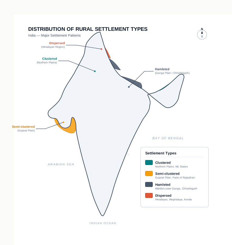
Fig. 2.0 – Dominant rural settlement types in India.
2.1 Human Settlement: Rural And Urban
What A Settlement Is
A human settlement is a cluster of dwellings of any type or size where people live. To make one, people build houses and other structures and claim some stretch of land or territory as their economic support-base — the ground they draw their living from. A settlement is therefore never just its buildings. It is a group of people together with a piece of territory that has been shared out among them as their resource base.
Settlements come in an enormous range, from a hamlet of a few houses to a sprawling metropolitan city of millions. Size is not simply a matter of headcount. As a settlement grows, its economic character, its social structure, and even its ecology and technology all shift with it. A place of twenty families works and lives quite differently from a city of two million.
Villages And Towns
At one end are the small, thinly spaced settlements we call villages, which specialise in agriculture and other primary activities — work that takes its produce straight from the land or water, such as farming, grazing, fishing, forestry and mining. At the other end are the fewer but far larger urban settlements. These specialise in secondary activities, the processing of raw materials and manufacturing of finished goods in factories, and in tertiary activities, the services of every kind — trade, transport, teaching, banking and administration.
The line between the two is drawn by which kind of work dominates, not by the presence of any single trade.
How Rural And Urban Settlements Differ
Rural and urban settlements differ in three clear ways, and it is worth holding all three together rather than learning them as a list.
The first difference is how each earns its living. A rural settlement draws its basic economic needs from land-based primary activity — it lives directly off the soil, pasture and water. An urban settlement lives off something one step removed: processing raw materials and manufacturing goods on one side, and providing a wide variety of services on the other. The town does not grow its own food; it makes things and it serves.
The second is the link between the two. Cities act as nodes of economic growth — points where activity concentrates. A city provides goods and services not only to its own residents but to the rural people of its surrounding hinterland, the countryside that looks to it as its market and its supply centre. In return, the hinterland sends the city food and raw materials. This two-way exchange is the functional relationship between town and country, and it runs along the network of transport and communication that ties them together.
The third difference is social. Rural people are less mobile, so they know one another over many years and their social relations are close and intimate. In a city, life is complex and fast, people move in and out constantly, and relations tend to be formal — organised by role and rule rather than by long acquaintance.
This exchange between town and country can be drawn as a simple loop.
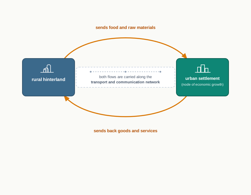
Fig. 2.1 – The economic exchange between town and hinterland.
Notice that growth in size and change in character move together, not separately.
2.2 Types Of Rural Settlement
The type of a rural settlement is decided by two simple measurements: how much ground the built-up area covers, and how far apart the houses stand. Across most of India, the compact village of a few hundred houses is the ordinary sight, especially in the northern plains. But several regions grow their villages in quite different shapes, and the reasons behind those shapes are what this section is about.
Three sets of factors decide which form a village takes. The first are physical features — the nature of the terrain, the altitude, the climate, and above all the availability of water. The second are cultural and ethnic factors — the social structure of the community, and divisions of caste and religion. The third are security factors — the need to defend against theft and robbery by living close together. Working in different combinations, these push Indian rural settlements into four broad types: clustered (also called agglomerated or nucleated), semi-clustered (or fragmented), hamleted, and dispersed (or isolated).
It helps to picture the four as different ways of scattering the same handful of dwellings across a patch of land.
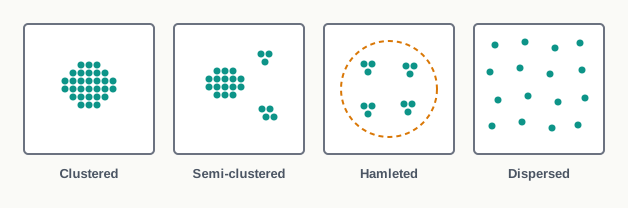
Fig. 2.2 – Four forms of rural settlement.
2.2.1 Clustered Settlements
The clustered rural settlement is a compact, closely built-up block of houses. Here the living area is distinct from, and separated from, the surrounding farms, barns and pastures — people live in one tight patch and go out to the fields. Seen from above, the built-up area and the lanes running through it take on a recognisable pattern or geometric shape: rectangular, radial or linear, depending on how the village grew.
Such villages are generally found on fertile alluvial plains and in the north-eastern states, where good farmland lets people live side by side and still reach their work.
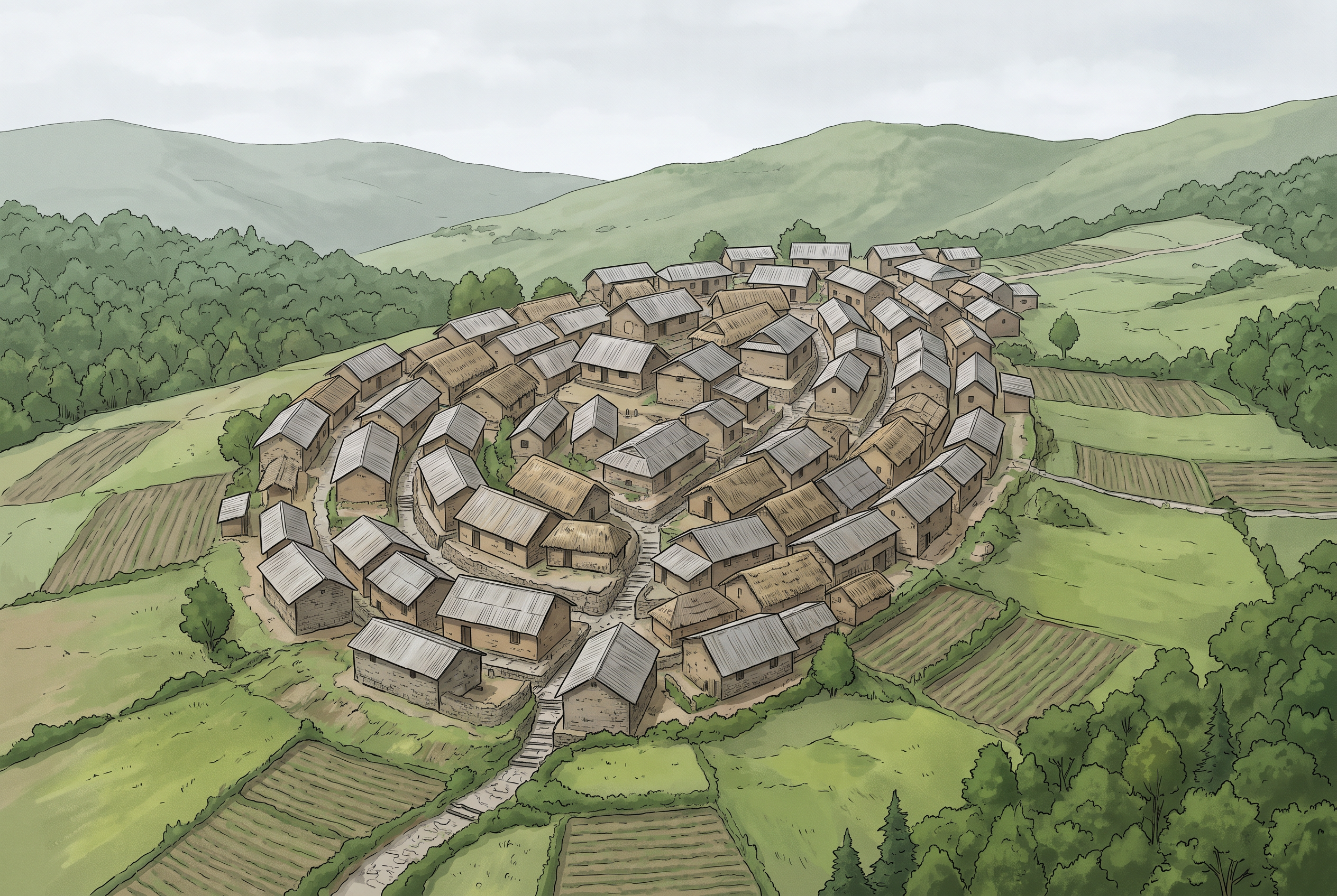
Fig. 2.3 – Clustered settlement in the north-eastern states.
Sometimes the pull to cluster is not fertility but fear or thirst. People crowd into a compact village for security and defence, as in the Bundelkhand region of central India and in Nagaland in the far north-east. In Rajasthan, in the arid west, it is the scarcity of water that forces houses together — packing the village around the little water available makes the most of a scarce resource.
2.2.2 Semi-Clustered Settlements
A semi-clustered settlement, also called fragmented, is a village that has partly, but not fully, come together. It can form in two ways. Sometimes it is a dispersed settlement that has begun to cluster within one restricted patch. More often, it is a large compact village that has split, with one or more sections of the community moving a little away from the main cluster.
In many such villages the split follows social lines. The land-owning and dominant community tends to hold the central part of the village, while households of lower social strata and those doing menial work settle on the outer flanks. The separation is drawn into the village plan itself, shaped by the caste and social structure named among the cultural factors above. This form is widespread on the Gujarat plain and in parts of Rajasthan.
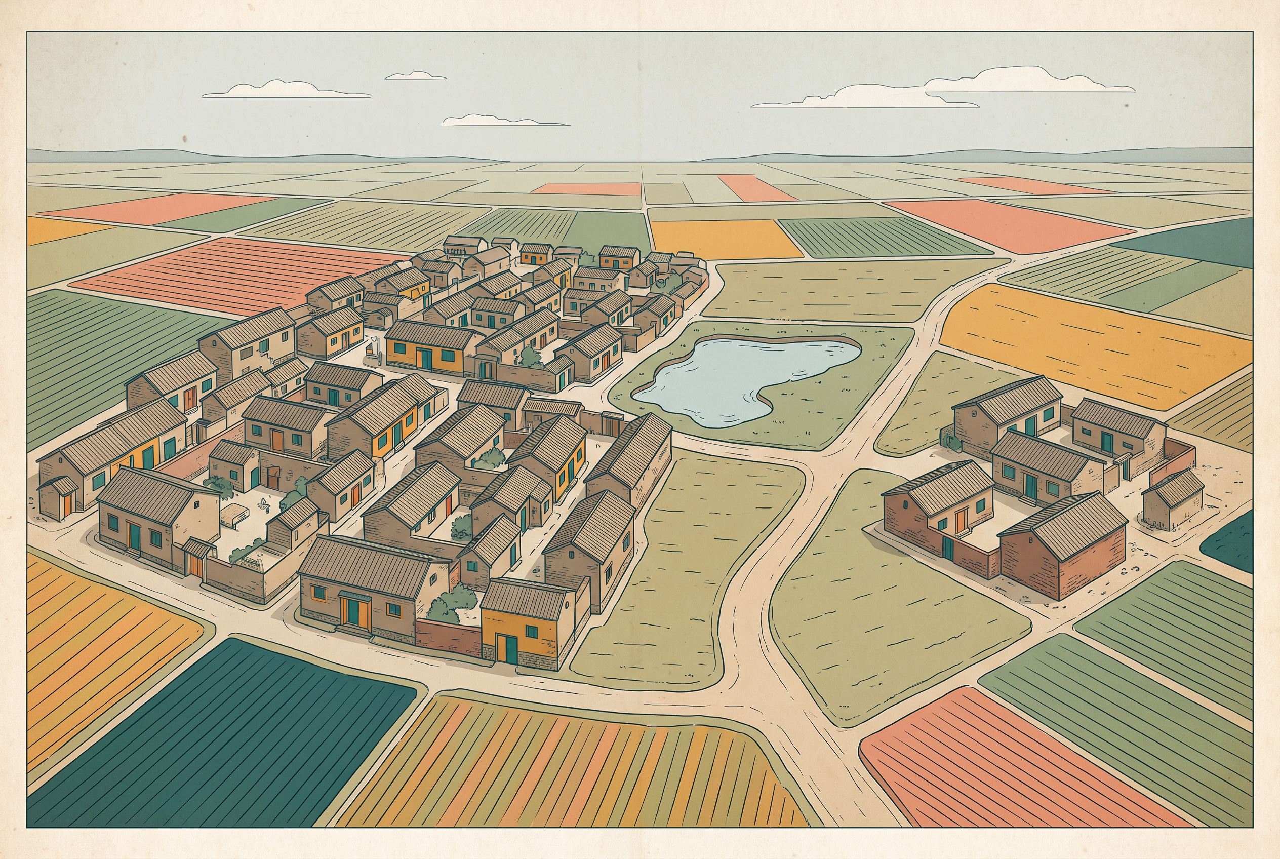
Fig. 2.4 – A semi-clustered settlement.
2.2.3 Hamleted Settlements
In a hamleted settlement, a single village is broken into several physically separate units that still share one common name. Each unit is a hamlet in its own right, and across the country these units carry local names — panna, para, palli, nagla or dhani, among others. The segmentation is usually driven by social and ethnic factors rather than by the land itself.
Hamleted villages appear most frequently in the middle and lower Ganga plain, in Chhattisgarh in central India, and in the lower valleys of the Himalayas. One village name may therefore spread across several small clumps of houses standing some distance apart.
2.2.4 Dispersed Settlements
At the far end of the scale is the dispersed, or isolated, settlement. Here dwellings do not gather at all. The pattern shows up as lone huts, or tiny hamlets of a few huts, set in remote jungle or perched on small hills with the family’s farms or pasture on the surrounding slopes.
This extreme scattering is usually forced by the land. Where the terrain is broken and the habitable, cultivable ground comes only in small separate patches, houses must scatter to sit beside the patches they work. Many areas of Meghalaya, Uttarakhand, Himachal Pradesh and Kerala carry this type of settlement.
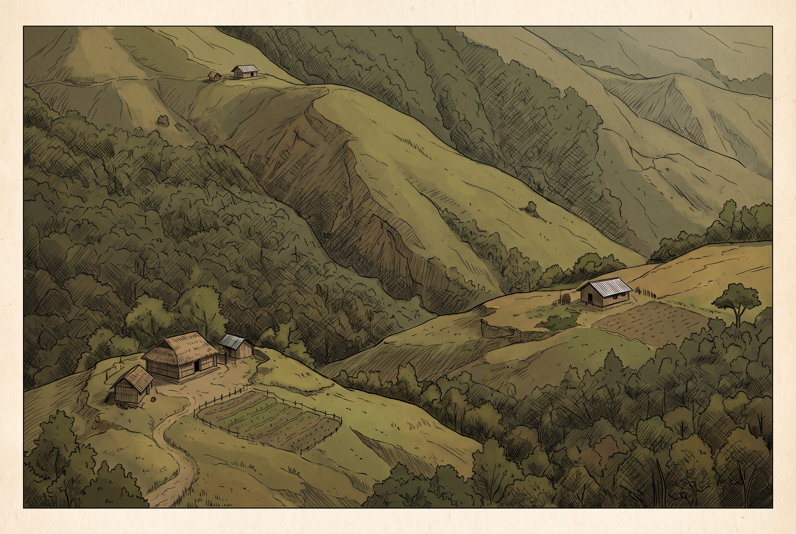
Fig. 2.5 – Dispersed settlement in Nagaland.
Placed side by side, the four types make one point clear: the same country arranges its villages in opposite ways because the land, the water and the community pull in different directions from place to place.
2.3 Urban Settlements
Urban settlements are the other kind of settlement. Unlike villages, they are generally compact and much larger in size, and their people work at a variety of non-agricultural jobs — economic and administrative functions rather than farming. As the town-and-country loop in the last section showed, a city is functionally linked to the rural areas around it.
That link is not always direct. The exchange of goods and services between a city and its countryside sometimes happens face to face, and sometimes it passes through a series of market towns and smaller cities along the way. So a city is joined to the villages both directly and indirectly, and it is joined to other cities as well. The result is a web of settlements trading with one another, not a scatter of separate points.
What Counts As Urban
Where exactly does a large village end and a town begin? India does not leave this to impression. The Census of India, in its 1991 definition, fixes it with a clear test, and a place must meet it to be counted urban.
A settlement is urban only if it satisfies all of the following at once. First, it must have a form of urban local government — a municipality, a corporation, a cantonment board, or a notified town area committee. Second, it must have a minimum population of 5,000 persons. Third, at least 75 per cent of its male working population must be engaged in non-agricultural pursuits — that is, in work other than farming. Fourth, it must have a population density of at least 400 persons per square kilometre, meaning 400 people living in every square-kilometre patch of its area.
Because every one of these conditions must hold, the definition works like a single test with four gates.
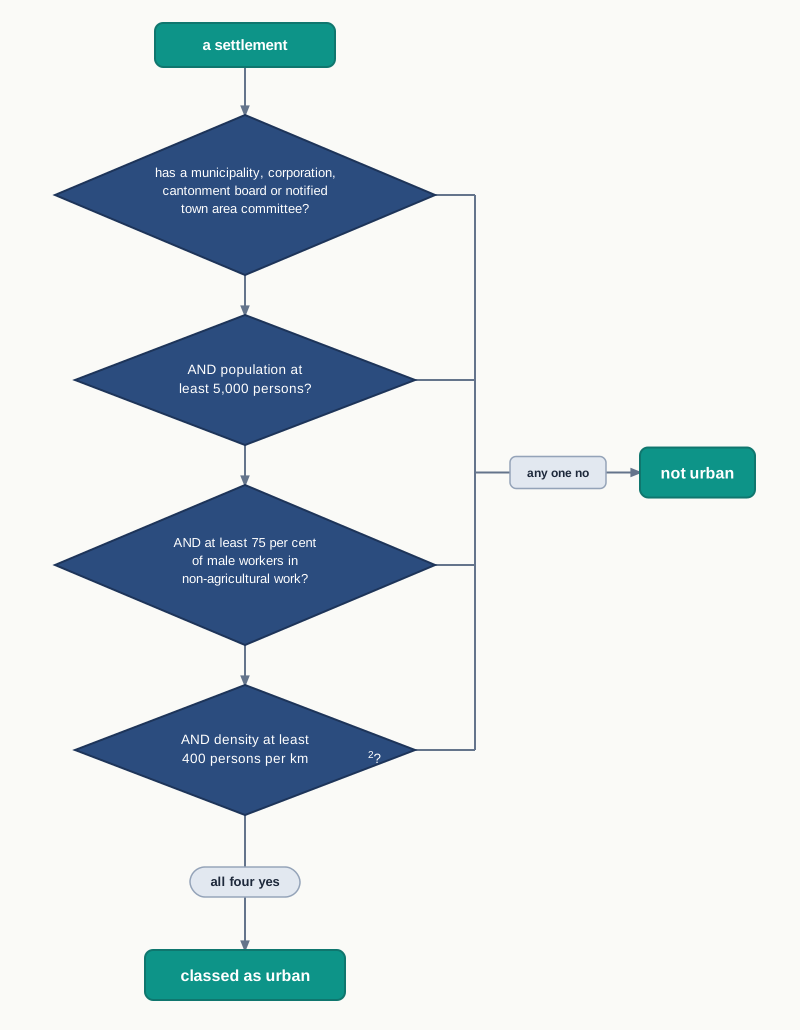
Fig. 2.6 – The census criteria for an urban settlement.
A place that clears all four gates is a town; a large farming village that fails even one of them is not.
2.4 Evolution Of Towns In India
Towns are not new to India. They have flourished here since prehistoric times — at the height of the Indus Valley civilisation, planned towns such as Harappa and Mohenjodaro were already in existence. The centuries that followed saw towns rise and fall in periodic ups and downs, a rhythm that continued until the arrival of Europeans in India in the eighteenth century.
Because towns were founded in very different periods, Indian towns are usually grouped by the age in which they took shape: ancient towns, medieval towns, and modern towns.
2.4.1 Ancient Towns
A number of Indian towns carry a historical background spanning more than 2,000 years. Most of them grew as religious and cultural centres — places people travelled to for worship and learning, which is why settlements gathered there.
Varanasi, on the Ganga in Uttar Pradesh, is one of the most important of these ancient towns. Prayag (now Prayagraj), at the meeting of the Ganga and the Yamuna, Pataliputra (now Patna), on the Ganga in Bihar, and Madurai, on the Vaigai in Tamil Nadu in the far south, are other well-known examples.
2.4.2 Medieval Towns
About a hundred of the towns standing today have their roots in the medieval period. Most grew as the headquarters of principalities and kingdoms — the seat from which a ruler governed. They are typically fort towns, and many came up on the ruins of older, ancient towns, reusing the same commanding site.
Delhi, Hyderabad, Jaipur, Lucknow, Agra and Nagpur are important towns of this medieval group. Agra, for instance, sits on the Yamuna, the river giving both defence and a supply route to the fort town.
2.4.3 Modern Towns
Modern towns are the work of the British and other Europeans. They began on the coast, opening trading ports where ships could load and unload — Surat on the Gujarat coast, along with Daman, Goa and Pondicherry (now Puducherry). The British then consolidated their hold around three principal nodes, all on the sea — Mumbai (then Bombay) on the west coast, Chennai (Madras) and Kolkata (Calcutta) on the east — and rebuilt them in the British style.
As their domination spread — sometimes by direct rule, sometimes through control over the princely states — the British set up administrative centres, built hill-towns as cool summer resorts, and added new civil, administrative and military quarters to existing towns. Towns built around modern industry also appeared after 1850; Jamshedpur, the steel town in what is now Jharkhand, is the standard example.
After Independence
After 1947 the pattern of town-building continued in new forms. Many towns were raised as administrative headquarters — planned capitals such as Chandigarh, Bhubaneswar, Gandhinagar and Dispur. Others grew as industrial centres, among them Durgapur, Bhilai, Sindri and Barauni.
Some older towns swelled into satellite towns — smaller towns that grow around a large metropolitan city and depend on it — such as Ghaziabad, Rohtak and Gurugram around Delhi. And as investment reached into rural areas, a great many medium and small towns sprang up across the whole country.
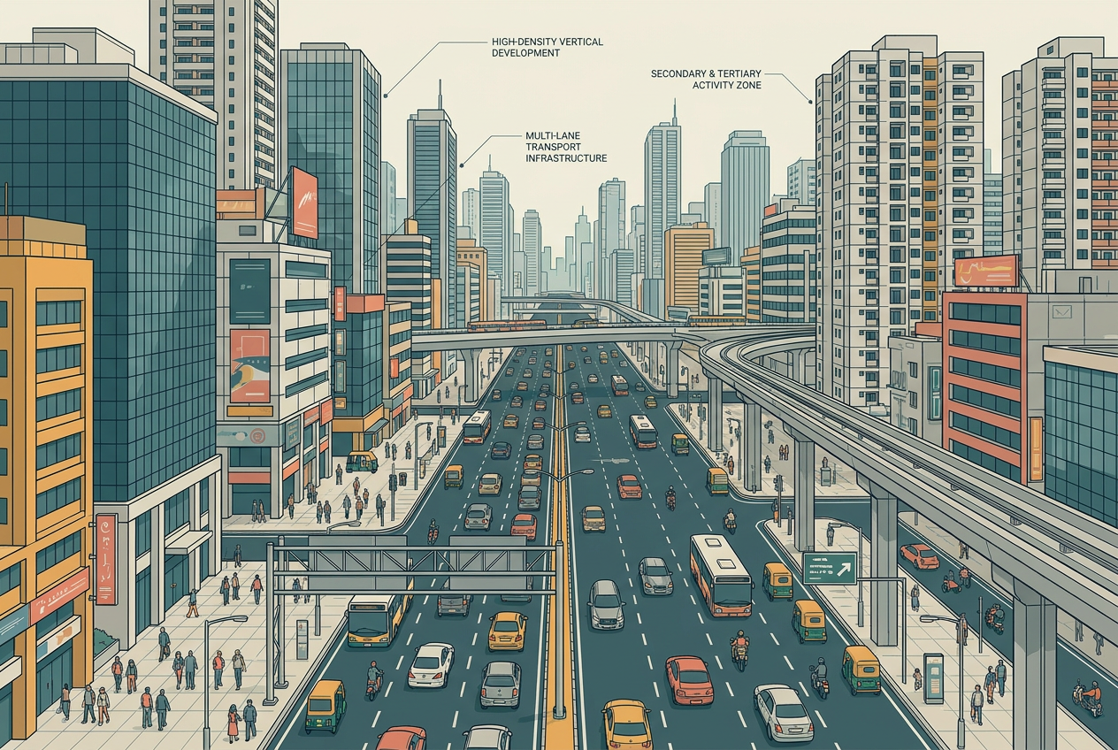
Fig. 2.7 – A modern city street.
2.5 Urbanisation In India
Urbanisation is the growth in the share of a country’s people who live in towns and cities. Its level is measured simply, as the percentage of the urban population out of the total population.
\[\text{Level of urbanisation} = \frac{\text{Urban population}}{\text{Total population}} \times 100 \quad (\text{per cent})\]
Here the urban population is the number of people living in settlements that pass the census test from the last section, the total population is everyone in the country, and the answer is a percentage. Note that this is a different question from the density figure met earlier: density asks how crowded a place is, in persons per square kilometre, while the level of urbanisation asks how large a share of the whole country is urban.
In 2011 India’s level of urbanisation was 31.16 per cent — still quite low compared with developed countries, where most people live in towns. Yet the country has urbanised steadily. Over the twentieth century the total urban population increased about eleven-fold, as existing urban centres grew larger and new towns emerged. Table 2.1 sets out this long climb decade by decade.
Reading The Trend
Plotting the share column shows the shape of the change more clearly than the numbers alone.
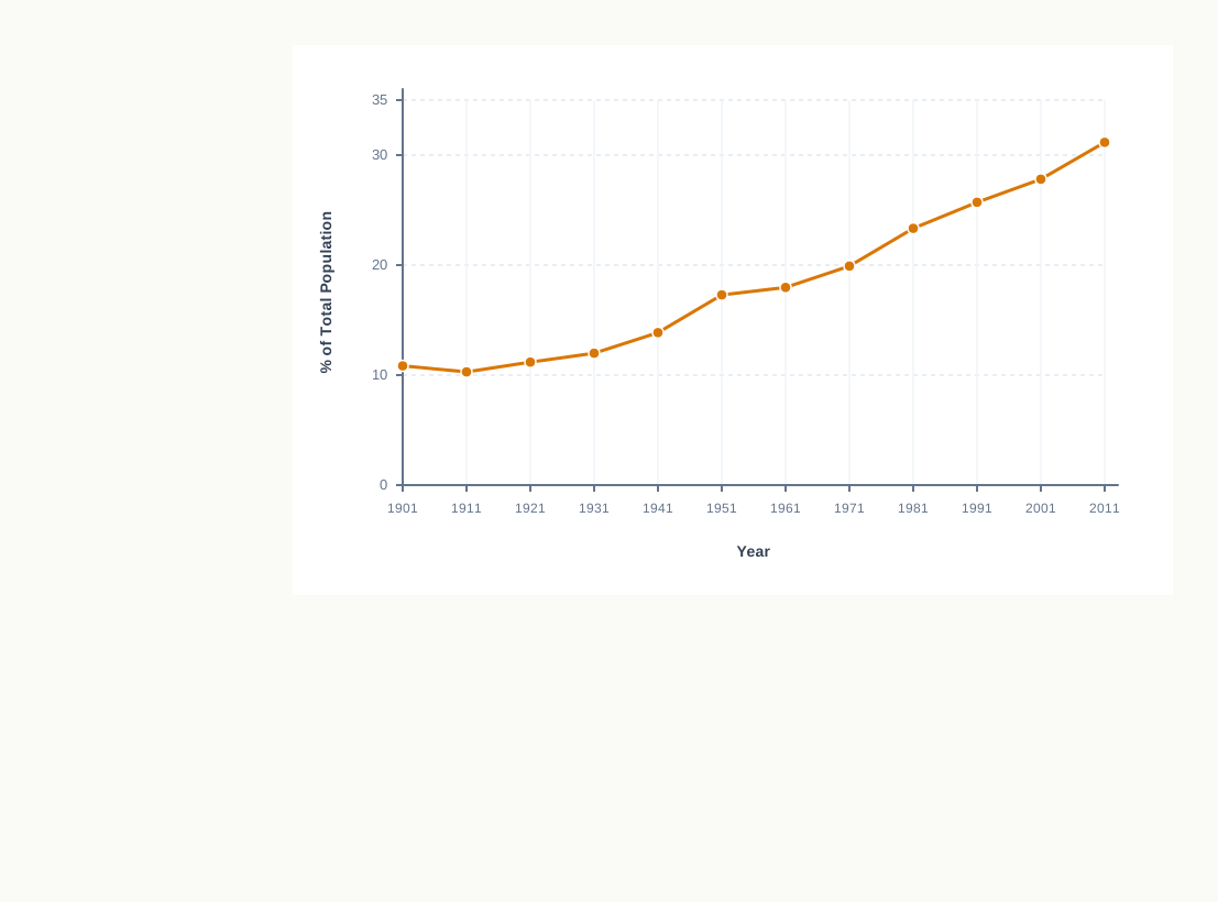
Fig. 2.8 – Urban share of India’s population, 1901–2011.
The line rises through the century, but not at a steady pace. The decennial growth column tells that part of the story: the rise was fastest around the middle decades and has eased since. In fact, the growth rate of urbanisation has slowed over the last two decades.
We can also check the chapter’s own claim that urban India grew about eleven-fold over the twentieth century, using nothing but the table’s numbers.
Eleven-fold sounds enormous, and in absolute numbers it is — the count of town-dwellers multiplied about eleven times. Yet over the same century the urban share rose only from 10.84 to 27.78 per cent. Both facts are true because the total population grew hugely as well: even as cities filled, the countryside kept growing too, so India stayed largely rural. This is why a rising headcount and a slowly rising share must be read together, never one alone.
2.6 Functional Classification Of Towns
Beyond simply being central or nodal places that serve a surrounding area, many towns and cities specialise. They become known for a particular activity, product or service — so much so that the town and the function come to stand for each other. This does not mean a town does only one thing. Every town performs a number of functions at once. But one function usually dominates, and it is by that dominant or specialised function that Indian towns and cities are broadly classified.
A useful exercise here is to list the urban agglomerations and cities of India state by state, and to look at the population living in this category of cities in each state — a quick way to see how unevenly urban India is spread across the country.
The classification runs into nine broad classes, which are easiest to see as branches of one tree.
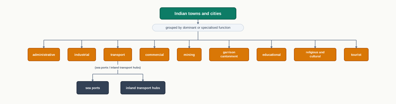
Fig. 2.9 – Functional classification of Indian towns and cities.
2.6.1 Administrative Towns And Cities
These are towns that support administrative headquarters of a higher order — the seats from which a state or the country is governed. Examples include Chandigarh, New Delhi, Bhopal, Shillong, Guwahati, Imphal, Srinagar, Gandhinagar, Jaipur and Chennai.
2.6.2 Industrial Towns
Here industry is the prime motive force — the engine that built the town and keeps it going. Mumbai, Salem, Coimbatore, Modinagar, Jamshedpur, Hugli and Bhilai are towns of this kind.
2.6.3 Transport Cities
Transport towns move goods and people rather than making them. Some are sea ports, mainly handling exports and imports, such as Kandla, Cochin, Kozhikode and Vishakhapatnam. Others are hubs of inland transport, where routes meet and cargo is exchanged, such as Agra, Dhulia, Pandit Deendayal Upadhyay Nagar, Itarsi and Katni.
2.6.4 Commercial Towns
Towns whose main business is trade and commerce fall in this class — centres of buying, selling and exchange. Kolkata, Saharanpur and Satna are examples.
2.6.5 Mining Towns
These towns have grown up in mineral-rich areas, raised by the work of extracting what lies beneath. Raniganj, Jharia, Digboi, Ankaleshwar and Singrauli are mining towns.
2.6.6 Garrisson Cantonment Towns
These towns emerged around a garrison — a body of troops permanently stationed in a place — and its cantonment. Ambala, Jalandhar, Mhow, Babina and Udhampur are garrison cantonment towns.
2.6.7 Educational Towns
Starting as centres of learning, some towns have grown into major campus towns built around their institutions. Roorki, Varanasi, Aligarh, Pilani and Prayagraj are examples.
2.6.8 Religious And Cultural Towns
These towns rose to prominence through their religious or cultural significance, drawing pilgrims and visitors over long stretches of time. Varanasi, Mathura, Amritsar, Madurai, Puri, Ajmer, Pushkar, Tirupati, Kurukshetra, Haridwar and Ujjain are towns of this kind.
2.6.9 Tourist Towns
Tourist towns owe their growth to the visitors their setting attracts — many of them hill stations and desert or scenic destinations. Nainital, Mussoorie, Shimla, Pachmarhi, Jodhpur, Jaisalmer, Udagamandalam (Ooty) and Mount Abu are among them.
Why Cities Become Multifunctional
The classes above are a snapshot, not a permanent label. Cities are not static in their function; their functions change as the cities themselves grow and change. A town that began around a single activity does not stay single for long. As it grows into a metropolis, industry, business, administration and transport all build up together, until the functions are so intertwined that the city can no longer be placed in any one class.
2.7 Summary
- A human settlement is a cluster of dwellings, of any size, where people live and claim a piece of territory as their economic support-base.
- Settlements range from a hamlet of a few houses to a metropolitan city; as size grows, economic character, social structure, ecology and technology all change with it.
- Rural settlements live off land-based primary activities; urban settlements off secondary and tertiary activities. The two are tied together by a town–hinterland exchange of goods and services for food and raw materials, carried along transport and communication networks.
- Rural settlement in India takes four forms — clustered, semi-clustered, hamleted and dispersed — shaped by physical features, cultural and ethnic factors, and security needs.
- Clustered villages pack together on fertile plains, for defence, or where water is scarce; dispersed huts scatter where the terrain is broken and farmland comes in separate patches.
- Urban settlements are compact, larger and non-agricultural. The Census of India (1991) counts a place as urban only if it has an urban local body, at least 5,000 people, at least 75 per cent of male workers in non-farm work, and a density of at least 400 persons per square kilometre.
- By age of origin, Indian towns are grouped as ancient, medieval and modern. Modern towns began as European coastal trading ports and grew after independence as administrative, industrial and satellite towns.
- Urbanisation, the share of people living in towns, reached 31.16 per cent in 2011 — low by the standards of developed countries. The urban population rose about eleven-fold over the twentieth century, though its growth rate has slowed over the last two decades.
- By dominant function, towns are classed as administrative, industrial, transport, commercial, mining, garrison cantonment, educational, religious and cultural, and tourist. But as a town grows into a metropolis its functions intertwine, and it outgrows any single class.
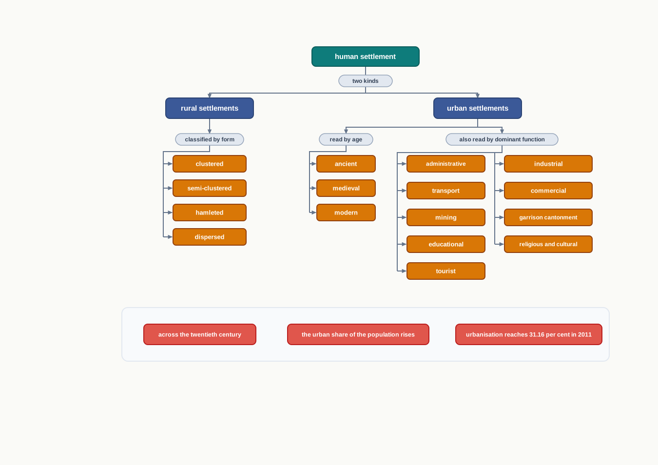
Fig. 2.10 – Summary of human settlements and urbanisation in India.
What This Chapter Cannot Tell You
A single national urbanisation figure, 31.16 per cent, hides how unevenly urban life is spread — some states are far more urban than the average, others far less, and the number says nothing about which. Census data comes at ten-year gaps and in fixed thresholds, so it smooths over the year-to-year change in between and draws a hard line where town and village actually blend into each other. And the functional classes are only snapshots of a dominant activity; they cannot capture the full mix of work a living city does, nor how that mix keeps shifting.
2.8 NCERT Questions
- Which one of the following towns is NOT located on a river bank?
- Agra
- Bhopal
- Patna
- Kolkata
- Which one of the following is NOT the part of the definition of a town as per the census of India?
- Population density of 400 persons per sq km.
- Presence of municipality, corporation, etc.
- More than 75% of the population engaged in primary sector.
- Population size of more than 5,000 persons.
- In which one of the following environments does one expect the presence of dispersed rural settlements?
- Alluvial plains of Ganga
- Arid and semi-arid regions of Rajasthan
- Lower valleys of Himalayas
- Forests and hills in north-east
- What are garrisson towns? What is their function? (30 words)
- What are the main factors for the location of villages in desert regions? (30 words)
- Discuss the features of different types of rural settlements. What are the factors responsible for the settlement patterns in different physical environments? (150 words)
- Can one imagine the presence of only one-function town? Why do the cities become multi-functional? (150 words)
2.9 Check Your Concepts
- Using the ‘% of Total Population’ column of Table 2.1, work out by how many percentage points the urban share of India’s population rose between 1901 and 2011. Show the subtraction.
- In both a hamleted settlement and a dispersed settlement the dwellings stand apart from one another. What, then, makes them two different types? State the key difference.
- The Europeans built their earliest modern towns as coastal trading ports rather than inland. Name the deciding factor behind this choice, and explain why it was decisive.
- Figures 2.3 and 2.5 both show settlements in India’s north-east, yet one is a tight cluster and the other widely scattered. What difference in the land best explains why the two patterns are so unlike?
- Read down the ‘Decennial Growth (%)’ column of Table 2.1. In which census year was the growth of urban population the fastest, and what was the figure for that year?
- India’s level of urbanisation in 2011 was 31.16 per cent — one figure for the whole country. What does this national average fail to tell you about how urbanisation actually varies across India?
- A mining town must grow exactly where its mineral lies, while an administrative town could in principle be placed almost anywhere. Explain this difference in terms of what fixes each town’s location.