Chapter 7: Transport And Communication
For roughly six months of every year, the Lahaul-Spiti valley used to drop out of everyday India. The valley sits high in the Himalayas of Himachal Pradesh, in the north of the country, and heavy winter snowfall would bury the passes that led into it. A person who needed a doctor, a sack of grain, or simply a way to reach the rest of the state had to wait for spring. The goods were available a few dozen kilometres away; the road to reach them was gone.
Then engineers of the Border Roads Organisation drove a tunnel straight through the Pir Panjal range. The Atal Tunnel — at 9.02 km, the world’s longest highway tunnel — runs at about 3,000 metres above sea level and links Manali to the valley right through the year. What snow had closed for half of each year, a single passage now holds open.
That is what transport does. It carries goods, people and even ideas from the place where they are available to the place where they are needed, and when it fails, a whole community is stranded. This chapter follows those connections across India — the roads and railways on land, the boats on its rivers and seas, the aircraft overhead, the pipelines underground, and the signals that now move a message faster than any of them.
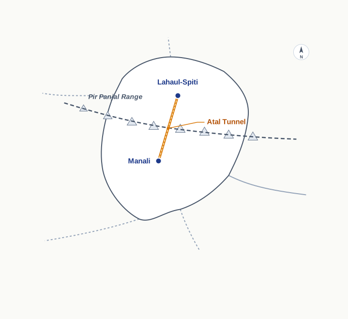
Fig. 7.0 – The Atal Tunnel through the Pir Panjal.
7.1 Means of Transport
We use dozens of things in an ordinary day — toothpaste, morning tea, milk, clothes, soap, food. Almost none of it is made where we use it. It is grown in fields or made in factories that may lie hundreds of kilometres away, and it reaches us only because something carries it there. Transport is that carrying: the movement of goods and people from the place where they are available to the place where they are needed.
All production is meant, in the end, for consumption. A crop in a field or a shirt in a factory is of no use to anyone until it reaches a buyer. The link that closes this gap — from the site of production to the market where consumers purchase — is transport. Without it, the shelves in any shop would stay empty.
We do not move only material things. We also move ideas, views and messages — a piece of news, an instruction, a greeting. Communication is the exchange of such ideas and messages from one place to another, or from one person to another, using various means. In earlier times the same runners and animals that carried goods also carried word; today the two have largely parted ways.
Both transport and communication answer the same basic need: to move something from where it is to where it is wanted. Human beings have devised many methods to do this, and geographers sort the methods of transport by the medium through which the movement happens.
Land, Water And Air
Movement can happen over land, over water or through the air, and this three-way split sits at the top of the classification. Each medium then divides again by the kind of route it uses. Land transport runs on roads, on railways and through pipelines. Water transport is either inland — along rivers and canals — or oceanic, along seaways and ocean routes. Air transport is grouped as national, within the country, or international, between countries. Fig. 7.1 sets out the full tree.
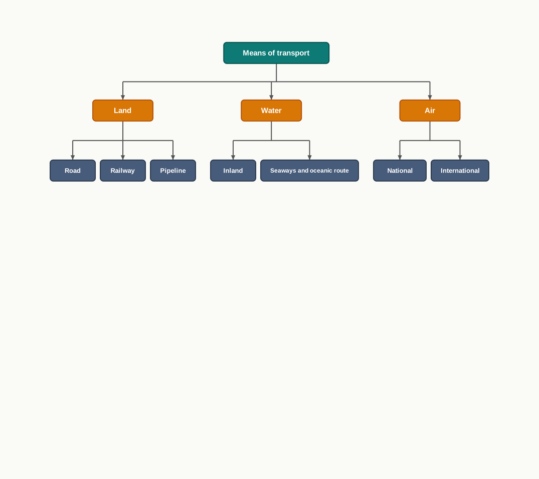
Fig. 7.1 – Classification of means of transport.
7.2 Land Transport
In India, pathways and unmetalled roads have carried goods and people since ancient times. An unmetalled road is a plain earth or gravel track with no hard surface, passable in dry weather but treacherous in the rains.
As the economy and technology grew, sturdier metalled roads — surfaced with crushed stone and tar so they carry heavy traffic in most weather — and railways were built to move large volumes of goods and people. For special loads and difficult ground, ropeways and cableways, which carry cabins slung from overhead cables, and pipelines were added to the land network.
7.2.1 Road Transport
India has the world’s second largest road network, running to about 62.16 lakh km (Ministry of Road Transport and Highways, Annual Report 2020-21). A lakh is one hundred thousand, so this is over six million kilometres of road.
Roads do the bulk of India’s carrying: about 85 per cent of passenger traffic and 70 per cent of freight travel by road every year. Road transport suits shorter journeys best, where door-to-door movement matters more than speed over long distances.
The weather can close even a major road. Fig. 7.2 shows traffic suspended on Himalayan highways after heavy snowfall, set beside the daily press of vehicles on a Delhi street.
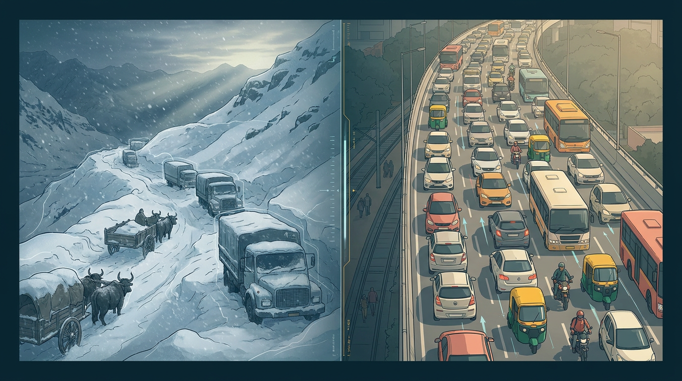
Fig. 7.2 – Traffic suspended on a mountain highway and flowing on a city road.
India’s oldest long roads run deep into history. Sher Shah Suri built the Shahi (or ‘royal’) road to hold his empire together, from the Indus Valley to the Sonar Valley in Bengal; the British renamed it the Grand Trunk (GT) road and used it to connect Calcutta and Peshawar. Today it runs from Amritsar to Kolkata. NCERT invites you to look up the old and new numbers of National Highways on the Ministry’s website (morth.nic.in).
Road transport in the modern sense was very limited before the Second World War. The first serious attempt to plan it came in 1943 with the Nagpur Plan, but it could not be carried out because the princely states and British India failed to coordinate. After Independence, a twenty-year road plan (1961) set out to improve the country’s roads.
Even then, roads stayed concentrated in and around towns and cities, and rural and remote areas were left with the least connectivity. For building and upkeep, roads are classified into National Highways (NH), State Highways (SH), Major District Roads and Rural Roads. Table 7.1 shows how the 2020 network divides across the main categories.
7.2.1.1 National Highways
The National Highways are the main roads built and maintained by the Central Government. They carry inter-state traffic and move defence personnel and material through strategically important areas, and they tie together state capitals, major cities, important ports and railway junctions.
Their length has grown from 19,700 km in 1951 to 1,36,440 km in 2020. Yet National Highways form only about 2 per cent of the total road length while carrying about 40 per cent of the road traffic. Table 7.1 lets us check that first figure.
So barely one-fiftieth of India’s road length carries two-fifths of its traffic. That gap is the whole purpose of a National Highway: a small network of wide, well-built inter-state roads does the heavy lifting, while the vast length of minor and rural roads exists mainly to reach the last village. Length and importance are not the same thing — a road’s value lies in how much moves along it, not in how many kilometres it runs.
The National Highways Authority of India (NHAI), set up in 1995, is an autonomous body under the Ministry of Surface Transport. It develops, maintains and operates the National Highways and is the apex body for improving their quality.
NHAI has taken up several large projects in phases. The Golden Quadrilateral is a 5,846-km, four-to-six-lane, high-density corridor joining India’s four big metro cities — Delhi, Mumbai, Chennai and Kolkata — to cut the time, distance and cost of movement between them. Two further axes cross the country: the North-South Corridor runs 4,076 km from Srinagar in Jammu and Kashmir to Kanniyakumari in Tamil Nadu (including the Cochin-Salem spur), and the East-West Corridor is planned over 3,640 km from Silchar in Assam to the port town of Porbandar in Gujarat. Fig. 7.3 sets out these corridors.
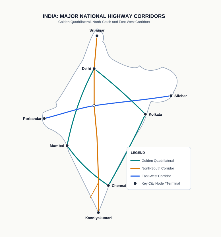
Fig. 7.3 – The Golden Quadrilateral and cross-country corridors.
A newer programme, Bharatmala Pariyojana, envisages about 26,000 km of Economic Corridors which, with the Golden Quadrilateral and the North-South and East-West Corridors, are expected to carry most of the country’s road freight. It also builds ring roads, bypasses and elevated corridors to ease traffic through cities and make the movement of goods more efficient.
7.2.1.2 State Highways
The State Highways are built and maintained by state governments. They join a state’s capital with its district headquarters and other important towns, and they connect onward to the National Highways, so a load can pass from a state road to a national one without a break.
7.2.1.3 District Roads
The District Roads are the connecting link between the district headquarters and the other important nodes within a district. They gather traffic from smaller places and feed it up to the state and national roads.
7.2.1.4 Rural Roads
Rural roads provide the vital links within the countryside, and they make up about 80 per cent of India’s total road length. Their density varies from region to region because the terrain shapes how easily they can be built and kept in repair. Fig. 7.4 shows a rural road built under the Pradhan Mantri Gram Sadak Yojna, the programme that has taken all-weather roads to villages.
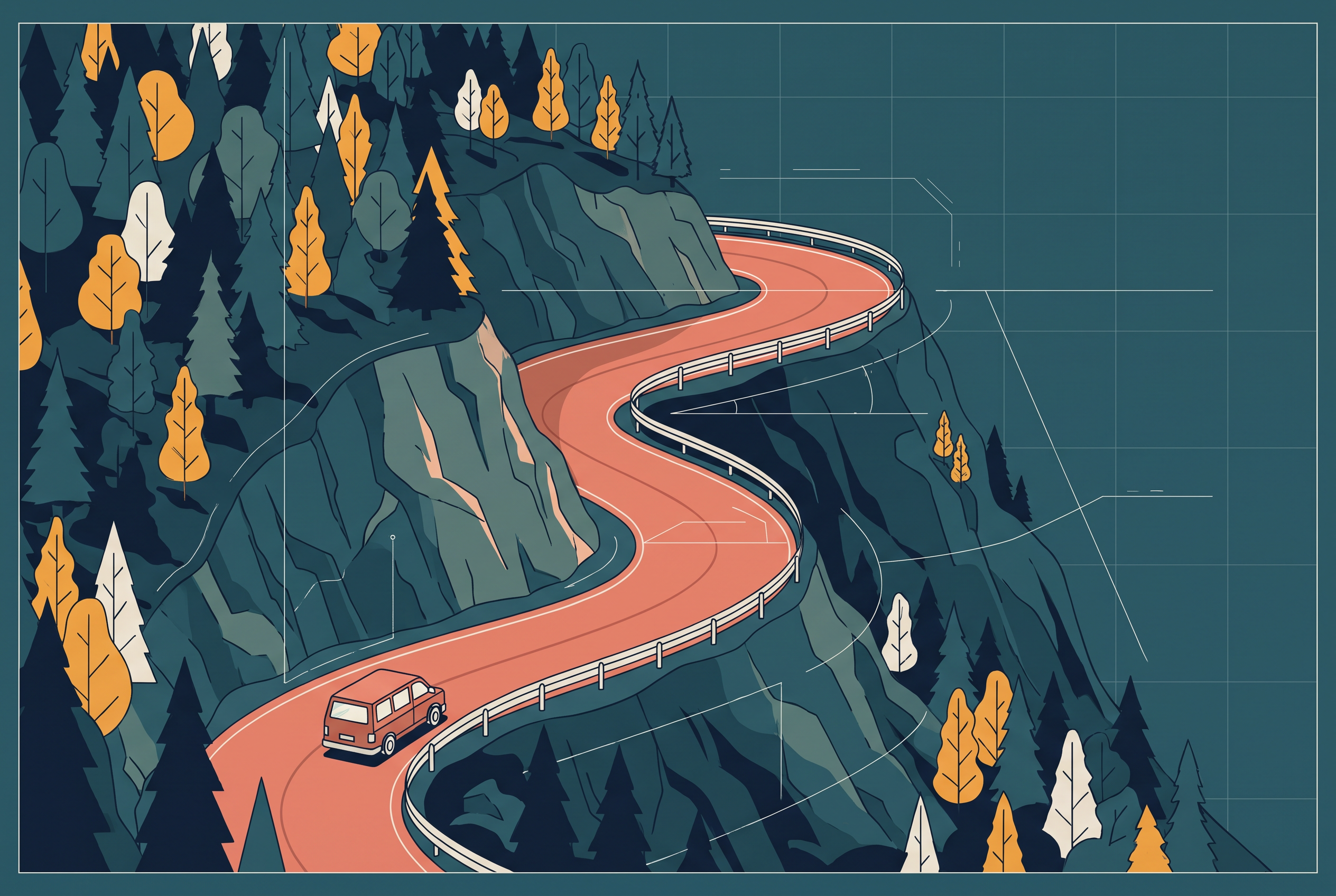
Fig. 7.4 – A rural road winding through hilly terrain.
7.2.1.5 Other Roads
Other roads include Border Roads and International Highways. The Border Road Organisation (BRO), set up in May 1960, builds and improves strategically important roads along India’s northern and north-eastern boundary, serving both economic development and defence preparedness. A premier construction agency, it has driven roads through high mountains — the route joining Chandigarh with Manali, in Himachal Pradesh, and Leh, in Ladakh, runs at an average altitude of 4,270 metres above mean sea level. Fig. 7.5 shows one such high pass.
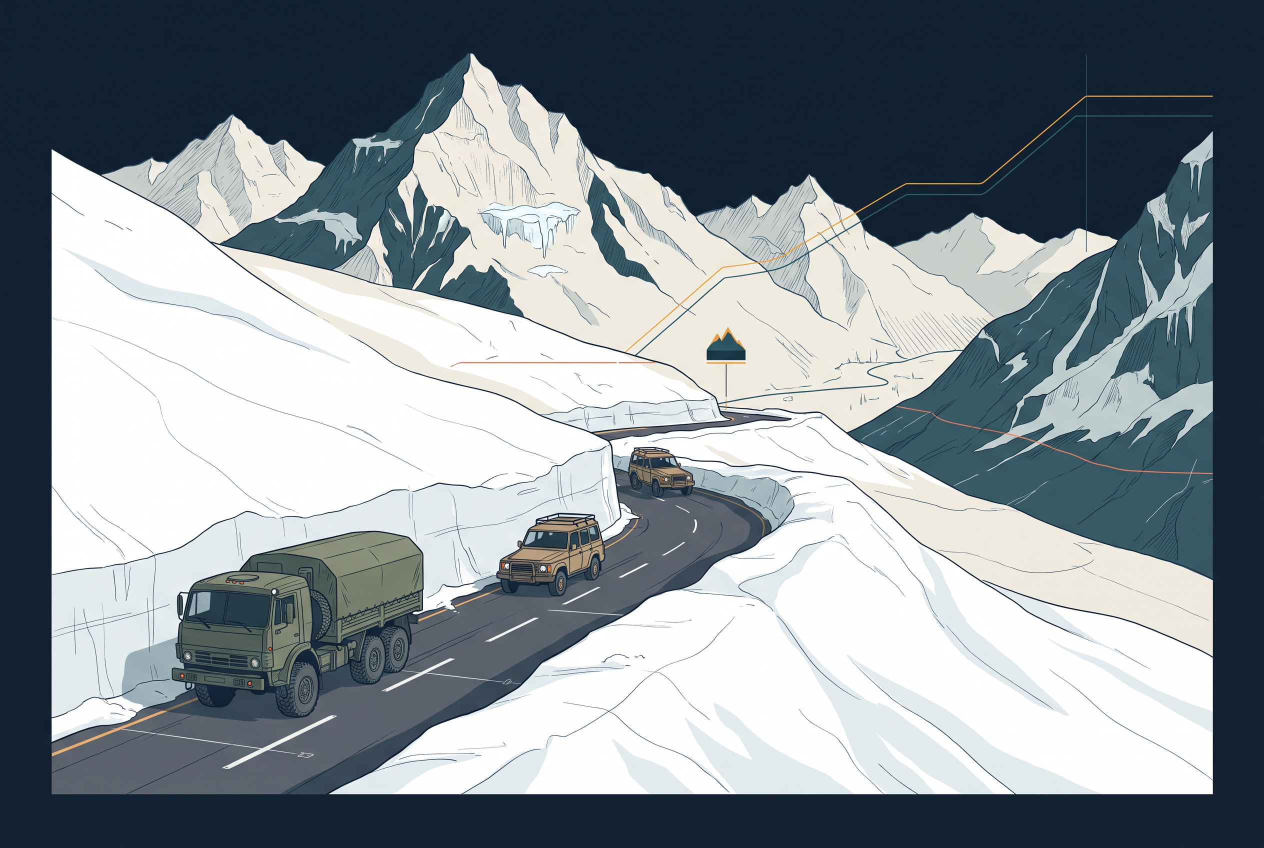
Fig. 7.5 – Vehicles navigating the snow-cleared Khardung La pass in Ladakh.
Beyond building and maintaining roads in sensitive areas, the BRO also clears snow at high altitude to keep the passes open. International highways serve a different end — they link India with its neighbours and are meant to keep relations with them friendly. Fig. 7.6 and Fig. 7.7 show two such cross-border links.
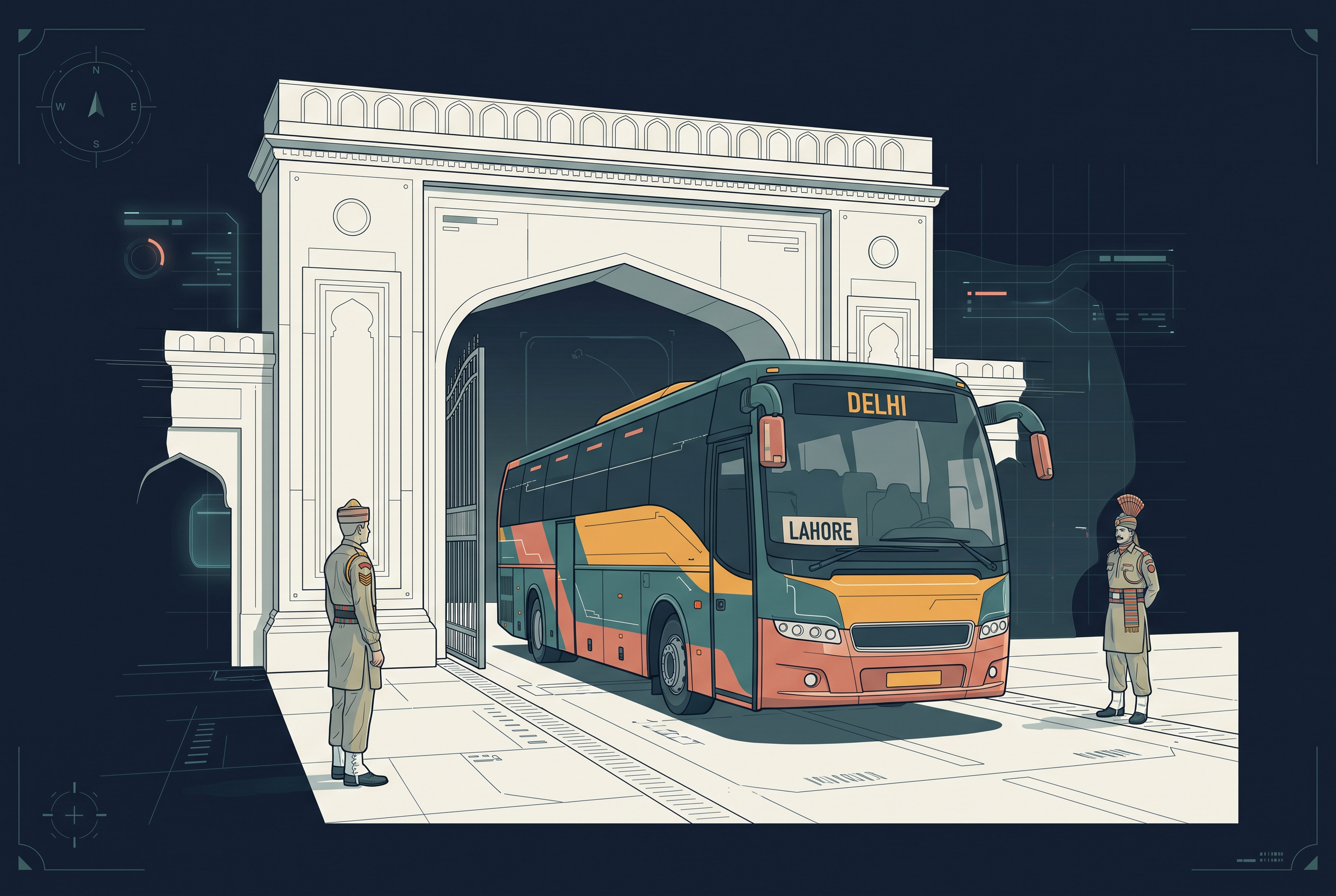
Fig. 7.6 – The Lahore–Delhi bus crossing the Wagah border.
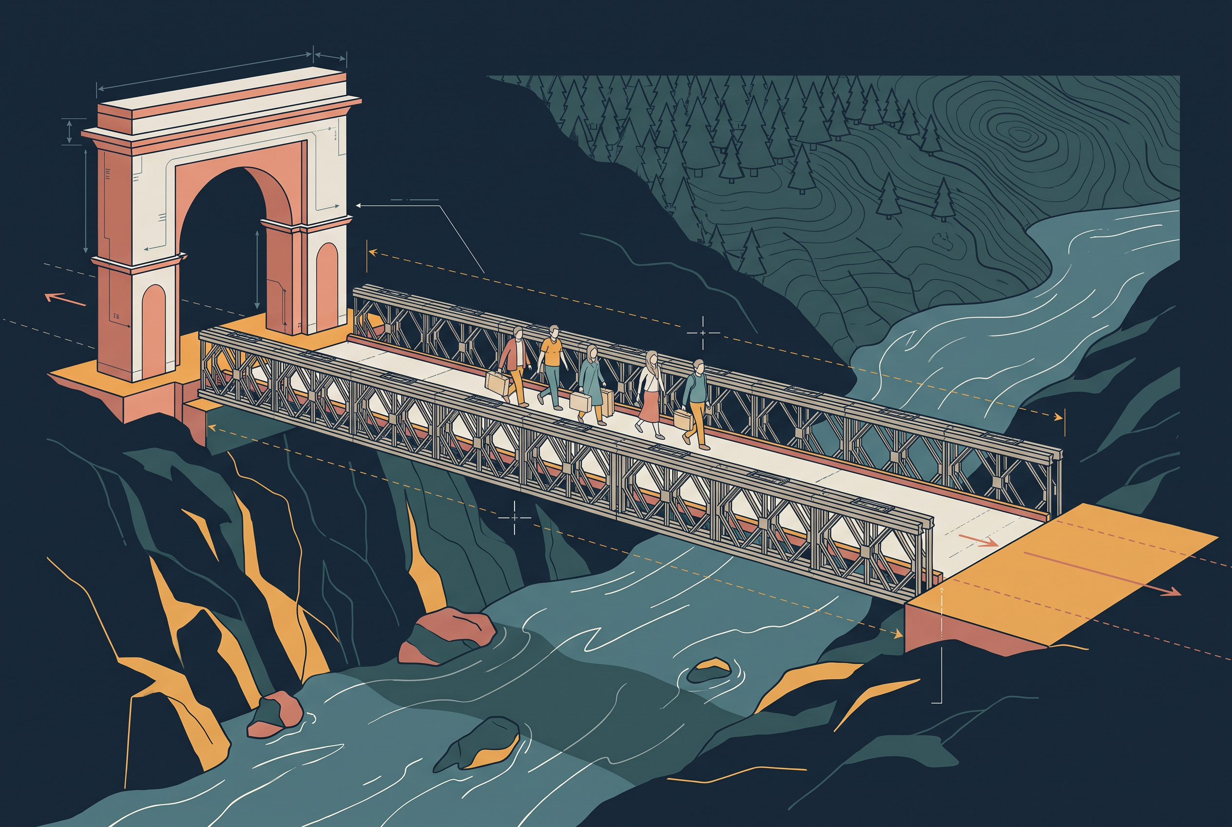
Fig. 7.7 – Passengers crossing the Aman Setu between Baramula and Muzaffarabad.
7.2.2 Rail Transport
Indian Railways runs one of the longest rail networks in the world, moving both freight and passengers and feeding the growth of the economy. Mahatma Gandhi said the railways ‘brought people of diverse cultures together to contribute to India’s freedom struggle’.
The Network And Its Zones
The railway came to India in 1853, when the first line ran from Bombay to Thane over a distance of 34 km. It is now the largest government undertaking in the country, with a network of 67,956 km (Railway yearbook 2019-20). Managing so vast a system from a single centre is difficult, so the railways are organised into 17 zones. Table 7.2 lists these zones and their headquarters.
Gauges, Engines And The Metro
Indian Railways runs on three track widths, or gauges. On broad gauge the rails are 1.676 metres apart, and broad-gauge lines ran to 63,950 km in 2019-20. On metre gauge the rails are exactly one metre apart, with 2,402 km of line. On narrow gauge the rails are 0.762 metre or 0.610 metre apart, totalling 1,604 km and generally confined to hilly areas, where a narrow track can hug tight bends. The railways have been converting metre and narrow gauge to broad gauge, so that trains can run through without a change of carriage.
Steam engines have been replaced by diesel and electric engines, which raised both speed and haulage capacity. Ending coal-fired steam also cleaned the air around the stations. In the cities, metro rail has transformed urban transport, and replacing diesel buses with CNG-run vehicles alongside the metro has helped curb air pollution. You might list which Indian cities now run a metro and discuss how it has changed daily travel.
From Colonial Lines To The Konkan
From the colonial era, railways reached mainly the areas that served the empire — around towns, raw-material and plantation belts, hill stations and cantonments — largely to move resources out. After Independence the network spread further, and its most striking addition was the Konkan Railway along the western coast, a direct link between Mumbai and Mangaluru.
Railways remain the main means of transport for ordinary people. Even so, the network is relatively thin in the hill states, the north-eastern states, central India and Rajasthan, where difficult terrain or sparse demand has kept the lines few.
7.3 Water Transport
Water transport carries both passengers and cargo, and among all the modes it is the cheapest. It suits heavy and bulky material best, and because a loaded boat needs little fuel for the weight it moves, it is both fuel-efficient and eco-friendly. India’s water transport is of two kinds — inland waterways along rivers and canals, and oceanic waterways along the coast and across the sea.
7.3.1 Inland Waterways
Inland waterways are routes for boats along the rivers, canals, backwaters and creeks inside the country. Before the railways arrived, they were the chief means of transport. Fig. 7.8 shows people crossing a river by boat in the north-east, where water is still a working route.
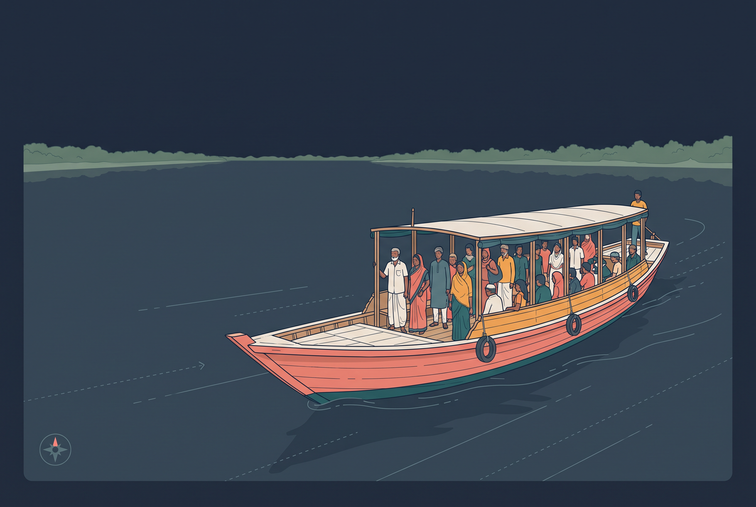
Fig. 7.8 – A crowded passenger ferry on a north-eastern river.
They then lost ground to road and railway transport, which were faster and reached more places. Worse, diverting river water for irrigation left long stretches too shallow to be navigable — that is, too shallow for boats to pass — over much of their length. Today India has 14,500 km of navigable waterways, made up of rivers, canals, backwaters and creeks, but they carry only about 1 per cent of the country’s transport.
The National Waterways
To develop, maintain and regulate these routes, the Inland Waterways Authority was set up in 1986. To widen the network and promote inland water transport as a cheap, environment-friendly support to road and rail, the National Waterways Act, 2016 declared 111 inland waterways as National Waterways — routes marked out for development as transport corridors. Five of these had been declared earlier. Fig. 7.9 maps National Waterway No. 3, the Kottapuram–Kollam route in Kerala.
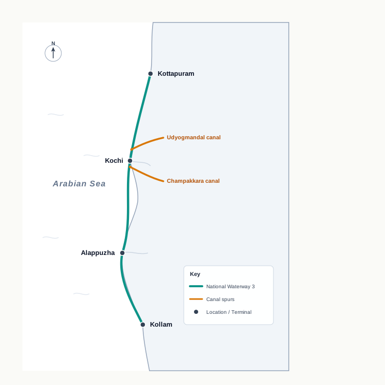
Fig. 7.9 – National Waterway No. 3: the Kottapuram–Kollam route.
Table 7.3 lists the first five National Waterways, each with the stretch it follows and what it is made of.
The sum confirms that a single National Waterway is often stitched together from several linked canals rather than one clean channel. Reading a waterway as a chain of named segments shows why developing it takes phased effort, and why a tidy figure like 205 km can hide three separate stretches, each with its own depth and condition.
The Authority has also identified ten more inland waterways that could be upgraded. In Kerala, the backwaters — the calm coastal lagoons known as Kayal — matter especially: besides offering cheap transport, they draw many tourists, and the famous Nehru Trophy Boat Race (Vallamkali) is held on them.
7.3.2 Oceanic Routes
Oceanic routes run along India’s coast and across the open sea. The country has a long coastline of about 7,517 km, including its islands, and this is served by twelve major ports and some 200 minor ports.
These sea routes are central to the economy: about 95 per cent of India’s foreign trade by volume, and 70 per cent by value, moves by ocean route. The gap between the two figures is telling — the sea carries almost everything by weight, but a good part of the higher-value trade travels by faster modes. Ocean routes also link the islands with the rest of the country.
7.4 Air Transportation
Air transport is the fastest way to move from one place to another, cutting the effect of distance by shrinking the time a journey takes. For a country as large as India, where distances are great and the terrain and climate vary widely, it is essential — an aircraft crosses in hours what a road or rail journey would take days to cover.
Air transport in India began in 1911, when an airmail service — mail carried by air — ran the short 10 km between Prayagraj and Naini, on opposite banks of the river in the north. Its real growth, however, came only after Independence. The Airport Authority of India now provides safe and efficient air traffic control and aeronautical communication services across Indian airspace.
Reaching The Regions
To spread flying beyond the big cities, the government runs UDAN (Ude Desh ka Aam Nagrik), a Regional Connectivity Scheme conceived by the Ministry of Civil Aviation. Described as a first-of-its-kind scheme anywhere in the world, it aims to make flying affordable for the ordinary citizen by encouraging airlines to serve regional and remote routes through enabling policies and incentives.
For hilly and remote country, helicopters fill the gap. Pawan Hans operates helicopter services in hilly areas and is widely used by tourists in the north-eastern sector. Pawan Hans Limited also provides helicopter services to the petroleum sector and for tourism.
7.5 Oil and Gas Pipelines
Pipelines are the most convenient and efficient way to move liquids and gases over long distances. Once laid, they carry a steady flow with no vehicles, no drivers and no empty return trips, which makes them ideal for oil and gas. Even solids can travel by pipeline if they are first turned into slurry — ground into fine particles and mixed with water so they flow like a liquid.
Oil India Limited (OIL), which works under the Ministry of Petroleum and Natural Gas, explores for, produces and transports crude oil — oil as it comes from the ground, before refining — and natural gas. It was set up as a company in 1959.
Asia’s first cross-country pipeline, 1,157 km long, was built by OIL from the Naharkatiya oilfield in Assam, in the north-east, to the Barauni refinery in Bihar, where crude is processed into usable fuels. In 1966 the line was extended further, up to Kanpur in Uttar Pradesh.
The Gas Network
Natural gas got its own carrier when GAIL (India) Ltd. was set up in 1984, a public sector undertaking to transport, process and market gas for economic use. Its first line, the 1,700-km Hazira–Vijaipur–Jagdishpur (HVJ) pipeline, linked the offshore Mumbai High and Bassein gas fields to fertiliser, power and industrial complexes across western and northern India, and gave a strong push to the country’s gas market. Fig. 7.10 traces both landmark pipelines.
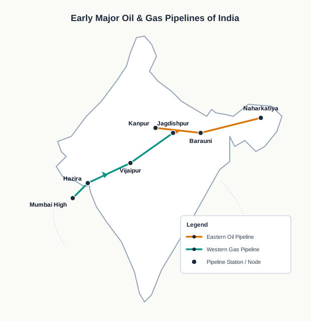
Fig. 7.10 – Landmark oil and gas pipelines in India.
Since then the network has expanded enormously. India’s cross-country gas pipelines have grown from that first 1,700 km to about 18,500 km, and are expected to reach over 34,000 km as a national Gas Grid, linking every gas source to its markets, including the North Eastern States.
A pipeline network is not simply longer — it ties more and more gas sources to the markets that burn the gas. Each new stretch turns a scattered set of fields and factories into a single grid, so that gas found in one corner of the country can feed a power station or a fertiliser plant in another. Length here is a measure of reach: how much of India the gas can actually get to.
7.6 Communication Networks
People have always found ways to send word across distance. In earlier times a message travelled by the beat of a drum on a hollow tree trunk, a column of smoke or fire, or a fast runner, and horses, camels, dogs, birds and other animals carried news from place to place. At first the means of communication were also the means of transport — the same runner who carried goods carried the message.
That changed with a string of inventions — the post office, the telegraph, the printing press, the telephone and, later, the satellite — each of which made communication faster and easier. Advances in science and technology have brought a real revolution in how messages move.
Geographers sort the modes of communication by their scale and quality into two kinds. Personal communication is a direct exchange between individuals — a letter, a telephone call, a telegram, a fax or an e-mail. Mass communication reaches large numbers at once, through radio, television, cinema, satellite, newspapers, magazines and books, and public meetings and conferences. Fig. 7.11 sets out the two branches.
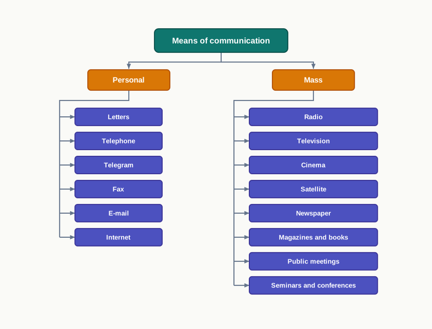
Fig. 7.11 – Classification of the modes of communication.
7.6.1 Personal Communication System
Among the personal systems, the internet is the most powerful and advanced, and it is used most in the cities. Through e-mail it puts a person in direct contact with the world’s store of knowledge and information, and it is used more and more for e-commerce — buying and selling online — and for money transactions.
The internet works like a vast central warehouse of data, holding detailed information on almost anything, and it gives efficient access to that information at a comparatively low cost. In effect, it offers the basic facilities of direct communication to anyone who is connected.
7.6.2 Mass Communication System
Mass communication carries the same message to a wide audience at once. In India its main carriers have been radio, television and, increasingly, satellites.
7.6.2.1 Radio
Radio broadcasting — sending programmes out to many receivers at once — began in India in 1923 with the Radio Club of Bombay. It spread quickly, reshaped social and cultural life, and soon found a place in nearly every home.
The government took control of this popular medium in 1930 under the Indian Broadcasting System. It was renamed All India Radio in 1936 and Akashwani in 1957. All India Radio carries programmes of information, education and entertainment, and puts out special news bulletins on occasions such as sessions of Parliament and the state legislatures.
7.6.2.2 Television (T.V.)
Television has become the most effective audio-visual medium for spreading information and educating people. It began in 1959, at first only in the national capital, and after 1972 several other centres started up.
In 1976, television was separated from All India Radio and given its own identity as Doordarshan. Once the INSAT-IA satellite came into service, Common National Programmes were started across the whole network, and the service reached backward and remote rural areas.
7.6.2.3 Satellite Communication
Satellites are a means of communication in their own right, and they also help regulate other means. Their real value is the continuous, synoptic view they give — a single wide view of a large area at one moment — which matters to India for economic and strategic reasons. Satellite images serve weather forecasting, the monitoring of natural calamities and the surveillance of border areas.
By design and purpose, India’s satellites fall into two systems. The Indian National Satellite System (INSAT), set up in 1983, is a multi-purpose system for telecommunication, weather observation and other data and programmes. The Indian Remote Sensing Satellite System (IRS) began with the launch of IRS-IA in March 1988 from Vaikanour in Russia; India has also built its own launch vehicle, the PSLV (Polar Satellite Launch Vehicle).
These satellites record the surface in several spectral bands — different ranges of energy the ground gives off — and send the data to ground stations. The National Remote Sensing Centre at Hyderabad receives and processes this data, which is then used to manage natural resources.
7.7 Summary
- Transport carries goods and people, and communication carries ideas and messages, from the place where they are available to the place where they are needed.
- Transport is grouped by the medium of movement: land (roads, railways, pipelines), water (inland and oceanic) and air.
- India has the world’s second largest road network, about 62.16 lakh km. Roads carry about 85 per cent of passenger and 70 per cent of freight traffic, and suit shorter journeys.
- Roads are classified into National Highways, State Highways, District Roads and Rural Roads. National Highways are only about 2 per cent of the length but carry about 40 per cent of the traffic; the NHAI (1995) builds and maintains them.
- Major projects include the Golden Quadrilateral joining Delhi, Mumbai, Chennai and Kolkata, the North-South and East-West Corridors, and Bharatmala Pariyojana.
- Rural roads make up about 80 per cent of road length, and their density varies with the terrain. The Border Road Organisation builds strategic roads in difficult border country.
- Indian Railways began in 1853 (Bombay–Thane), runs to about 67,956 km, and is organised into 17 zones. It uses broad, metre and narrow gauge, now being converted to broad gauge; the Konkan Railway links the western coast.
- Water is the cheapest mode, best for heavy, bulky loads. India has 14,500 km of inland waterways (about 1 per cent of transport), developed under the National Waterways Act, 2016.
- Oceanic routes along a coastline of about 7,517 km carry about 95 per cent of India’s foreign trade by volume and 70 per cent by value.
- Air is the fastest mode. It began in 1911; the Airport Authority of India manages the airspace, UDAN spreads regional connectivity, and Pawan Hans flies helicopters in hilly areas.
- Pipelines move liquids and gases efficiently over long distances. OIL and GAIL built the first oil and gas lines, and the gas network has grown from 1,700 km towards a national Gas Grid.
- Communication is divided into personal, a direct exchange between individuals such as the internet and e-mail, and mass, which reaches many at once.
- Radio (from 1923, later All India Radio and Akashwani), television (from 1959, later Doordarshan) and satellites (INSAT and IRS) carry mass communication; satellites also aid weather forecasting, disaster monitoring and resource management.
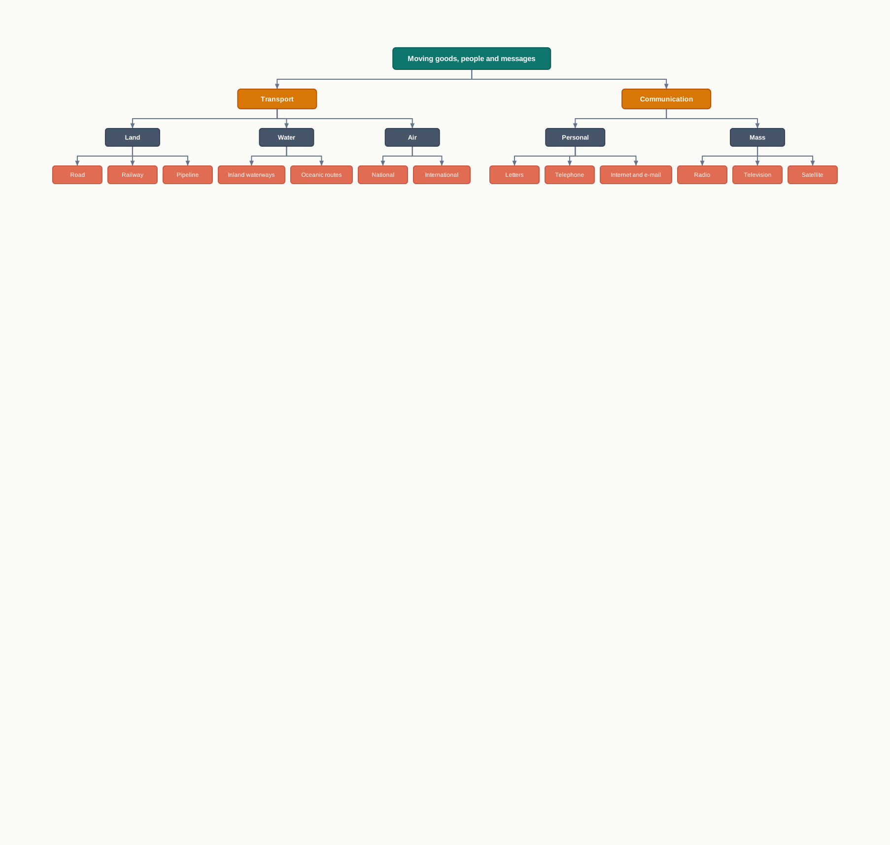
Fig. 7.12 – Summary of transport and communication networks.
What This Chapter Cannot Tell You
- The national totals hide huge regional differences: a country-wide road length or trade share says nothing about the hill village still waiting for an all-weather road.
- The figures belong to particular years, mostly around 2019 to 2021, and have already moved on; they are a snapshot of the network, not its present size.
- The neat classification sorts the modes, but it cannot tell you which one actually serves a given place, or what a new road, line or pipeline costs the land and the people it crosses.
7.8 NCERT Questions
- In how many zones has the Indian Railways system been divided?
- 9
- 12
- 17
- 14
- On which river, and between which two places, does National Waterway No. 1 lie?
- The Brahmaputra, Sadiya–Dhubri
- The Ganga, Haldia–Prayagraj
- West Coast Canal, Kottapuram to Kollam
- Godavari–Kakinada Puducherry
- In which year was the first radio programme broadcast?
- 1911
- 1936
- 1927
- 1923
- Which activity does transportation convey? Name three major modes of transportation. (30 words)
- Discuss the advantages and disadvantages of pipeline transportation. (30 words)
- What do you mean by ‘communication’? (30 words)
- Which are the chief means of transportation in India? Discuss the factors affecting their development. (150 words)
- Give a detailed account of the development of railways in India and highlight their importance. (150 words)
- Describe the role of roads in the economic development of India. (150 words)
7.9 Check Your Concepts
- Using Table 7.1, list the three categories of road it gives, and state which category makes up the greatest share of India’s road length.
- Distinguish between personal and mass communication, giving one example of each from the chapter.
- Name the three gauges on which Indian Railways runs, and give the distance between the rails for each.
- Using Table 7.3, name the three canals that make up National Waterway No. 3 and show that their lengths add up to its total stretch of 205 km.
- Why does the Golden Quadrilateral link Delhi, Mumbai, Chennai and Kolkata rather than other Indian cities?
- National Highways form only about 2 per cent of India’s road length, yet they carry about 40 per cent of the road traffic. Explain how so small a share of road can carry so much of the traffic.
- Water is the cheapest means of transport, yet inland waterways carry only about 1 per cent of India’s transport. Give two reasons from the chapter for this low share.