Chapter 10: Water In The Atmosphere
It is well before dawn on a still winter morning on the northern plains. The sky is clear, there is no wind, and the long night has drained the warmth out of the ground. As the ground cools, it chills the thin layer of air resting on it. That air had carried its water vapour invisibly all through the previous day. Now, sinking below the temperature at which it can hold that moisture, it begins to let the water go.
The vapour does not fall. It gathers, molecule by molecule, around tiny floating specks of dust, smoke and salt. Each speck becomes the seed of a droplet too small to see on its own, yet blinding in its millions. By the time the first buses reach the highway, a white wall has closed over the road. Drivers slow to walking pace, headlights reach only a few metres, and a train waits outside the station for the murk to lift.
Nothing new has entered the air. The same water that was there yesterday is simply wearing a different coat. When the sun climbs high enough to warm the ground again, the droplets thin, shrink and vanish back into invisible vapour, and the road reappears as though the fog had never been.
This chapter is about that quiet, constant traffic of water between the air, the land and the sea.
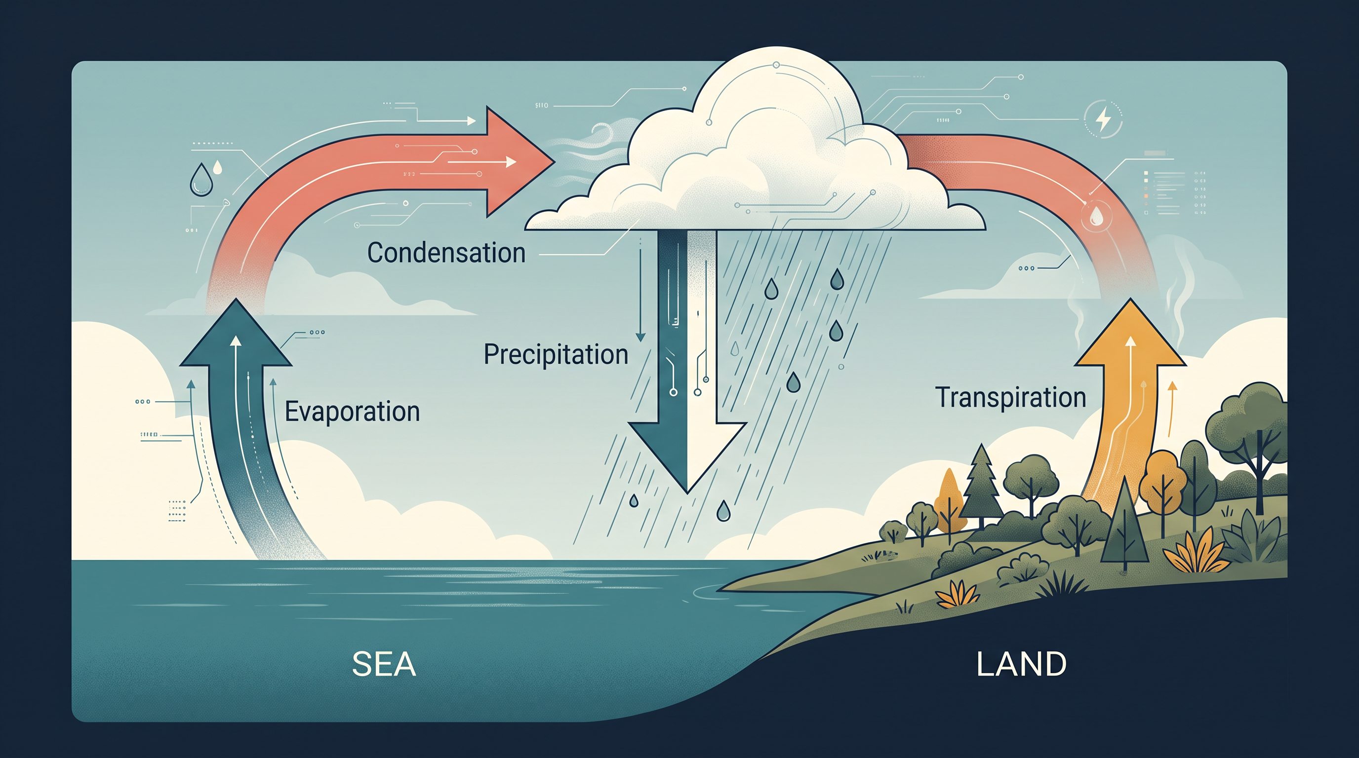
Fig. 10.0 – The endless exchange of water between oceans, air and land.
By the end of this chapter you will be able to answer each of these for yourself.
10.1 Water Vapour And Humidity
The air around us is never completely dry. It always carries some water in the form of an invisible gas — water vapour. This vapour makes up only a small part of the atmosphere, varying from zero to four per cent of its volume, yet it drives almost everything we call weather: cloud, rain, fog, frost and snow.
Water is present in the atmosphere in three states at once. It exists as a gas (vapour), as a liquid (the droplets in cloud and mist), and as a solid (ice crystals and snow). It shifts easily between these states, and each shift either releases moisture into the air or takes it out.
The Water Exchange
The moisture in the air does not appear from nowhere. It rises from oceans, lakes and rivers as they evaporate, and from plants, which release water vapour through their leaves in a process called transpiration. Once aloft, the vapour cools, gathers into cloud, and returns to the surface as rain or snow. Water is therefore in constant circulation between the sea, the air and the land, through the linked processes of evaporation, transpiration, condensation and precipitation.
This circulation is a closed loop, shown in Fig. 10.1. The water that falls as rain today is the same water that evaporated from an ocean surface days or weeks earlier. None is created and none is lost; it simply changes its form and its address.
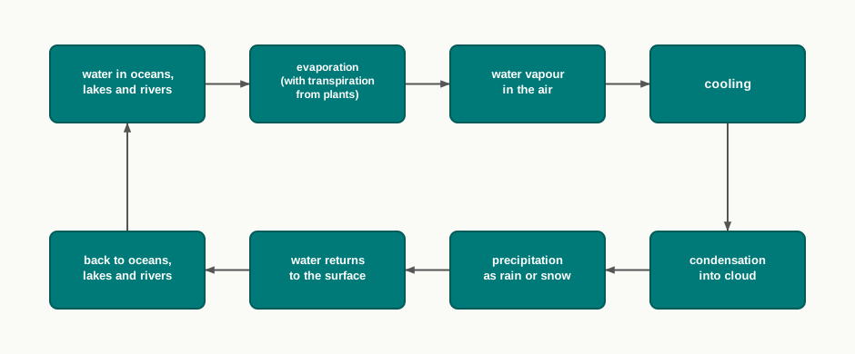
Fig. 10.1 – The endless circulation of water.
Two Ways To Measure Moisture
The water vapour present in the air is called humidity. Because moisture matters in more than one way, humidity is measured in more than one way.
The absolute humidity is the actual quantity of water vapour in the air. Strictly, it is the weight of vapour held in a given volume, measured in grams per cubic metre. It tells you how much moisture is physically present.
How much vapour the air can hold, however, depends entirely on its temperature: warm air can carry far more moisture than cold air. So the same amount of vapour may leave the air feeling nearly dry on a hot afternoon and clammy on a cool evening. Absolute humidity therefore differs from place to place across the earth’s surface.
This is why a second measure is needed. The relative humidity is the amount of moisture in the air compared with the most it could hold at that temperature, written as a percentage. Air at 50 per cent relative humidity is carrying half of its full capacity. The two measures are not the same thing: absolute humidity is a straight weight of vapour, while relative humidity is a ratio that only makes sense once the temperature is fixed.
Because capacity changes with temperature, relative humidity changes even when the actual vapour does not. If the air cools, its capacity shrinks, the same vapour now fills a larger share of it, and the relative humidity rises. Relative humidity is generally greater over the oceans, where evaporation keeps the air moist, and least over the continents.
Saturation And Dew Point
When air holds all the moisture it possibly can at its temperature, it is said to be saturated. Saturated air cannot take in any more vapour; any extra must leave the air as liquid. The temperature at which a particular sample of air reaches saturation is its dew point. Cool the air down to its dew point and the vapour in it begins to turn back into liquid. That single fact is how dew, fog and cloud all begin, as the coming sections show.
10.2 Evaporation And Condensation
The amount of water vapour in the air is constantly being topped up and drawn down. It is added by evaporation and withdrawn by condensation — two processes that run in opposite directions. Evaporation loads the air with moisture and needs heat to do it; condensation unloads that moisture and happens when heat is lost. Understanding one is really understanding the other in reverse.
Evaporation
Evaporation is the process by which water is transformed from its liquid state into a gas. Heat is its main cause: energy is needed to pull water molecules apart from one another and set them loose as vapour. That energy has a name. The latent heat of vaporisation is the amount of heat required to turn a unit mass of liquid into vapour without any rise in temperature. The word ‘latent’ means hidden — the heat is soaked up by the water, yet the thermometer does not climb, because the energy goes into changing the state rather than raising the temperature.
Three things speed evaporation up. First, a rise in temperature increases the water-absorbing and water-holding capacity of a parcel of air — a body of air treated as a single unit — so warmer air draws up moisture faster. Second, when the air is already low in moisture, it has more room to take up water, so evaporation runs quickly. Third, the movement of air matters. As vapour collects, the thin layer of air right against the water surface becomes saturated and evaporation there stalls. Moving air sweeps that saturated layer away and replaces it with drier air. Hence the greater the movement of air, the greater the evaporation.
Condensation
The reverse change — the transformation of water vapour back into liquid water — is called condensation. It is caused by the loss of heat. When moist air is cooled, it eventually reaches a level at which it can no longer hold all its vapour. Its capacity has been overtaken, and the excess vapour condenses into liquid.
Out in the free air, away from any surface, this liquid does not form in empty space. It gathers around tiny floating particles called hygroscopic condensation nuclei — specks of dust, smoke and sea salt that attract and hold water. (‘Hygroscopic’ simply means water-attracting.) Salt lifted from the ocean and smoke from towns make especially good nuclei, which is why hazy, dusty air condenses its moisture so readily.
Condensation can also begin in other ways: when moist air touches a colder object and surrenders its heat to it, and when the air is cooled to near its dew point. It therefore depends on two things above all — how much the air is cooled, and how close it already is to saturation, which is measured by its relative humidity. Alongside these, the volume of the air, its temperature, its pressure and its humidity all influence the result.
The Forms Condensation Takes
Once vapour has condensed, the moisture appears in one of four forms — dew, frost, fog and cloud. These are sorted out on two grounds: the temperature at which condensation happens, and the location where it happens. Temperature decides the state, since if the dew point is above freezing the moisture stays liquid, while if it is at or below freezing the moisture forms ice. Location decides the setting, since the moisture may collect on cool solid surfaces, or in the free air near the ground, or in the free air high above it. Condensation itself, note, occurs whether the dew point lies above the freezing point or below it — the difference only changes which of the four forms appears.

Fig. 10.2 – The four forms of condensation.
10.3 Dew
Dew is moisture deposited as tiny water droplets directly on the cooler surfaces of solid objects — stones, blades of grass, plant leaves — rather than on nuclei floating in the air above them. This is what sets it apart from fog or cloud: dew forms on things, not in the open air.
Why It Needs A Clear, Calm Night
The ideal conditions for dew are a clear sky, calm air, high relative humidity, and cold, long nights. These are not four separate requirements so much as four ways of doing one job — cooling a surface below its dew point.
A clear sky lets the ground radiate its heat freely to the open sky after sunset, so the surface loses warmth quickly and cools. Calm air keeps that cold, damp layer resting against the surface, instead of being stirred away and replaced by warmer air from above. High relative humidity means the air is already close to saturation, so only a little cooling is enough to bring it to its dew point. And a cold, long night gives the surface the unbroken hours it needs to cool that far.
One further condition is essential: the dew point must lie above the freezing point. Only then does the condensing moisture settle as liquid droplets. If the surface is any colder, the water freezes and dew gives way to frost.
10.4 Frost
Frost forms on cold surfaces when condensation takes place below the freezing point, 0 °C — that is, when the dew point is at or below freezing. The moisture that would otherwise have settled as dew instead freezes as it forms, and the excess is deposited as minute ice crystals rather than water droplets.
The conditions that produce a white frost are exactly the same as those that produce dew — a clear sky, calm air, high relative humidity, and a cold, long night. There is one difference, and it changes the outcome entirely: the air temperature must fall to or below the freezing point.
Dew Or Frost — The Freezing Line
Dew and frost are the same event separated by a single line on the thermometer. Both are moisture from the air condensing onto cool solid surfaces on a still, clear, humid night, and both need the surface to cool below the dew point. What decides which one you wake up to is only whether that dew point sits above the freezing point, or at or below it. Above freezing, the vapour condenses as liquid and leaves dew on the grass. At or below freezing, it deposits directly as ice and leaves a coat of white frost instead.
10.5 Fog And Mist
How Fog Forms
Fog begins when an air mass — a large body of air with fairly even temperature and humidity — is carrying a great deal of water vapour and its temperature falls suddenly. The rapid cooling pushes the air past its dew point, and condensation takes place within the air itself, around fine dust particles floating in it. The result is a fog: in effect a cloud whose base sits at or very near to the ground.
Because the droplets hang in the air, fog blocks the view. It reduces horizontal visibility at the earth’s surface to less than 1 km. A mist is the same kind of ground-level cloud, but thinner: it limits visibility to between 1 km and 2 km.
Smoke, Smog And The City
Fog and mist both need nuclei to condense on, and towns supply them in abundance. In urban and industrial centres, smoke pours countless fine particles into the air, and these provide plenty of nuclei that help fog and mist form. When fog and smoke combine, the mixture is called smog.
Fog Or Mist?
Fog and mist look alike, yet they differ in how wet they are. Mist contains more moisture than fog: in mist, each nucleus is wrapped in a thicker layer of water, which is why it feels damper. Fog is the drier of the two. This difference shows up in where each tends to form. Mists are frequent over mountains, where warm air rising up the slopes meets a cold surface and is chilled. Fogs are common where a warm current of air comes into contact with a cold current. In both, the process at heart is the same: fogs are really mini clouds, formed by condensation around nuclei of dust, smoke and salt.
10.6 Clouds
A cloud is a mass of minute water droplets, or tiny crystals of ice, formed by the condensation of water vapour in free air at considerable elevations — high above the ground, and this is what sets it apart from fog. Because they form high in the open sky, clouds are free to take on many shapes.
Clouds are grouped into four basic types according to their height, their expanse (how much of the sky they spread across), their density, and their transparency or opaqueness — how much sunlight they let through. The four types are cirrus, cumulus, stratus and nimbus.
10.6.1 Cirrus
Cirrus clouds form at high altitudes, between 8,000 and 12,000 m — near the top of the weather-bearing air, around the heights at which jet aircraft cruise. They are thin, detached clouds with a feathery, wispy appearance, and they are always white in colour.
10.6.2 Cumulus
Cumulus clouds look like heaps of cotton wool. They generally form at a height of 4,000 to 7,000 m and appear in separate patches, scattered here and there across the sky, each with a distinct flat base.
10.6.3 Stratus
Stratus clouds are, as the name suggests, layered clouds that spread in sheets across large portions of the sky. They generally form either when air loses heat, or when air masses of different temperatures mix together.
10.6.4 Nimbus
Nimbus clouds are black or dark grey. They form at middle levels or very near the surface, and are so dense and opaque that they block the sun’s rays almost completely. Sometimes they hang so low that they seem to touch the ground. Unlike the others, nimbus clouds have no definite shape — they are shapeless masses of thick, heavy vapour.
Identifying Clouds In The Sky
The skies photographed in Fig. 10.3 and Fig. 10.4 are real ones you can learn to name. Look at each and try to identify the cloud type, using the four clues — height, expanse, density and colour — that tell one type from another.
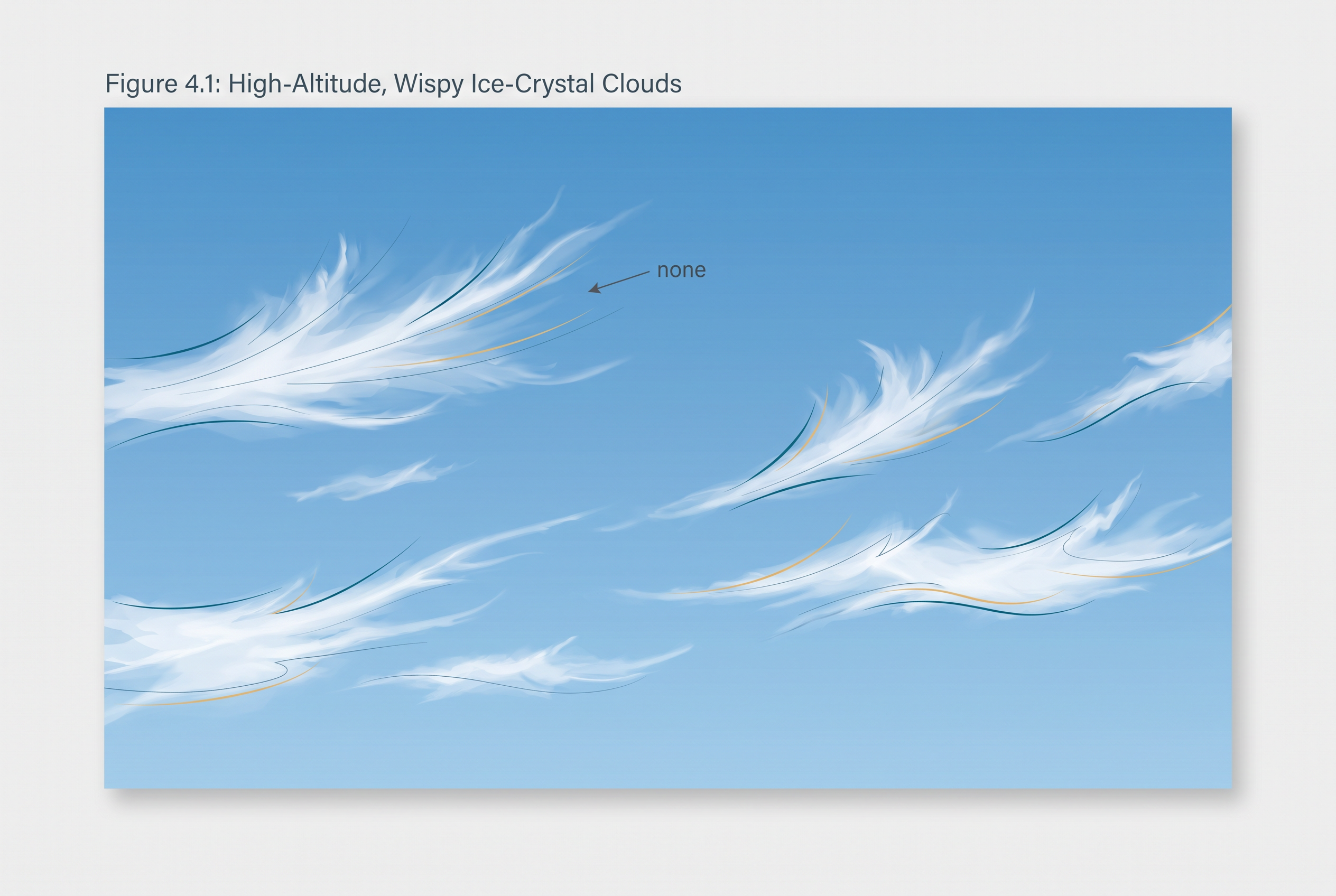
Fig. 10.3 – A sky for cloud identification.
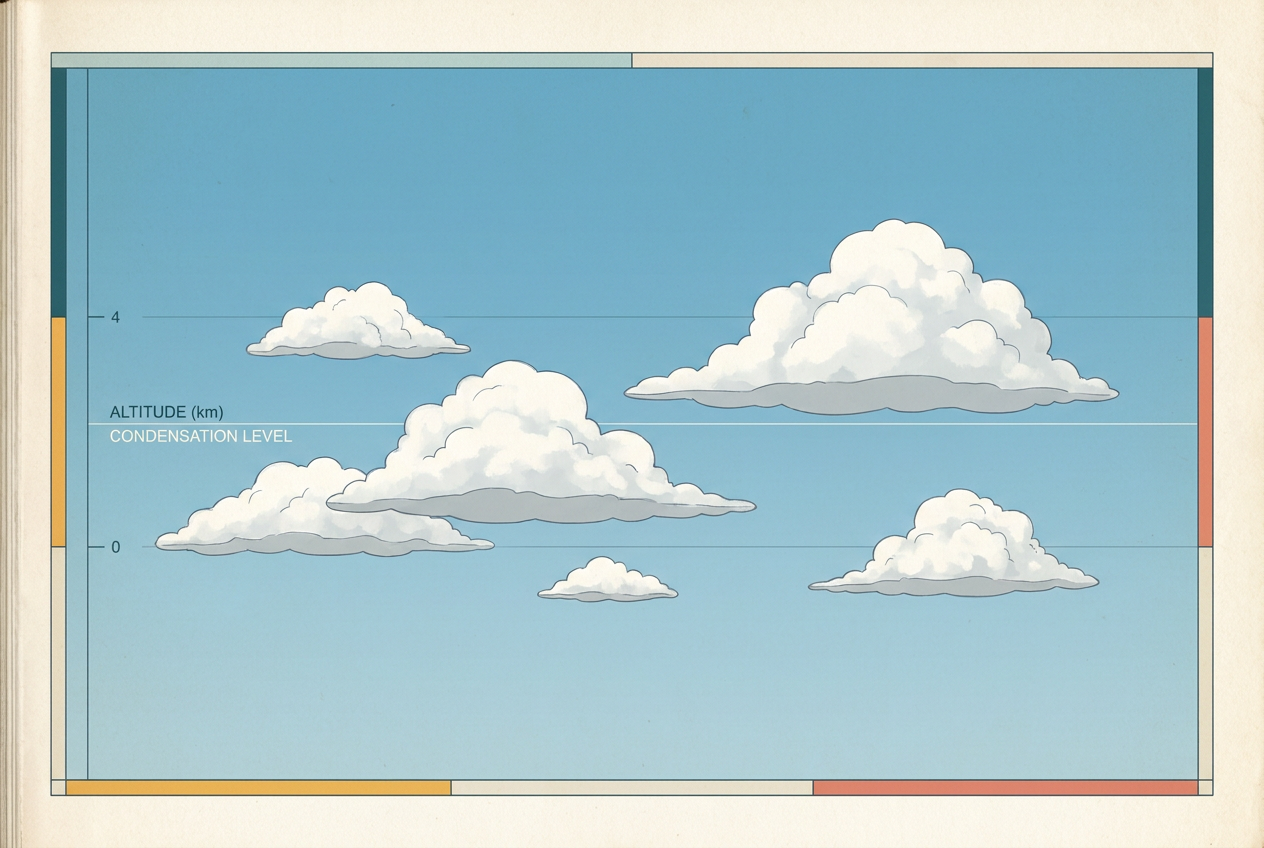
Fig. 10.4 – A second sky for cloud identification.
Combining The Basic Types
These four basic types rarely appear alone. Combined, they give rise to a fuller family of clouds, which are grouped by the height at which they sit. High clouds are the cirrus, cirrostratus and cirrocumulus. Middle clouds are the altostratus and altocumulus. Low clouds are the stratocumulus and nimbostratus. And a separate group, the clouds with extensive vertical development that tower from low levels to high, are the cumulus and cumulonimbus.

Fig. 10.5 – The family of clouds grouped by height.
10.7 Precipitation
How Precipitation Falls
Inside a cloud, condensation does not stop once droplets form. It continues, and as it does the condensed particles keep growing in size. For a while the air itself holds them up, but a point comes when the particles are simply too heavy. The air’s resistance can no longer support them against the pull of gravity, and they fall to the earth’s surface.
This falling release of moisture, coming after the condensation of water vapour, is called precipitation. It may reach the ground in liquid form or in solid form, and which one it is depends on the temperatures of the air it falls through.
The Forms Precipitation Takes
Precipitation that reaches the ground as water is called rainfall. When the temperature is lower than 0 °C, the moisture is instead released as fine, six-sided (hexagonal) ice crystals that clump together into flakes; this is snowfall. Besides rain and snow there are two further forms — sleet and hail — though hail is limited in where it occurs and falls only sporadically, meaning irregularly in both time and place.
Sleet is frozen raindrops, together with refrozen water from melted snow. It forms from a particular layering of the air: a warmer layer, above freezing point, sitting on top of a subfreezing layer near the ground. Raindrops set off through the warm air, then run into the cold air below, and in that colder layer they solidify. They reach the ground as small pellets of ice, no bigger than the raindrops they started as.
Hail falls as hailstones — small, rounded, solid lumps of ice. They begin as ordinary drops of rain released by a cloud, which solidify as they pass through colder layers of air on the way down. A hailstone is not a single frozen drop but a set of several layers of ice, built one over the other in concentric shells.
The four forms are therefore one process reaching the ground under different temperatures. Fig. 10.6 sets them side by side.
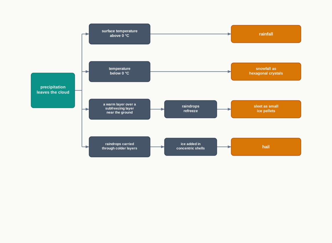
Fig. 10.6 – Precipitation forms and air temperatures.
10.8 Types Of Rainfall
Not all rain is made the same way. On the basis of its origin — what lifts the air in the first place — rainfall is classified into three main types: convectional rain, orographic or relief rain, and cyclonic or frontal rain. In every case the air must be made to rise, expand and cool until its moisture condenses; the three differ only in what does the lifting. Fig. 10.7 sets them out.
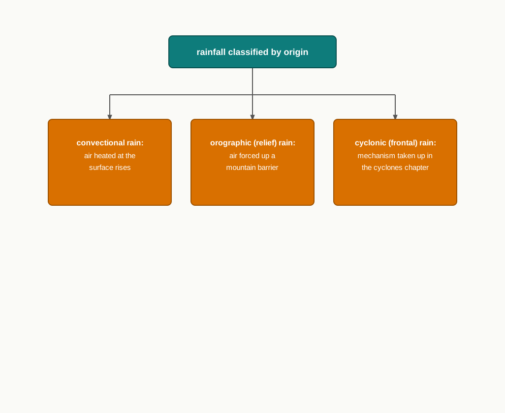
Fig. 10.7 – Three types of rainfall by origin.
10.8.1 Convectional Rain
Convectional rain starts at the ground. When the surface heats the air resting on it, that air becomes lighter and rises in convection currents — rising streams of warm air. As it climbs it expands and loses heat, condensation sets in, and cumulus clouds build up. The result is a sharp downpour, often with thunder and lightning, but it does not last long.
Because it depends on strong surface heating, this rain is common in summer or in the hotter part of the day. It is very common in the equatorial regions, near the equator, and in the interior parts of the continents, particularly in the northern hemisphere.
10.8.2 Orographic Rain
The word ‘orographic’ means relating to mountains, and this rain is the work of a mountain barrier. When a saturated air mass is driven against a mountain, it is forced to ascend. As it rises it expands, its temperature falls, and its moisture condenses into rain. The chief feature of this rain is that the windward slope — the side facing the oncoming wind — receives the greater share of the rainfall. Because it is produced by the land’s relief, its mountains and highlands, this type is also called relief rain.
Once the winds cross the crest and start down the far side, everything reverses. As the air descends the leeward slope — the sheltered side, away from the wind — it warms, and warming air can take up more moisture rather than release it. So the leeward slopes stay rainless and dry. This drier tract in the mountain’s lee is called the rain-shadow area. The whole contrast is captured in Fig. 10.8.
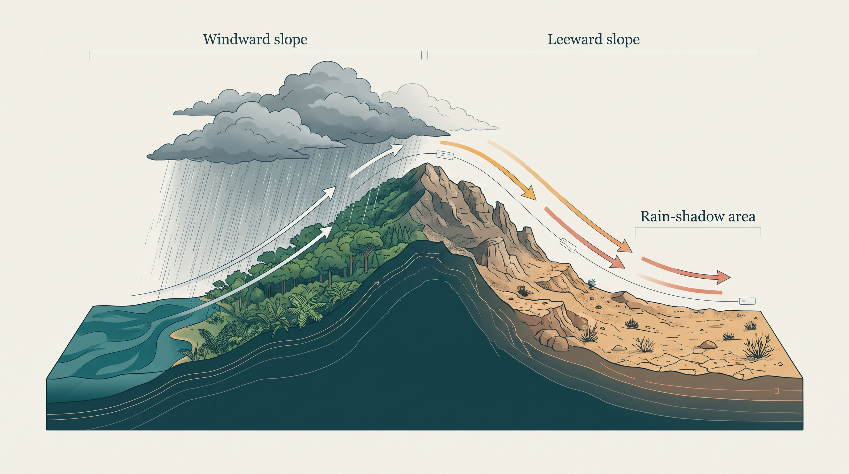
Fig. 10.8 – Orographic rain and the rain-shadow effect.
10.8.3 Cyclonic Rain
The third type by origin is cyclonic rain, also called frontal rain, which is produced within cyclones. Its mechanism is taken up in the chapter dealing with cyclones rather than here, so it is not repeated in this chapter. For how a cyclone lifts air to give rain, that chapter is the place to look.
10.9 World Distribution Of Rainfall
The Broad Pattern
Different places on the earth’s surface receive very different amounts of rainfall over a year, and receive it in different seasons. Yet the differences are not random. They follow patterns that the earth’s heating and its winds lay down.
The first pattern is with latitude. As we move from the equator towards the poles, rainfall goes on decreasing steadily. The second is with distance from the sea. Coastal areas receive more rainfall than the interiors of the continents, and rainfall is greater over the oceans than over the landmasses, because the oceans are the great sources of the water that feeds it.
Which Coast Gets The Rain
Where the rain falls heaviest along a coast depends on the latitude. Between the latitudes 35° and 40° N and S of the equator, the rain is heavier on the eastern coasts and decreases towards the west. Between 45° and 65° N and S, the position reverses. Here the westerlies — the steady winds that blow from the west across these mid-latitudes — carry moisture onto the western margins of the continents first, so rainfall is heaviest in the west and decreases eastward.
The land’s shape sharpens the pattern. Wherever mountains run parallel to the coast, the rain is greater on the coastal plain, on the windward side, and falls away towards the drier leeward side — the same rain-shadow effect met in orographic rain.
Regimes By Amount
Ranked by the total amount of rainfall received in a year — its annual precipitation — the world sorts into a few broad regimes.
Heavy rainfall, of over 200 cm per annum (per year), falls in three kinds of place: the equatorial belt; the windward slopes of the mountains along the western coasts in the cool temperate zone, which is the mid-latitude belt of cool climates; and the coastal areas of the monsoon lands, where seasonal winds bring a strong wet season. Interior continental areas receive a moderate 100 to 200 cm per annum, and the coastal areas of the continents likewise receive moderate amounts. Between 50 and 100 cm per annum falls over the central parts of the tropical land and over the eastern and interior parts of the temperate lands. The lowest totals of all, under 50 cm per annum, belong to two kinds of area: the rain-shadow zones deep in the interiors of the continents, and the high latitudes near the poles.
Amount, though, is only half the story. How the rain is spread through the year — its seasonal distribution — decides how useful it is. In some regions the rain is spread evenly across all the months, as in the equatorial belt and the western parts of the cool temperate regions; elsewhere it is packed into a few months and the rest of the year runs dry. The overall picture is drawn in Map 10.A1.
Map
Map 10.A1 Caption: The world’s rainfall sorted into four broad regimes by the total it receives in a year. Brief: World map shading land into the four annual-rainfall classes described in this section: over 200 cm, 100 to 200 cm, 50 to 100 cm, and under 50 cm per annum. Place the classes only as the text describes them — the equatorial belt, western-coast windward slopes in the cool temperate zone and monsoon coasts as heaviest; continental interiors and continental coasts as moderate; central tropical and eastern and interior temperate lands in the 50 to 100 cm class; deep-interior rain-shadow zones and high latitudes as lowest. Key must show the four classes. Show the full extent of India as officially defined. Add no rainfall data beyond these four classes.
10.10 Summary
- Air always carries some water vapour — from zero to four per cent of its volume — and water is present in the atmosphere as gas, liquid and solid. This moisture is what drives the weather.
- The vapour in the air is called humidity. Absolute humidity is the actual weight of vapour in a given volume of air; relative humidity is that vapour written as a percentage of the most the air could hold at its temperature.
- Air’s capacity to hold vapour depends on its temperature. Air holding all it can is saturated, and the temperature at which it saturates is its dew point.
- Evaporation turns liquid water into vapour and is driven by heat — the latent heat of vaporisation. It is faster when the air is warm, when it is dry, and when it is moving.
- Condensation turns vapour back into liquid as the air cools, gathering around hygroscopic nuclei of dust, smoke and salt. A fall in temperature is its most favourable condition.
- Condensed moisture takes four forms, sorted by temperature and location: dew, frost, fog and cloud.
- Dew is droplets left on cool surfaces on a clear, calm, humid night when the dew point is above freezing. Frost is the same event when the dew point is at or below freezing, so ice crystals form instead of droplets.
- Fog is a cloud resting on the ground that cuts visibility to below 1 km. Mist is thinner and wetter, limiting it to between 1 and 2 km, and fog mixed with smoke is smog.
- A cloud is condensed droplets or ice crystals in free air, high above the surface. Clouds are grouped by height, expanse, density and transparency into cirrus, cumulus, stratus and nimbus.
- Precipitation is the fall of moisture once the growing particles are too heavy for the air to hold. It reaches the ground as rain, snow, sleet or hail, according to the temperatures it passes through.
- By origin, rainfall is convectional (from surface heating), orographic or relief (from air forced up a mountain, wet on the windward side and dry in the leeward rain-shadow), or cyclonic, also called frontal.
- Rainfall decreases steadily from the equator towards the poles, and is greater on coasts and over oceans than in continental interiors. By annual total the world falls into regimes of over 200, 100 to 200, 50 to 100 and under 50 cm per annum, and how evenly the rain is spread across the year decides how useful it is.

Fig. 10.9 – The journey of water through the air.
What This Chapter Cannot Tell You
- An annual rainfall total says nothing about the season. Two places with the same yearly figure can differ hugely if one receives its rain evenly and the other in a single burst — which is why the chapter itself warns that seasonal distribution decides a rainfall’s effectiveness.
- The neat four-class regime map smooths over everything below its scale. Within any one belt, a coast, a valley and a rain-shadow can each receive very different amounts.
- Sorting clouds and rain into tidy types is a teaching device, not a full account. Real skies blend cloud forms, and a single storm can deliver rain, sleet and hail together.
10.11 NCERT Questions
Which one of the following is the most important constituent of the atmosphere for human beings?
- Water vapour
- Nitrogen
- Dust particle
- Oxygen
Which one of the following processes is responsible for transforming liquid into vapour?
- Condensation
- Transpiration
- Evaporation
- Precipitation
The air that contains moisture to its full capacity:
- Relative humidity
- Specific humidity
- Absolute humidity
- Saturated air
Which one of the following is the highest cloud in the sky?
- Cirrus
- Stratus
- Nimbus
- Cumulus
Name the three types of precipitation. (30 words)
Explain relative humidity. (30 words)
Why does the amount of water vapour decrease rapidly with altitude? (30 words)
How are clouds formed? Classify them. (30 words)
Discuss the salient features of the world distribution of precipitation. (150 words)
What are forms of condensation? Describe the process of dew and frost formation. (150 words)
10.12 Check Your Concepts
Fog and mist form in the same way, yet a driver finds one far harder to see through than the other. State two ways in which fog and mist differ.
The amount of water vapour in a parcel of air does not change through the evening, yet its relative humidity rises. Explain how this can happen.
Convectional rain is heavy but brief. Using the way it forms, explain why such a downpour does not last long.
Study Fig. 10.8. State which slope of the mountain receives more rain, and then explain, step by step, why the leeward slope stays dry.
A hailstone cut in half shows several rings of ice, one inside the next. What do these rings tell you about the hailstone’s journey through the air before it reached the ground?
Two regions receive the same total rainfall over a year, yet one supports farming far better than the other. Using the idea of seasonal distribution, explain how this is possible.